Overview
About Doris McCarthy Trail, Scarborough, Ontario, Canada
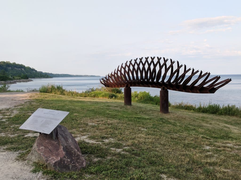
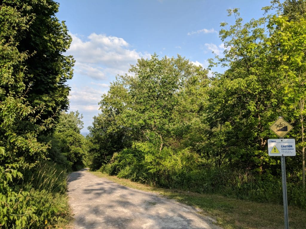
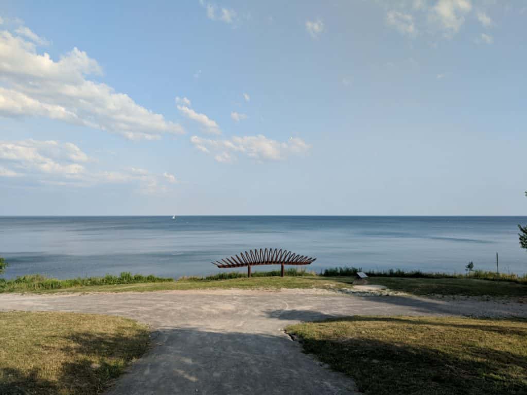
Doris McCarthy Trail or Gates Gully is a pathway that leads from Ravine Drive, off Kingston Road to Lake Ontario along the Bellamy Ravine Creek that flows through the ravine. It is also called Gates Gully because the Gates Inn and Tavern by Jonathan Gates once stood east of Bellamy Road. The inn was a rallying point for the Scarborough militia preparing to defend Toronto from William Lyon Mackenzie’s rebels in the Upper Canada Rebellion. The trail is named after the well-known Calgary-born artist Doris Jean McCarthy, best known for her landscape painting, who lived in the Scarborough Bluffs area. A sculpture that pays homage to the artist is located at the base of the trail — the point where the Doris McCarthy Trail meets the lakeshore.
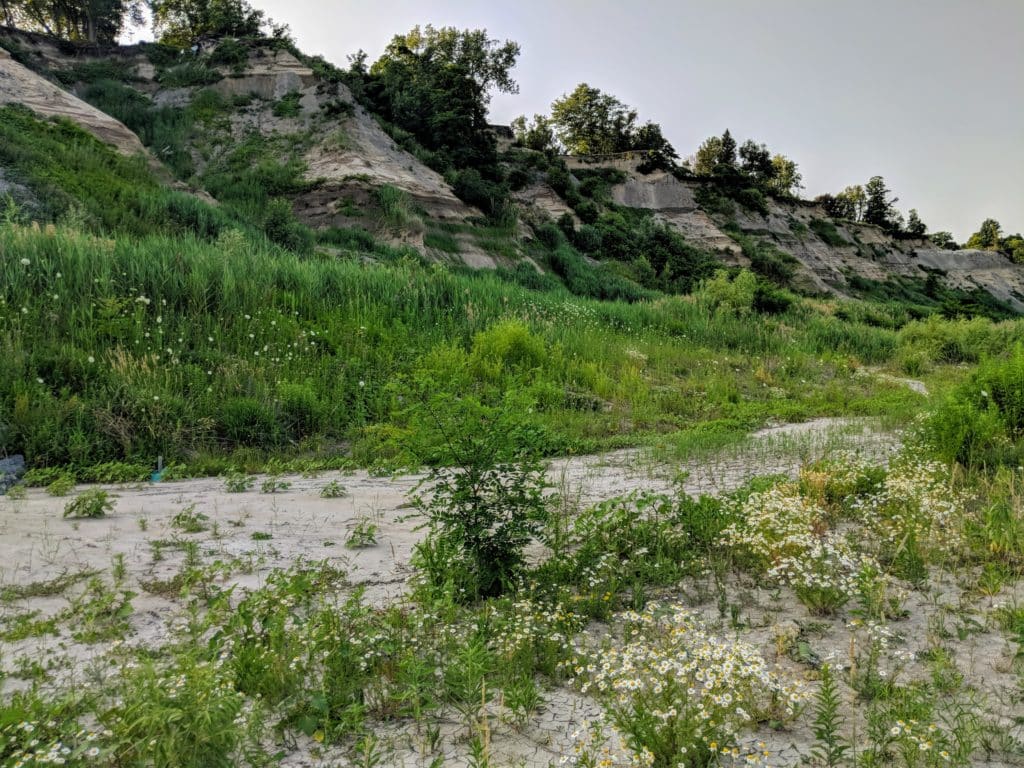
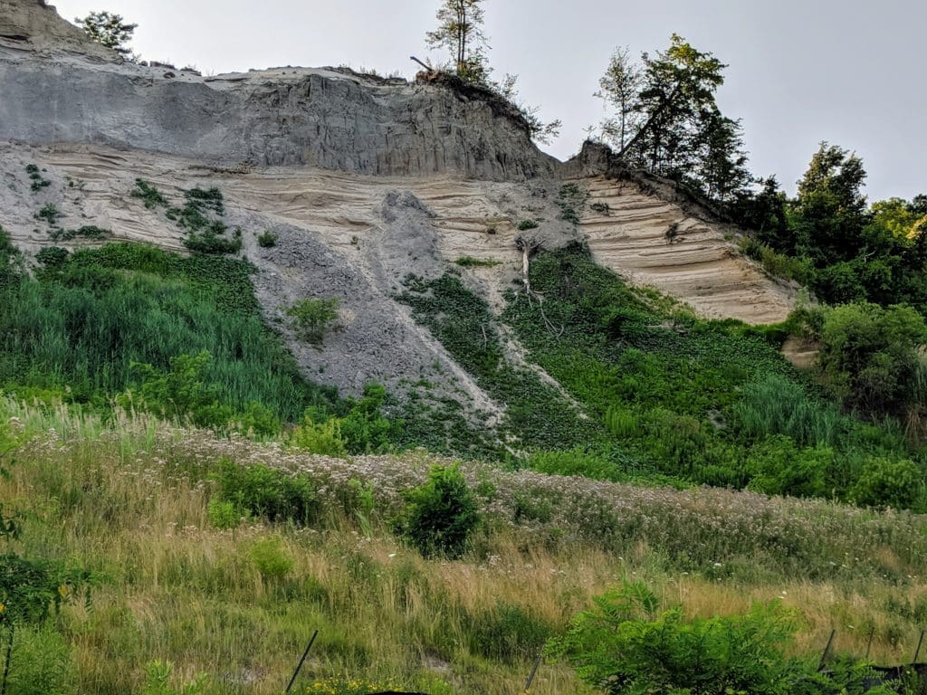
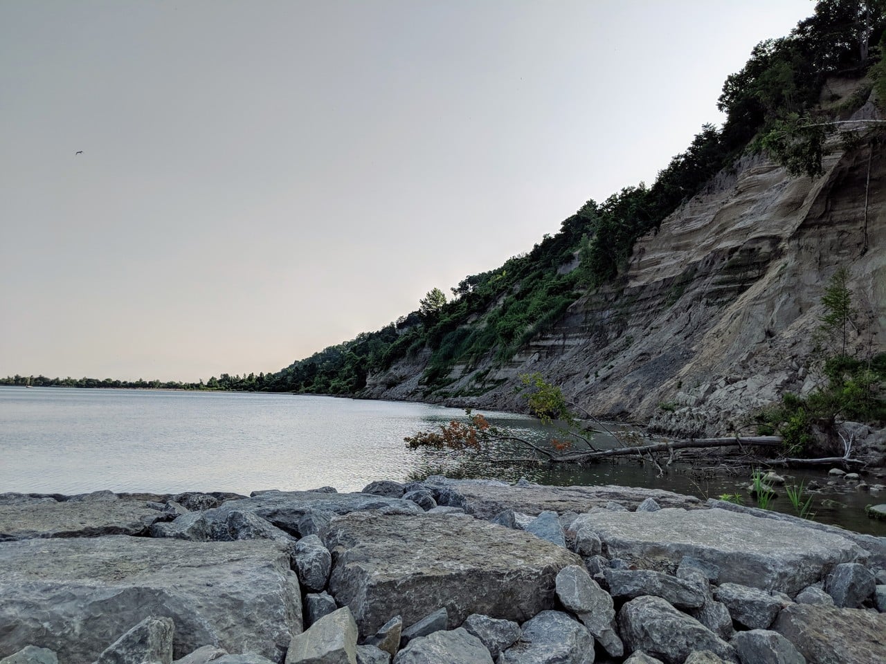
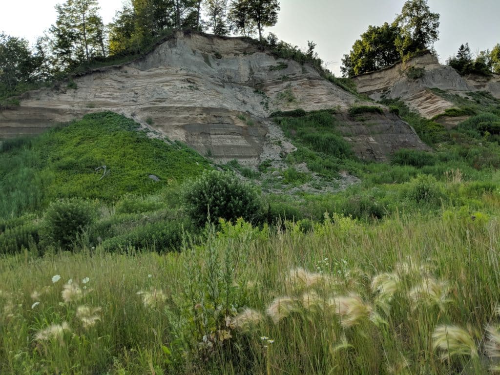
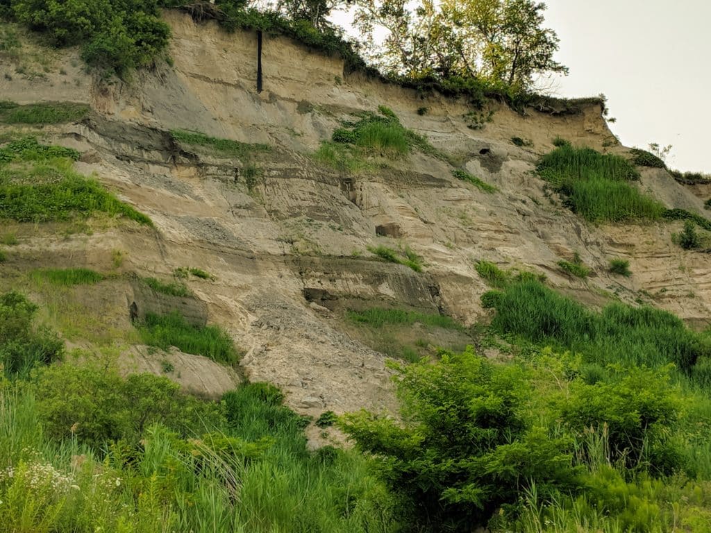
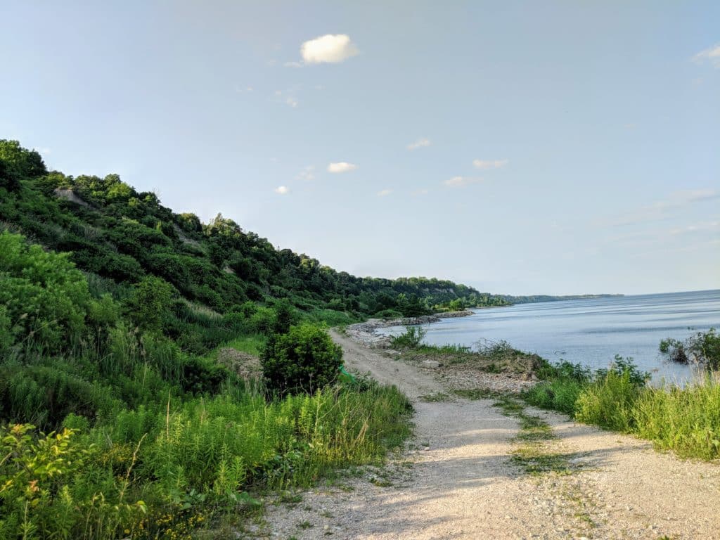
The trail gives access to exceptional views of Lake Ontario and the Scarborough Bluffs, an escarpment that runs along the eastern waterfront of Toronto.
Doris McCarthy Trail is part of Toronto and Region Conservation Authority’s Scarborough waterfront project. A new headland beach system at the base of the Doris McCarthy Trail, with two new headlands and the extension of an existing headland into the lake at the east end of the Meadowcliffe shoreline is being studied.
What to do at Doris McCarthy Trail?
Attractions & Things to do
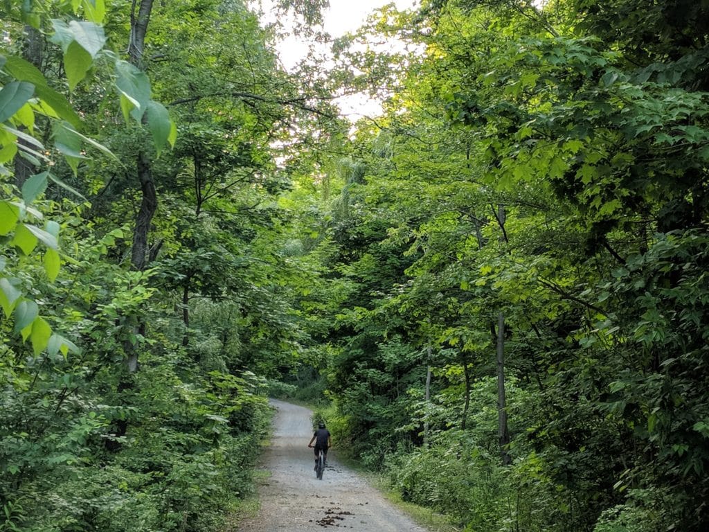
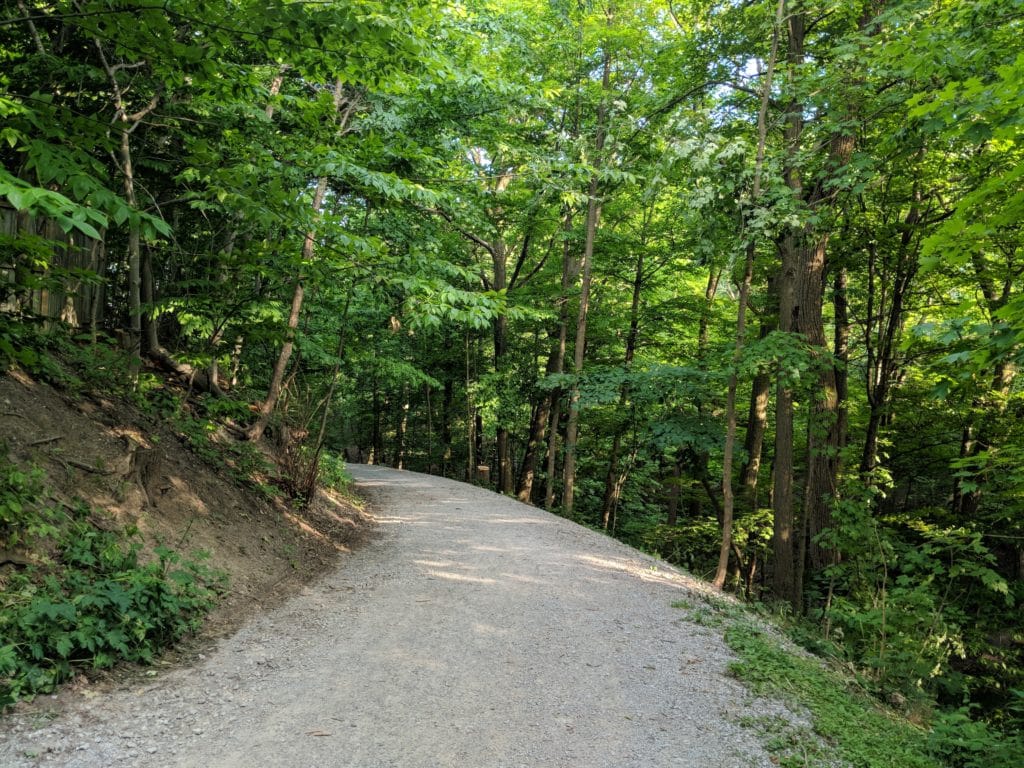
- Hike the steep trail that borders Bellamy Ravine (creek) leads to the Lake.

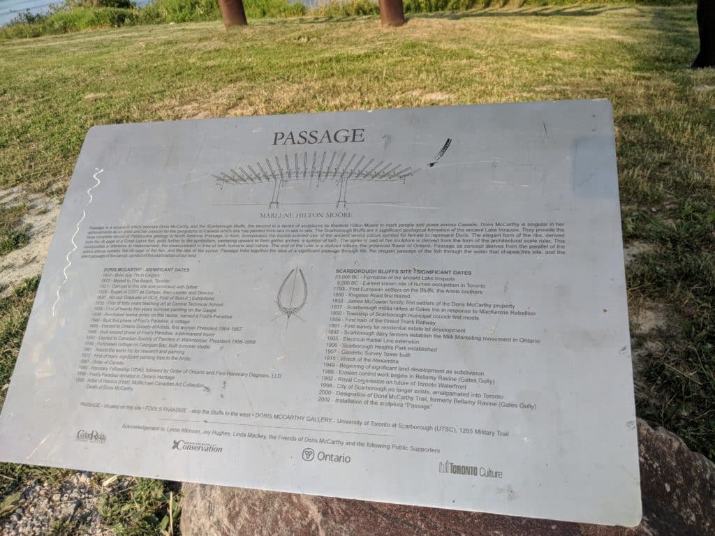
- Admire the Passage, the large corten-steel sculpture that pays homage to Doris McCarthy. Passage is an artwork by Marlene Hilton Moore, and is inspired by the rib cage of a fish and the ribs of a canoe. The sculpture links together the ideas of a significant individual’s passage through life, a fish’s passage through water and a canoe’s passage through the landscape we explore. The interior base simulates an architectural scale ruler, with a stylized end resembling Ontario’s provincial flower, the trillium.
- Enjoy the close-up view of Scarborough Bluffs without the crowds.
- Doris McCarthy Trail is one of the best places to teach kids about erosion. You can literally see trees at the very edge of the cliff. The bluffs erode every year during spring and torrential rains. Sections of the Scarborough Bluffs along the Doris McCarthy Trail are very active, especially in the spring.
- Birdwatch and see wildlife along the trail!
- Enjoy the views of Lake Ontario as you hike along the Bluffs.
- Get quite a workout by biking uphill.
- Plan a perfect date with your loved one at this secluded place that gives the best views of the Lake and the Bluffs.
- Take right from the Passage to enjoy the Bluffs. You can see Bluffers Park from the end of the trail, but there is no direct access without getting wet.
End of the Trail
When to visit Doris McCarthy Trail?
 Doris McCarthy Trail Hours
Year-round – dawn to dusk.
Trails are not maintained in winter.
Landslides along the Scarborough Bluffs occur every year, all year long. You need to be sure there are no TRCA advisories (especially after heavy rains). Use extreme caution during heavy rains due to the potential for landslides.
Time required to visit:
One hour or more depending on interest.
The hike takes about 10 minutes downhill and 15 minutes uphill and approximately another 15 minutes of leisurely walking to the edge of Bluffers Park, along the Bluffs.
How much to visit Doris McCarthy Trail?
Free Admission.
How to get to Doris McCarthy Trail?
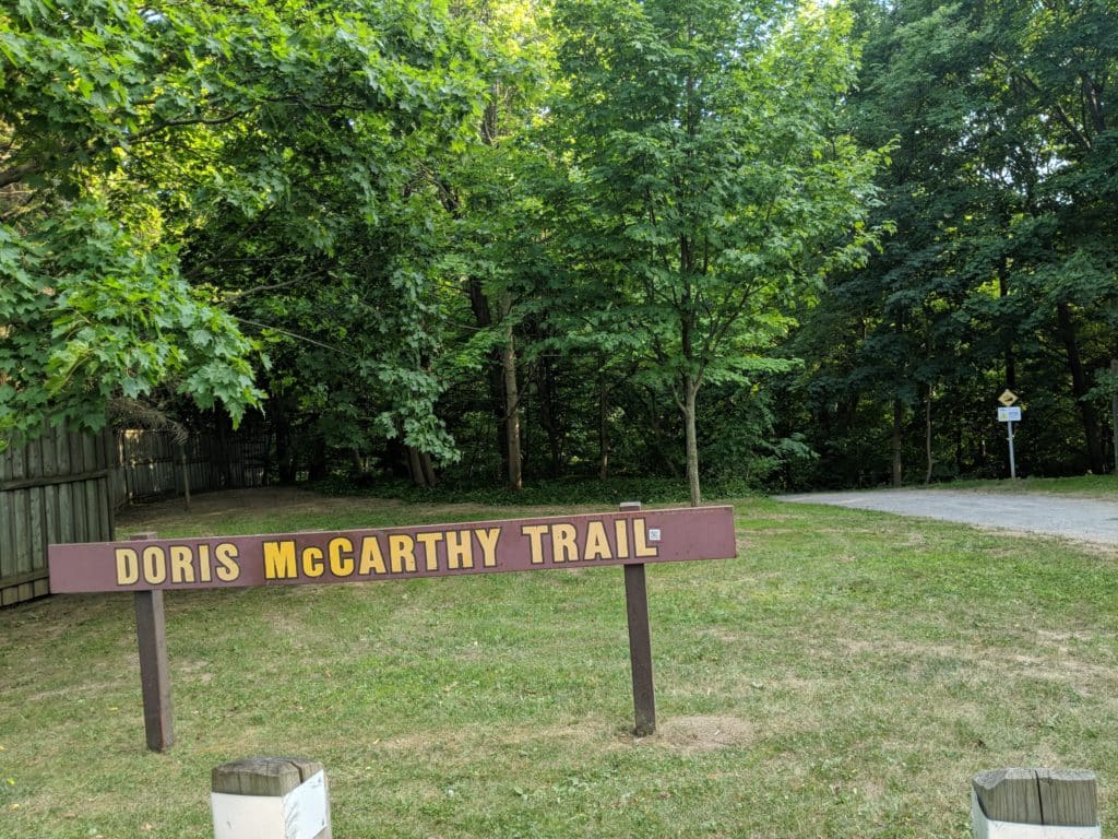
Doris McCarthy Trailhead is located at Ravine Drive and Bellehaven Crescent off Kingston Road.
Turn onto Ravine Dr from Kingston Road, the trailhead is on your right. Watch for signage indicating the start of the Doris McCarthy Trail.
Turn right onto the trail and follow it down to the lake.
Once you reach the “Passage”, you can turn left or right.
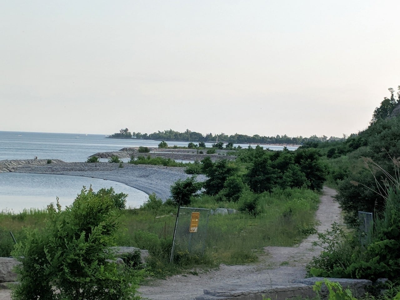
The trail to the Edge of Bluffer’s Park (you can see Bluffers Park beach at a distance)
The right trail leads you to the edge of Bluffers Park, while the left takes you along the water’s edge to the headlands at the base of Sylvan Park.
Trail to the left.
By public transit
Easily accessible by TTC. #102 Markham Bus stops are within 200 meters near the trailhead.
NO PARKING LOT. Street Parking is available near the trailhead.
What about Amenities & Accessibility at Doris McCarthy Trail ?
Not accessible, the wide gravel trail till the “Passage” is extremely steep.
NO washrooms.
Thank you very much for this site and the description of the Doris McCarthy Trail. It helped me save time, and plan my hike. Otherwise, I would have wasted time figuring things out myself. Thanks again.
Lovely trail. Since the trail is on the southern side of the province, the evening Sun doesn’t hit the trail as much, so if you want the Sun, it might be better to go for the hike earlier in the day. By around 5 pm on Labor Day, there was sunlight only on the rock extensions into the water. These were pretty nice, since one can stand and take in the view and watch the calm waters, but it’s only for breaks from the hike — if you want to walk, then the trail is mostly in the shade in the late afternoon.
The Map link on this page is WRONG! It takes you to a Ravine Drive in Tennessee. Webmaster – please fix to show Ravine Drive Scarborough Ontario.
Click on View Large Link, it will give you correct link. The “Tennessee” issue is a software issue, beyond our control.
can I park on the street ( Ravine Dr. ) at 5 am to walk down the trails to see sunrise ?