Credit: Parks Canada
Kootenay National Park was created way back in 1920, as a means to create a new road through the Rockies, and visitors are now so thankful that it was. The incredible beauty of the area is found in every waterfall, river, crevasse, mountaintop, and valley. You can explore by car or on foot, or a mixture of the two, whichever suits you best. Part of the UNESCO Canadian Rocky Mountain Parks World Heritage Site, there are no towns within the park itself, but accommodations can be found nearby in Radium Hot Springs, and Banff.
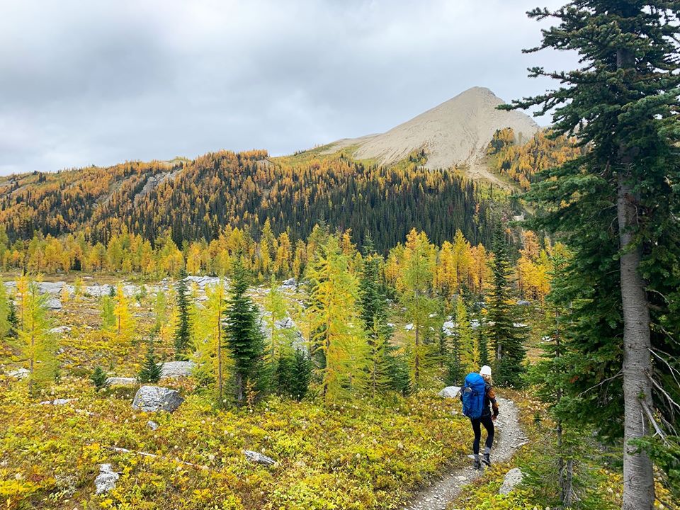
The Great Divide Trail in Kootenay National Park
This is a worthwhile journey, but for those who are very into hiking and have lots of experience. This is considered a difficult hike that is not for everyone. The entire trail crosses five national parks – Banff, Kootenay, Waterton, Jasper and Yoho and criss-crosses the Divide more than 30 times, but you can do a short portion that will give you an incredible wilderness experience. Be prepared for all conditions, including wildlife.
Radium Hot Springs
Technically not in the park itself, Radium is located just on the edge and makes a perfect stop to get some relaxation in. Radium is considered one of B.C.’s best mountain getaways. You could make this your destination and use it as a jumping off point to some of the best activities in the Kootenays. There are both hot and cold pools here with temperatures suitable for everyone. Consider this as either a summer or winter destination as there is plenty to enjoy in the area in all seasons.
Details
The Paint Pots
Just north of Radium Hot Springs you are going to find a short trail to take you to some unique natural pools, referred to as the paint pots. The trail is only about a kilometer long but prepared to get a bit dirty, good hiking shoes or boots are recommended if you are going in the summer. These iron-rich pools and ochre beds are culturally significant to indigenous people of the area. These spring-fed, colorful pools can be accessed by a snowshoe trail in the winter as well.
Kootenay National Park Red Chairs
Following the popularity of the red chairs in the surrounding areas, Parks Canada has placed two sets of red Muskoka chairs at scenic locations in Kootenay National Park for visitor’s enjoyment. The iconic red chairs always have incredible views and can be accessed all year round. You will find them at Marble Canyon and on the Juniper Trail at Radium Hot Springs.
Details
Marble Canyon
A year-round destination, this beautiful and unique area is popular with both locals and tourists. The water rushing down the craggy canyon creates an otherworldly experience that you can enjoy with a short hike through the wilderness. The 1.6-kilometer journey will take you across the canyon several times for incredible photo ops. The well-marked and well-maintained trail is suitable for all ages and abilities.
Details
Sinclair Canyon Hike
There are several gorgeous places within the park, but Sinclair Canyon with its falls is someplace, that if you don’t mind a hike, is a must-see destination. You need about an hour and a half to complete the walk if you don’t dawdle, as it is about 7.6 kilometers round trip. This is located right on the edge of the park by Radium Hot Springs and is easily accessible. You not only get up close to the base of the falls, but you have an opportunity to go up to get a view of the highway and surrounding peaks.
Trailhead: Parking area just inside the park’s West Gate; OR above the Radium Hot Springs Pools main parking lot.Habitat: Arid and cedar forests, canyon, and creek.
The Redwall Fault
Highway 93, which takes travellers from Radium Hot Springs, through Kootenay National Park, to the province of Alberta and the connection to Highway 1, offers phenomenal views of the region. As you drive through, one of the best photo stops and one of the most incredible formations is the Redwall Fault. You don’t have to worry about missing this, as the highway travels right through it! Along with the unique formation, you have a bird’s eye view of Sinclair Canyon and the beautiful falls.
Directions
Stanley Glacier
Most people access this hike from Banff or Lake Louise as it is not too far but is also accessible from Radium on Highway 93. You need at least four hours to complete this as it is an out and back length of just over 11 kilometers. The stunning landscape that accompanies you as you walk makes this all worth while, as you navigate the alpine meadows and forest. In the spring and early summer you will be able to see quite a few waterfalls streaming down, creating a piece of heaven on earth.
Details
Numa Falls
The Vermilion River area is easily accessed from the Banff-Windermere Highway 93and the Falls themselves are near the British Columbia and Alberta border, after the Kootenay River turns into the Vermilion River. There is a short walk from the parking lot to the scenic viewpoint and, while these may not be the most impressive falls in the area, they are amongst the most gorgeous. With the surrounding mountains, lush forest and rushing waters, photo ops abound. If you are a bit more adventurous, cross the river and continue onto the hiking path through the park.
Details
Olive Lake
After travelling the highway, you will find some quiet solace on the shores of the spring fed Olive Lake. The day use area is located right on the lake and it is a fantastic place to stretch your legs and breath in some clean mountain air. There are pit toilets on site, along with picnic tables to enjoy a lunch or snack. If you like, take a short stroll down the boardwalk to two viewpoints that overlook the lake and take in the informative signs on the area. Keep your eyes open, you may see wildlife or birdlife! Trail head: South side of Highway 93 South, east of the Radium Hot Springs pools.
Details
Continental Divide
On the western border of Kootenay National Park, you will find a small pull off area on the side of the highway with a monument noting the location of the Continental Divide. There are three significant reasons for this monument. It indicates the border of Kootenay National Park and Banff National Park, as well as the border between Alberta and British Columbia. The most important reason is the description of the continental divide as it is the drainage border of Western Canada, which means that all waters to the east flow to the Atlantic Ocean, and all waters to the west flow to the Pacific Ocean. Of course, along with the interesting information, there are beautiful views to enjoy.
Google Map
Fireweed Loops
The lower part of this trail is an interpretive walkway that covers information about the wildfire that was started by a lightening strike. The higher trail is a bit harder as it gains about 50 meters in elevation, but it is only about 700 meters in length, so if you don’t have a lot of time, you can still complete this walk. It takes you through the forest that was affected by the 1968 fire and gives you a good chance to see how the forest regenerates afterwards. We would suggest going through the interpretive route before climbing up to see the regrown forest area. You will start from the end of the parking lot at the Continental Divide.
Directions
Details
Kootenay Valley Viewpoint
The scenic Highway 93 offers vistas along its entire route and this viewpoint is just one of the many that provides travellers with an opportunity to pull over, breath in the incredibly clean mountain air, and soak up the views. With the Mitchell and Vermilion mountain ranges in view, there is no better place to stop.
Directions
McLeod Meadows Day Use Area
A lovely place to spend a bit of time on a hot day, the day use area is perfect to stop for a picnic or some relaxing time outdoors. The scenery can’t be beat and if you choose, you can walk a part or all of the Dog Lake Trail (listed below). There are toilets available in the day use area, along with picnic tables for your convenience.
Directions
Dog Lake Trail
This trail starts at the McLeod Meadows day use area and is an easy walk of just over 5 kilometers round trip. You can have great views of the Mitchell Mountain Range as you make your way down the trail and enjoy crossing the two incredible suspension bridges that span the Kootenay River. The trail is well marked and good for most hikers. The lovely trail takes you through a beautiful forest of firs to the peaceful lake. Be aware that this trail crosses some mountain biking trails.
Details
Wildlife Viewing in the Park
On a must-see list for Kootenay National Park, birdlife and wildlife viewing have to be a part of it. Some people travel to this area just for that. There are at least 180 species of birds and 57 species of mammals in the park. They range in size from the tiny pigmy shrew to the huge moose. The species normally found within the area include grizzly and black bear, wolf, coyote, cougar, lynx, wolverine, marten, marmot, white-tailed and mule deer, elk, moose, golden-mantled ground squirrels, mountain goat and Rocky Mountain bighorn sheep. Please do not approach or feed wildlife, remain in your vehicle (if you are driving), keep your campsites clean and don’t leave food out. Stay on designated trails as unofficial trails are often used by wildlife. Most importantly, make sure you have a camera on hand so you can document your wildlife views!
Details
East Kootenay Trail
Mountain biking is a big part of being in the mountains, so if you have a love of riding through some gorgeous scenery, this trail may be for you. It takes bikers from Pitts Creek to Daer Creek, a distance of approximately 12 km.There is access mid-trail at McLeod Meadows Picnic Area via Dog Lake Trail, but if you start at the day use area note that biking is not permitted on the Dog Lake Trail, so walk your bike to the cut off and ride from there.
Burgess Shale Fossils
While we are aware that the beginning of this hike actually starts in Yoho National Park, a big part of this UNESCO World Heritage Site is located in Kootenay National Park. It offers part of the oldest and most significant fossil beds in the world, which will definitely hold the interest of, well, pretty much anyone who has any interest in natural history. The Visitor’s Center offers a number of enjoyable exhibits about the area. Please note that these are accessed by guided tour only and it is advisable to make reservations well in advance.
Details
West Kootenay Trail
A fantastically beautiful mountain biking trail that leads you 12.8 kilometers one way to the park boundary from Kootenay Crossing. You can’t beat the views as you travel along this trail, and since it is relatively short you can allow lots of time for photo stops and to just enjoy the area. Maps are available from the visitors centre or online on the Parks Canada website.
Details
Dolly Varden Trail
Another fantastic mountain biking trail that will take you 10 kilometers one way between Kootenay Crossing and the Crooks Meadow Group Campground. This is listed as a moderate trail, so you may not want to try this is you are a complete beginner to doing off-road biking. The beautiful trail will make you want to spend even more time in the mountains.
Details
Fishing in the Kootenays
This is a great activity that is going to give you access to lakes and rivers in the Park. There is a mandatory catch and release order in place in the park, so be aware that you can’t keep what you catch. You can find kokanee, rainbow and cutthroat trout, dolly varden, burbot, and whitefish. You need a licence to enjoy this activity, although kids that are 16 years of age and under can fish without one. This is a fantastic way to soak up the gorgeous scenery of the Kootenays. Check the government website for any other information required.
Details
Simpson River Trail
The river trail takes you through an incredible burnout area from a fire in 2001, and its pretty cool to make your way through the regrowth with the amazing views of the mountaintops surrounding you. The rush of the beautiful river makes this walk even more special, not to mention the fact that it was named after Sir George Simpson, the Governor-In-Chief of the Hudson’s Bay Company way back in 1841. How neat to think that you may be walking in the exact same place as he did so many years ago.
Details
The Rockwall Trail
This is a trekkers dream destination, but please keep in mind that this is for experienced backcountry hikers only. The entire route is 55 kilometers in length, but it is possible to do some shorter sections instead (see descriptions below). You want to allow three to five days to do this hike. This is considered to be one of the finest treks in Canada, and the views are stunning as you take in the high alpine passes, creeks, falls, forests and slides. You need to be well prepared for backcountry trekking, potentially seeing wildlife including bears, and keep in mind that you should reserve your spot beforehand and get a wilderness pass.
Details
Helmet Creek and Falls Trail
A section of the Rockwall Trail, this is a 30-kilometerround trip journey that should take you two to three days to complete. The amazing destination is Helmet Falls, which falls 300 meters. Along with the gorgeous alpine scenery, you will come across unique avalanche areas and make your way through pretty forested areas. If you don’t think you have the skills to complete a multiday trek, or a beginner to the backwoods routes, try the Helmet Creek to Ocher Junction section instead. It is along the same path, but only 12.6 kilometers round trip and only two days.
Details
Tumbling Creek Trail
This trail is part of the difficult multiday Rockwall route and leads to the Tumbling Creek backcountry campground. The round trip is 21 kilometers in total for this section and will take two days. You will start at the Paint Pots parking lot and traverse your way through a beautiful forested route and along interesting avalanche slopes. The flowers in the early summer are gorgeous and one of the highlights of this trail is Tumbling Falls. Keep in mind that you will still require a wilderness pass and a reservation.
Details
Comfort Camping
Camp in style at an Otentik located at Redstreak Campground and enjoy homey comforts while enjoying everything that we know and love about the Canadian Rockies.
Plan Your Visit
When to Visit: Open Year Round Activities vary
How much: Adult: $ 10.00
Senior: $ 8.40
Youth: free
Family/Group: $ 20.00
Where:
More Information