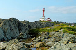
Credit: Nova Scotia Tourism
Halifax is a great city for walking, and with the weather getting warmer it’s a great time to get out and explore the trails. These 25 trails are in and around the HRM, so there’s sure to be one close by. Bring some water and strike out on an adventure; just social distance while you do.
Note: the areas defined below are rough approximations of the main trailheads, and there are some that have other names (ex. Uniacke is in Hants County).
1. Bayers Lake Business Park
BLT Trail
I love this trail, and I’m sure you will too. Following the old Beechville-Lakeside-Timberlea rail line, this trail is mainly flat and winds through some beautiful nature spots, while remaining close to civilization. The trail is 13 km long with several entry points (one in Bayers Lake Business Park), so you can walk for as long or as short as you want. If you want a really long challenge, the BLT hooks onto the St. Margaret’s trail which stretches all the way down to Hubbards.
Rating: Easy (Flat, straightforward, places to sit down)
Trail Map
Directions
Chain of Lakes Trail
This trail connects to the BLT trailhead, and heads in the other direction. The Chain of Lakes trailhead is on Joseph Howe Drive, and it continues out to the Bayers and Lakeside Business Parks, where it connects to the BLT. The 7.25km trail is nice and big, paved in some parts, and it stops right where the BLT begins.
Rating: Easy (flat, several places to connect to civilization)
Trail Map
Directions
2. Bedford
Cabin Lake Trail
This is a short trail close to Hemlock Ravine Park (see below). It’s a quiet walk in the woods about 2.5 km one way, and part of the trail is next to a lake. You’re allowed to bring your skates in the winter, but check to be sure that the lake is sufficiently frozen (and if you’re not sure, don’t go on it). The cabin this trail is named for is gone, but there are information panels that will tell you about its history.
Rating: Easy, flat and fairly short
Trail Map
Directions
Hemlock Ravine Park
Hemlock Ravine Park has several trails. There are loop trails of about 1km each, including one that you can have your dog off-leash. If you’re interested in a more challenging hike, there is a trail through a ravine that has fewer markings and is much wilder.
Rating: Easy with hills, Ravine is hard
Trail Map
Directions
Old Coach Road Trail
You’ll find this trail right off the Bedford Highway. It’s a 1 km stroll that let’s you birdwatch in all seasons, and snowshoe in the winter. It’s a great place to take a quick walk into the woods and get a taste of nature without getting deep into spooky woods.
Rating: Easy, short and sweet
Trail Map
Directions
3. Clayton Park
Belchers Marsh Park Trails
This is a small, beautiful little park in Clayton Park West. The trail is 2.5 km one way, and it takes you around the marsh through woodlands and wetlands. It’s a great spot for birdwatching, too!
Rating: Easy, mostly flat, fairly short
Trail Map
Directions
Mainland North Linear Parkway
This trail is an interesting beast. It winds through Clayton Park for 4.5 km and includes a 1 km loop, several hills, and crosses several major roads, so you can make some stops. In fact, it links important parts of Clayton Park, like schools, the Keshen Goodman library, and the Canada Games Centre.
Rating: Medium hilly in parts, also crosses major roads
Trail Map
Directions
4. Cole Harbour
Cole Harbour Heritage Park
This is a beautiful forested park in Cole Harbour, and the best way to explore it is along the trails. The main trail is a 9 km loop, but you can pick your own routes throughout the park. Most of the terrain is flat, so you can experience as much of the park as you can walk.
Rating: Easy, mostly flat, can choose your own route
Trail Map
Directions
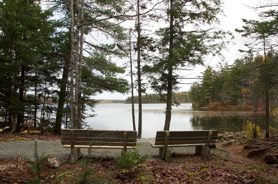
Salt Marsh Trail
This trail is internationally recognized as a fantastic place for birdwatching. There have been over 300 different species of birds observed here at different times of the year, so get a Bingo card, and start looking for seasonal sightings. The trail itself goes through the marsh, and is 6.5 km one way, so it’ll be a longer trip, but totally worth it for bird lovers and nature lovers of all kinds.
Rating: Easy, benches, pretty flat
Trail Map
Directions
5. Dartmouth
The Great Trail
The Trans-Canada Trail is obviously very long and awesome, and this 7 km section is a great introduction. It’s multipurpose, is parallel to the Shubenacadie Canal (see below), and passes lake Banook and lake Micmac. It’s a pleasant walk along the water and into the trees, and maybe one day you’ll start down the trail and not stop until you’re all the way on the other side of the country (make sure you bring snacks that day).
Rating: Easy, flat
Trail Map
Directions
Shubenacadie Canal Waterway
This trail follows the route of the old canals (some of which are functional, though not really in use). The whole of the waterway stretches 114 km from Dartmouth to the Bay of Fundy, so you’ve got plenty of places to get onto the trail. I’d recommend in Shubie Park (see below) in Dartmouth, or you could start at the other end in the Bay of Fundy, but that’s quite the walk home so maybe work up to that.
Rating: Easy, mostly flat
Trail Map
Directions
Shubie Park Trails
Shubie Park may not look as large as some of the other parks on this list, but it’s easily accessible to anyone in Dartmouth and it has lots of trail options. You can walk along part of the Shubenacadie Canal Waterway, but there’s 9km of trail options in total around the park, with parts where dogs are allowed off-leash. Shubie Park is a fantastic place to explore all year round, and these trails are the way to do it.
Rating: Easy, mainly flat
Trail Map
Directions
6. Fall River
Laurie Provincial Park
This park is mainly for camping, so why not make a trip out of it? There’s an official 1.9 km loop around the campgrounds, but there’s also plenty of places to wander throughout, including close to the water along the rocks and through the forest. You can easily choose your own terrain and distance, and then head off to work up an appetite for s’mores!
Rating: Easy to medium depending on how far you wander
Trail Map
Directions
7. Halifax
Halifax Urban Greenway
If you want to go for a quick walk in the city, check out the Urban Greenway. It’s 1 km long and paved, although there are natural footpaths leading off of it. You get a quick taste of nature without going too far out of your way, so it’s good for a very hot or very cool day.
Rating: Easy, flat, and short
Trail Map
Directions
Point Pleasant Park
Point Pleasant Park is a beautiful park full of history, mystery, and it has a gazebo (gazebos are important to me). There are several trails throughout the park (39 km in total), or you can just walk the perimeter of the park, see a lot, and that walk is only 3.36 km. There’s a variety of terrain, including some pretty steep hills, so if you’ve got any mobility issues make sure to check the maps.
Rating: Easy to medium–there are hills in the park, some are quite steep, but you can stick to flatter trails fairly easily.
Trail Map
Directions
8. Sackville/ Lower Sackville
Credit: Sackville Lakes Park and Trails Association
Fort Sackville Walkway
This trail is actually mostly in Bedford, leading along the Sackville River. It’s 2 km long, and gets to the Bedford Basin from Fort Sackville. Since the trail goes along the sidewalk, you can also stop at the Superstore if you want to grab a nice cold drink on a hot day.
Rating: Easy, mostly flat
Trail Map
Sackville Lakes Park
This park is known for its lakes for swimming and beach-going, but it also has two main trails. The first is along the shores of First Lake and is a linear 2 km trail. The second is by Second Lake, and is semi-looped and 2.8 km return trip. This would be a great place to go in the summer, because if you get too hot, you can just go jump in the lake to cool off—and you’ve got your choice of lakes, too!
Rating: Easy, mostly flat, shorter trails
Trail Map
Directions
9. Purcell’s Cove
Shaw Wilderness Park
This is a hauntingly beautiful wilderness park, and you’ll need hiking experience to enjoy it fully. It’s near Williams Lake, which is a great place for swimming, but the main draw are the trails that crisscross the park. There are too many to name here, especially since not all of them are mapped. Be prepared, bring a map and a compass, and set out on an adventure in this awesome park.
Rating: Medium ranging to experienced, not all trails are mapped
Trail Map
Directions
10. Sambro Creek
Crystal Crescent Park
Walking near the ocean is always wonderful, no matter what the season. Crystal Crescent Park is a great place to go for that. You can walk on the beaches, or you can take the boardwalk trail about 1-2km, or you can go for an 11 km loop hike that’s beautiful but also involves considerably more difficulty in terrain and navigating. Enjoy the sea air and the quiet in the fall; there’s nothing quite like it.
Rating: The boardwalk and beaches are easy, the 11 km loop is medium-experienced.
Trail Map
Directions
11. Spryfield
Frog Pond Trail
Frog Pond does indeed have frogs, and it’s a beautiful pond to see in any season (the winter is especially lovely in the snow). The trail goes around the pond for 1.6 km, and connects to the Sir Sandford Fleming Trail (see below). It’s a splendid place to take kids to see frogs, birds, and some other animals that you’ll have to find for yourself!
Rating: Easy, mostly flat, loop
Trail Map
Directions
Long Lake Provincial Park
This is a beautiful park to explore, and there’s something for everyone here. There’s even a variety of options for hiking. There are several paths that are easier for beginners, including the loop around Witherod Lake. In addition, there are harder trails, including some that are unmarked, so exercise caution and bring navigation aids like maps and compasses (and also snacks, because snacks are important). Only fifteen minutes from downtown Halifax by car, this park is a great option for a group with different skill levels.
Rating: Easy ranging to experienced
Trail Map
Directions
McIntosh Run Community Trail
As far as I can tell, there are no apples here. There is a lovely 3 km trail where you can run beside a river and ponds, so the name is mostly right. It’s not fully paved, so there are some challenges, but it’s mostly flat. You might spot beavers, and depending on the season you’re likely to see fly fishermen.
Rating: easy to medium due to terrain, but fairly short
Trail Map
Directions
Sir Sandford Fleming Park
This loop trail does connect to Frog Pond Trail, but if you just want to walk the 2.8 km loop you’ll still get a great walk in nature. The park is on the Northwest Arm, so you’ll see the ocean, and if you’ve got kids with you they can play at the playground after the walk. This particular trail is open April 1st-October 31st—that might be a fun idea for a Halloween adventure!
Rating: Easy, mostly flat, short loop
Trail Map
Directions
12. Timberlea
Bluff Wilderness Hiking Trail
If you want to really get out into the wilderness, you can get here by hiking down the BLT trail as far as Timberlea, or you could drive to the parking lot (which is much easier, see map). The Bluff Wilderness Hiking trail is a loop trail with four stacked loops. Each loop can take 3-6 hours with varying terrain, and that’s not counting walking along the link between the loops.
Rating: Experienced. It’s very remote, they’re backcountry trails and the terrain varies between the loops–check the link below to decide on your loop adventure.
Trail Map
Directions
13. Uniacke
Uniacke Estate Museum Park
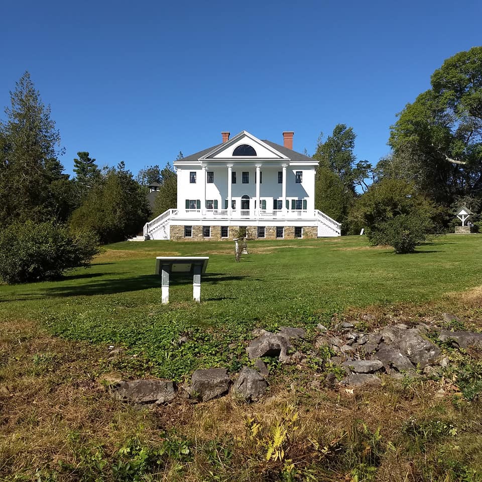
Credit: Uniacke Estate Museum Park
This is a great park for both history and exercise. There are eight different trails throughout the park, with lengths ranging from 0.7 km to 7.8 km long, so you can choose how long you want to wander. You can also have a picnic, as there are picnic tables scattered throughout the park.
Rating: Depends on the trail, easy to medium
Trail Map
Directions
By: Adrienne Colborne