Cascade, tiered, punchbowl, plunge. There are so many Waterfalls in Hamilton that its no wonder it’s known as the City of Waterfalls. Many of the popular hiking trails lead to these beautiful falls. But did you know, there are other hiking trails that introduces you to the unique history of the region – geological, natural and economic? Check out this list of hiking trails in and around Hamilton.
Check the trail opening (some trails/parts of them may be closed to maintain social distancing) and the trail conditions before starting.
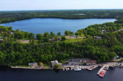
1. Christie Lake Hiking Trails
Christie Lake Trails are among the most popular hiking trails in Hamilton. Explore over 10 km of multi-use recreational trails that pass through meadows and pine forests. The trails range from easy to moderate with very short 0.4 km Wedeln Run trail to the longer 5.6 km Round the Lake trail. Trail Map
Parking lot: At 1000 ON 5
2. Sassafras Point Trail
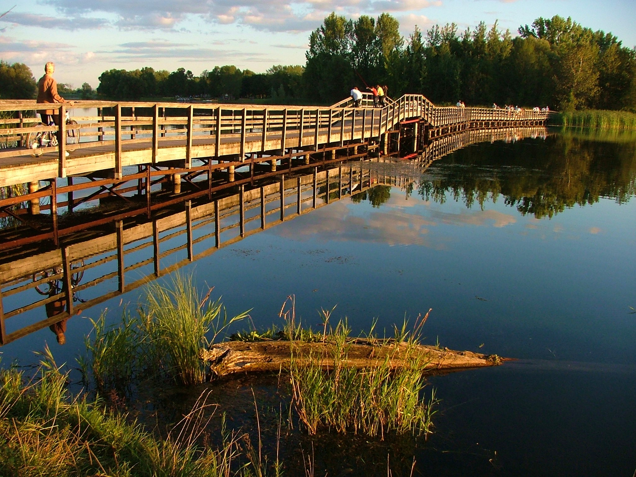
Sassafras Point Trail is a part of the 27-kms of Cootes Paradise Trails traversing boardwalks, asphalt, crushed stones, and packed earth with few steep and hilly sections. Cootes Paradise is an 840-hectare sanctuary and a significant migratory bird stopover managed by the Royal Botanical Gardens. The more popular of those is the Sassafras Trail. The trail can be accessed from Caleb’s Walk via Ravine Road Trail. It can also be accessed from Michell Crescent, or from Marion Avenue/Dromore Crescent North. Trail Map
Parking lot: Paid trailheads Parking lots at RGB
3. Waterdown Wetland Trail
This is a 10.2 km return hiking trail leading to Smokey Hollow Falls. This is a great hike to undertake with kids. Although some sections may be hard for small kids, the trail has plenty of shaded regions and rewards with spectacular views along the Niagara Escarpment slope. This beautiful 10-metre ribbon waterfall flowing from Grindstone Creek is also known as Grindstone, Waterdown or Great Falls. More details
Parking lot: Parking lot just off Mill Street.
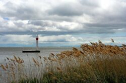
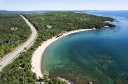
4. The Waterfront Trail
The Waterfront Trail is a 3000 km long route along the Canadian shores of the Great Lakes region, passing through, among others, many provincial parks, national parks, lakes, and beaches. Hamilton’s waterfront is a great place to spend time with family. Have a picnic at Bayfront Park, enjoy a meal at one of the restaurants nearby, go on a cycling adventure; whichever you choose, you can be guaranteed a great time outdoors. Check out the waterfront trails website where you can find fun ideas you can do as a family. Did you know there are also some excellent campsites that you can camp out near the trail?
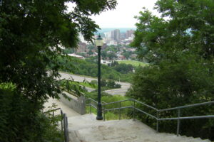
5. Chedoke Radial Trail
Chedoke Radial Trail is a 2.7 km long pedestrian and bicycle recreational trail section of the Bruce Trail and follows the former trackway of the Brantford and Hamilton Electric Railway. The trail starts at Hillcrest Avenue and winds southwest along the Chedoke Golf Course, traverses the escarpment to Scenic Drive where it links with the Bruce Trail. The trail ends at Highway 403. Hikers along the trail can enjoy several waterfalls, views of West Hamilton, and the Dundas Valley as well as the beauty of the Niagara Escarpment. Another popular alternative to reach the trails is to go up the 289 Chedoke Stairs which will give you direct access to the top of the escarpment. Trail Map
Parking lot: Cherdoke Parking lot
6. The Bruce Trail
Hiking the whole Bruce trail from Niagara to Tobermory is a true multi-day outdoor adventure with amazing waterfalls and the breathtaking beauty of the Niagara Escarpment to keep you company. The section of Bruce trail in the region begins at the shoreline of Lake Iroquois. The trail is well connected to major urban centres of Southern Ontario, which means you can easily access the trail. Great Falls loop trail and the Felker’s to Albion Falls trails are good options for a short day hike. Details
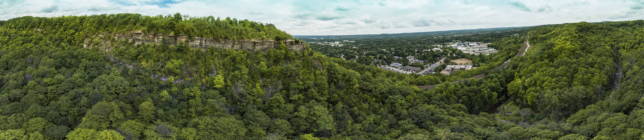
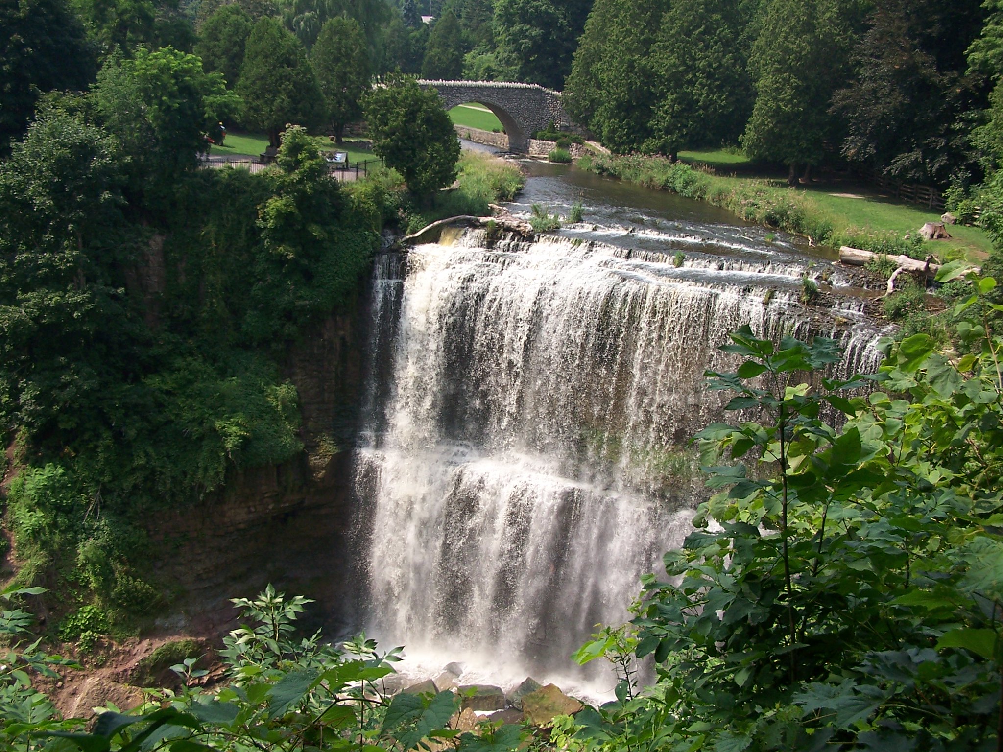
7. Spencer Adventure Trail
Stretching 5.4 km from Christie Dam to Dundas Peak is the Spencer Adventure Trail along the Spencer Creek Gorge. Sections of the trail match the Bruce Trail and pass along Webster Falls and Tew Falls (highest in the region). Spencer Creek Gorge is part of the Niagara Escarpment Biosphere and the trail reflects the unique geology and ecology of the area. Hikers, cyclists, cross-country skiers, dog-walkers can access the trail system and get to know the history of the region. You can see ruins of mills and dams on the route. Trail Map
Parking lot: Parking lot near Optimist trailhead
8. Devil’s Punchbowl Trail
Located at the Devil’s Punchbowl Conservation Area, there are two waterfalls to view on the trail – Upper and Lower Punch Bowl Falls. The Punchbowl and the gorge were created by melt-water rivers that plunged over the Stoney Creek escarpment at the end of the last ice age, creating one of the most picturesque sights of the Niagara Escarpment. Details
Parking lot: Devil’s Punchbowl Parking lot
9. Dofasco 2000 Rail Trail
This is an 11.5-km trek through rural Stoney Creek, along the boardwalk through Vinemount Swamp Forest. The trail connects Devil’s PunchBowl Conservation Area, 87-Acres Park, the Bruce Trail and Battlefield House Museum and Park. The trail can be accessed from anywhere along its length. Details
Parking lot: Devil’s Punchbowl Parking lot
10. Pioneer Creek Trail
With 6.5-km of beauty in a natural setting with raptors, bisons, horses, and more to keep your company, the trail is a welcome change from urban life. Younger ones in the family would love the easy 1.6 km Wildlife Walkway. Trail Map
Parking lot: Mountsberg Conservation Area Parking Lot
11. Dundas Valley Trail System
The Dundas Valley trail is a 40-km trail system with access to almost every part of Dundas Valley. Of the three major trails here, the Main Loop Trail is a popular one which leads to the Hermitage Ruins, Sulphur Spring and Hermitage Cascade. The Monarch trails have several branches including the Headwaters Trail, Monarch Trail, Sulphur Creek trail and the Heritage trail that leads to Canterbury Falls. The other major trails here are the Bruce Trail and the 32-km Hamilton to Brantford Rail Trail. The trail system is open to hikers, cyclists, dog-walkers, and equestrians. Trail map
Parking lot: 6 parking lots to choose from.
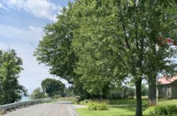
12. Hamilton to Brantford Rail Trail
This is Canada’s first fully developed interurban recreational trail. This multi-use trail offers good bicycling and hiking opportunities and most sections can be accessed on wheelchairs. The 32-km roundtrip trail uses the abandoned route of the Toronto, Hamilton & Buffalo Railway. Trail Map
Parking lot: Parking lot at Ewen Road trailhead
13. Princess Point Trail
Princess Point Trail is also a part of the Cootes Paradise Trail. The Princess Point is a gathering place and trail hub. View this great video by RGB for a virtual journey along the trail. Trail Map
Parking lot: Princess Point Parking lot
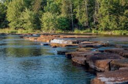
14. Quarry Trail
Quarry Trail is located at The Fletcher Creek Ecological Preserve, a provincially significant wetland. The Quarry trail takes you to view an abandoned quarry which on restoration created a rare type of wetland of a fen plant community. The interpretive panels along the trail explain the importance of the region. Trail Map
Parking lot: Parking lot at Concession Road 7
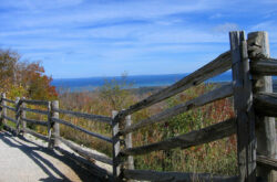
15. North and South Loop Hiking Trails
Located at the Mount Nemo Conservation Area are two small hiking loop trails – the 2.3-km North Loop Trail and the 2.6-km South Loop Trail. Both trails are among the best scenic trails in the province with unique geological features, plant and animal life. The Brock Harris Lookout is a magnificent viewpoint that provides glimpses of the communities from above. Trail Map
Parking lot: Mount Nemo Conservation Area Parking lot
16. King’s Forest Waterfall Walk
The trek takes you to one of Hamilton’s popular waterfalls, the Albion Falls. Albion Falls is a 19 m tall and 18 m wide tiered waterfall and easily accessed. For a more leisurely hike, start from the Oak Knoll Parking lot and trek the Mountain Brow Side Trail towards Albion Falls. There are a couple of lookouts here from where you can get views of the cascade falls. Continue on this road to Albion Falls crossing Mud Street and the parking lot. Cross to the Red Hill Valley along the Bruce Trail to the Glendale Falls. You can hike back along the Mountian Brow Access Trail to the Oak Knoll Parking lot. Details
Parking lot: the closest one is the Mountain Brow Blvd parking lot
17. Bull’s Point Trail
This is a great hike to enjoy at the Royal Botanical Gardens with magnificent views and vistas. This is a 5.8 km hike with lookout points along the trail. Spot local birds and other marsh creatures. Trail Map
Parking lot: Access from York Road
18. Rock Chapel Loop
The Rock Chapel Loop is a 6.3 km trail along the Niagara Escarpment and a part of the Niagara Escarpment UNESCO World Biosphere Reserve. The hike features Borer’s Falls, a 15-meter waterfall drop, and scenic escarpment valley home to a diverse variety of rare flora and fauna. Walkthrough more than 420 million years of history during this 6.3 km hike with distinct habitats. There are many unique sights you can observe along the trail including the rock wall, cedar trees at the very edge of a cliff The bench lookout along the trail is a great lookout point with views of the west end of Coote’s Paradise, downtown Hamilton, Dundas, as well as the escarpment. Trail Map
Parking lot: Trailhead access from York Road
19. Red Hill Valley Trail
10-km trail starts from the Kings Forest Park and has some very picturesque scenery. The trail traverses the escarpment and runs alongside the Red Hill Valley to its end at Barton Street E or continue on to the Confederation Park at Waterfront Trail. Hikers who don’t want to hike the whole distance can cut short their trip at any of the road crossings. Details
Parking lot: Red Hill Trail South Parking lot
20. Gordon Glaves Grand River Loop
The trail follows the Grand River southwards along the SC Johnson Trail, passing Wilkes Dam towards Waterworks Park, across Brant’s Crossing, and then follows the river back upstream on the return route passing D’Augigny Creek Park and the Oakhill Cemetry to meetup with SC Johnson Trail. Beautiful scenes of forests, tall grass prairie, with natural areas can be seen on this 18-km route. Trail Map
Parking lot: Hardy Road Parking lot across the trailhead
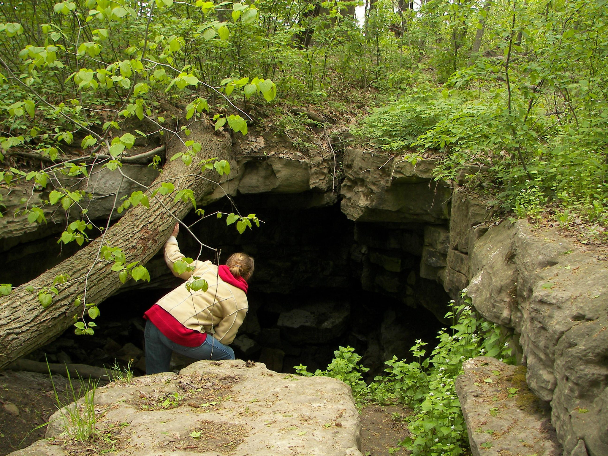
21. Eramosa Karst Hiking Trails
Hike through escarpment forests along boardwalks and bridges with underground caves, passages, caverns, and underground streams at the Eramosa Hiking Trails. Visitors to this region will be introduced to the karst landscape, a limestone formation with sinkholes, dry valleys, soil pipes, and sinking streams all caused by dissolving rock. This is an area is designated as an Area of Natural and Scientific Interest; with The Eramosa Karst having 16 different karst features including a 335 meter-long cave, the tenth longest in Ontario. Trail map
Parking lot: Eramosa Karst Parking lot; Parking is $10 per day; free with HCA Membership Pass.
22. Friendship Trail Loop
Located at Kerns Road is the trailhead of this 2.9-km route that is a great hiking trail for all skill levels. Details
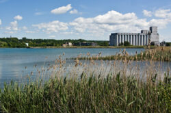
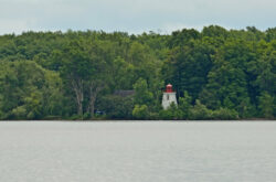
23. Valens Lake Trail
Credit: Hamilton Conservation Authority
Valens Lake Conservation Area is a popular place with its access to great hiking trails, wildlife viewing, fishing area, beach for swimming, boating and not to mention the campsites here. There are 10-km of trails you can explore including passing a wetland boardwalk and an observation tower overlooking the Valens Lake. Trail Map
Parking lot: Parking lot off Regional 97 Road
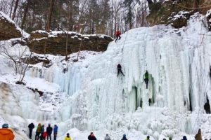
24. Hilton Falls Trails
A popular trail with lots of visitors, the Hilton Falls trails is a 3-km trail ending with climbing the stairs for a scenic view of the Hilton Falls. Though certain sections of the trail are uneven and have steep stairs, this is still a great hike to do with young ones. For a more challenging hike, try the 8-km return Beaver Dam Trail. Trail Map
Parking lot: At Hilton Falls Conservation Area
25. The Nassagaweya Trail
Trek through the Nassagaweya Canyon to the Crawford Lake Conservation Area on this 9.4-km return trail. With beautiful lookouts of the Nassagaweta Canyon, the trek more than makes up for the challenge it provides. Vista Adventure trail also has very scenic lookout points. Trail Map
Parking lot: At the Rattlesnake Point Conservation Area
26. Westfield Heritage Village Conservation Area Hiking Trails
Explore 8-km of walking trails at the Village that are easily accessed and great for families. Details and Map
Parking lot: Westfield Heritage Village Conservation Area
Useful Resources
- The Loops and Lattes hiking books (Hamilton Edition) – Available online or at RBG shop
Winter Fun in Hamilton: Top Events, Festivals and Outdoor Adventures