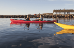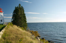
Credit: Municipality of Digby Trails
Nova Scotia is a beautiful province in so many ways, so there have to be many ways to enjoy these beauties. From the Halifax Regional Municipality to off the South Shore to the northern tip of Cape Breton, you’ll find hiking trails and lookouts for multiple points of interest. I hope this article will help you in your quest to see the beautiful places you’re most keen to see, and maybe even discover a few new ones!
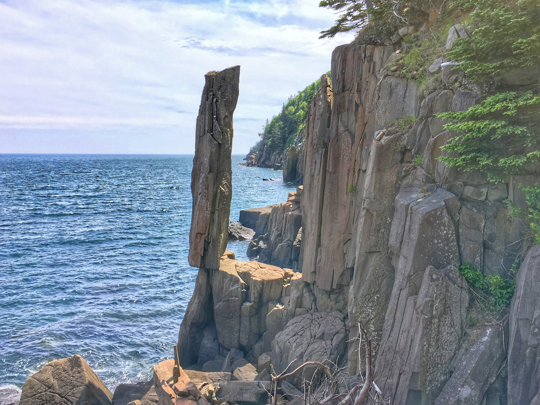
Balancing Rock Trail
Balancing Rock makes me laugh every time I see a picture of it, because it looks so absurd and majestic at the same time. It’s 20 tonnes of rock defying gravity at the edge of a cliff, so that view alone is worth the trail. The Balancing Rock Trail is also an enjoyable way to view the Bay of Fundy as you clamber up the 235 stairs at the end to stand beside the Balancing Rock. Get a workout, see a natural marvel, and enjoy the spectacular view of the bay all at once. Details
Rating: Medium (that’s a lot of stairs)
BLT Trail
Once upon a time you’d be enjoying the scenery of this trail from a train window. The Beechville-Lakeside-Timberlea line was ripped up and in its place is a beautiful flat trail perfect for walking, running, and biking. You’ll cross some larger roads, but most of the trail is in the woods, winding past rivers and lakes. I’d personally recommend early summer or fall, whenthe scenery is at its finest. Details
Rating: Easy, flat and mostly paved
Bluff Wilderness Hiking Trail
If you’re looking for a wilder backcountry experience, the Bluff Wilderness Hiking Trail should fit the bill. The trail is technically four interconnected loops about 10 km long each, with a trail connecting the loops. It’s very isolated and perfect for quiet hiking days. Just bring a buddy and set out on an adventure.
Rating: Medium to Experienced, navigational aids recommended
Long Lake Provincial Park
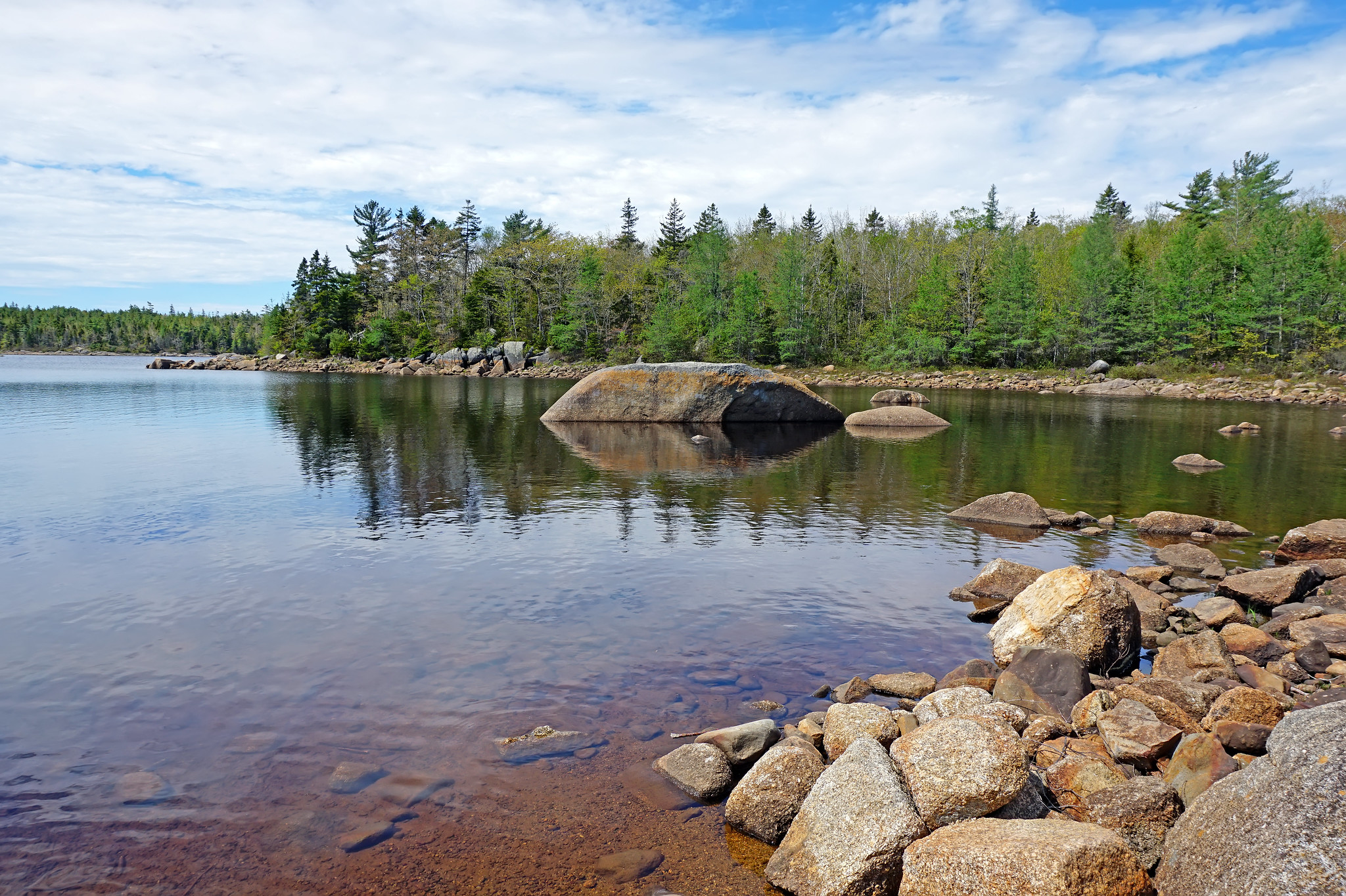
Long Lake Provincial Park; Credit: Dennis Jarvis
Fifteen minutes from downtown Halifax, Long Lake Provincial Park gives you a variety of scenery to experience. The lake itself is beautiful and you can enjoy sitting along the shore, swimming, or kayaking. There are also several trails that wind throughout the park’s varied terrain, some easy and some only for the adventurous and experienced. With a short drive back to the big city, you can easily take a whole day and still not see everything this park has to offer. Details
Rating: Easy to Experienced; if you’re going on the unmarked trails you will need to bring navigational aids.
Peggy’s Cove
This cove is an icon of Nova Scotia for many reasons; the fishing village that could be mistaken for another century’s homes, the lighthouse that stands guard, and the hiking trails that let you explore the area. Simply driving to the lighthouse is enough to take a deep look out at the ocean, gazing across endless waves as you stand on the rocks under the lighthouse. Every day is different, but the roar of the ocean and the power of the history in this place remains the same. Details
Note: please don’t climb on wet rocks, and follow the signs and any instructions from staff. Be safe!
Pennant Point Trail
Rating: Medium to Hard, navigational aids encouraged
Salt Marsh Trail
Salt marshes are an interesting part of the Nova Scotian coastlines, and Salt Marsh Trail is an excellent place for a first look. The trail itself is under 5 km, and every metre of it shows off the unique loveliness of the area. Keep a sharp eye for birds; this trail is internationally recognized as an ideal spot for bird watching of hundreds of species. Sometimes you need to stop to smell the roses; other times you need to stop and breath in the salty air as you take pictures of stunning birds. Details
Rating: Easy, mainly flat trail
Shaw Wilderness Park
This is a recent conservation project, connecting several areas well-known for outdoor recreation under a conservation umbrella. It’s a huge wilderness area that’s meant to be preserved for humans and nature for generations. It’ll be fully open this summer, so take some time now to check out the park and where you can go to see nature in its full glory; trails, lakes, and climbing awaits! Details
Rating: Easy to Experienced depending on the routes you take; navigational aids encouraged
Blomidon Look-Off
The Annapolis Valley is an integral part of Nova Scotia. It’s kilometres of rolling farmlands, dozens of U-picks, the home of Acadia university, and even a ski hill. When you’re in the valley you can see pretty far, but if you want to see the whole of the valley you need to head to Blomidon Provincial Park. The Blomidon Look-Off shows off the valley in all its glory, so bring some snacks and see what you can see—it’s a great place to play I Spy. Details
https://www.instagram.com/p/B4f4JIQHAWo/
Rating: Easy, there’s not much walking to the Look-Off itself
George Fraser Shot Canyon
This is a special kind of hike because it’s significantly more dangerous than the other hikes in this article, but the risk is worth the reward. Once you’ve hiked to the first waterfall and climbed down the rope, you’ll get into the canyon, where you’ll find another huge waterfall flanked by high gorge walls. Exercise caution, bring your own gear and buddies and set off prepared for an exceptional hike. Details
Rating: Experienced
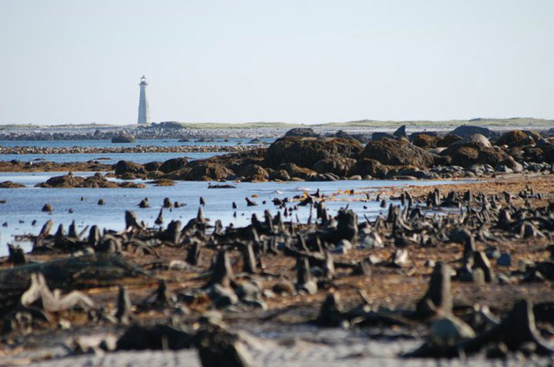
The Hawk Beach
Cape Sable Island doesn’t have ponies (that’s Sable Island, further out to sea), but you can drive onto this island to see Hawk Beach. There are dozens of beaches in Nova Scotia, but Hawk Beach holds something very special: a drowned forest. At low tide you can see petrified tree roots that are over 1500 years old. Wander among the drowned and look for birds flying overhead through this Important Bird Area. Details
Rating: Easy, mainly beach walking
Kejimkujik National Park
Kejimkujik National Park provides a variety of beautiful scenery. Hike through the backcountry woods, walk along easier trails to spend time with the family, or just walk along the water. At night there’s a special kind of scenery: the stars, because Keji is a Dark Sky Preserve. Sit beside a campfire and watch the stars before you go to sleep, ready for another day at the park tomorrow. Details
Rating: Easy to Experienced, navigational aids encouraged
Lunenburg
Lunenburg is a UNESCO heritage site for many reasons, and most of those reasons contribute to the loveliness of the area. Lunenburg is a beautiful little town rich with history, and there are a few trails that will take you through the surrounding land. Even walking through the town is beautiful, because you’re never far from the water and the fishing boats, as well as the place where the Bluenose II was built.
Rating: Easy, either flat trails or flat streets
The Ovens
The phrase ‘hauntingly beautiful’ seems to have been created for this place. The Ovens are a park with many trails along a cliffside, overlooking three giant sea caves – Tucker’s Tunnel, Indian Cave, Cannon Cave. Rain or shine, the noise of the waves moving into the caves will make you look down, while the vista of open ocean will make you lookout. If you’re feeling particularly ambitious, you can also kayak alongside the caves. Details
Rating: Easy to Medium depending on tolerance for rougher paths
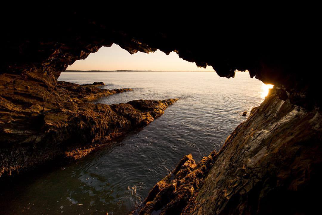
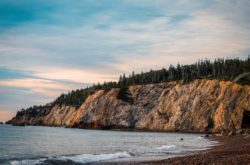
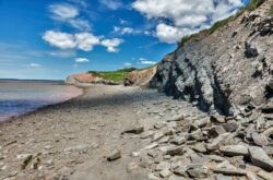
Ovens Natural Park
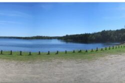
The Tobeatic Wilderness
Rating: Easy to medium, check your route for specifics
Brier Island
Right at the entrance to the Bay of Fundy lies Brier Island, whose cliffs tower over the Bay and provide a spectacular vantage point for the lodge. You can spend a whole day exploring the island through its various trails, watching birds, seals, and maybe even a whale or two. If you like rocks, you’ll find dozens of specimens quite easily, and if you really like whales, you can take a whale watching tour to spot even more before you head back to the lodge to watch the sunset. Details
Rating: Easy to Medium, depending on trail, navigational aids encouraged
Burncoat Head Park
This park is fascinating because you can literally see the power of the Bay of Fundy’s tides. As you walk along the beach, you’ll see huge areas of uncovered ocean floor at low tide, letting you see shallow-water marine life up close and personal. Make sure not to leave anything too close to the waterline, though; the tides rise very quickly, and you can easily lose your sandals, like my sister almost did. For picnics, it’s best to go into the Acadian Forest part of the park, where you can sit at a picnic table before taking a walk through the trees. Details
Rating: Easy, the beach is flat and the forest trails aren’t challenging
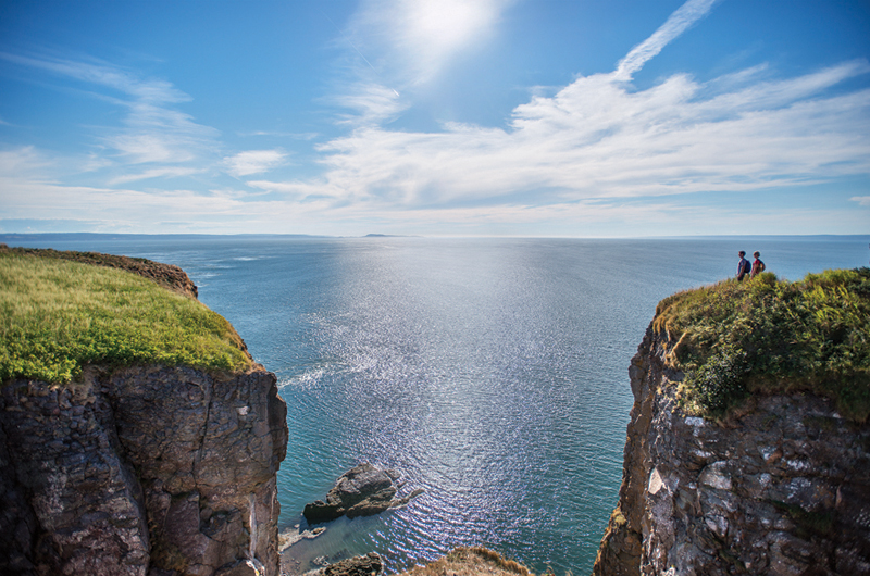
Cape Split Provincial Park
Cape Split is kind of like a wilder version of Brier Island. The trail through this park is challenging, taking around 5 hours to complete. But the end of the trail is a spectacular view of the Bay of Fundy, so if you’re looking for a more adventurous day hike, this is the place for you. Observe wildlife, stay on the trail, and soak in the beauty of the park, which is beautiful even without the view of the bay. Details
Rating: Medium to Hard, depending on tolerance of rougher paths, navigational aids encouraged if you’re planning to wander off the trail
Credit: Govt. of Nova Scotia
Acadian Trail
The Acadian Trail (or le sentierAcadien) is an 8.4 km loop trail above Chéticamp. Yes, above; the trail rises to a 365 m elevation. The terrain itself isn’t too challenging, and there are plenty of benches along the way to rest as you climber higher. You can look out over the Chéticamp River, or just watch as the forest changes around you the higher you go. As always, practice animal safety as you climb, and check out all five look-out telescopes along the path to see all you can see. Details
Rating: Medium to Hard, depending on experience with climbing
Cape Clear
The link below describes in detail how to get to Cape Clear, so I won’t go over that, although it’s worth pointing out that you can drive most of the way there, so it’s not too demanding a hike. It is truly a remarkable lookout point at 1,500m of elevation, and you can see for about that far over the river and valleys below. Details
Rating: Easy, you can drive the majority of the way out depending on the weather
https://www.instagram.com/p/61DREjDduq/
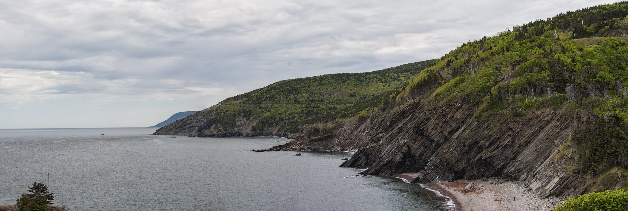
Cabot Trail
This is an epic trail; some would say the trail in Cape Breton, and possibly all of Nova Scotia. It’s a 300 km loop, so it’s not a day trip by any means if you’re going by foot. Most people will drive part of the way and then do a hike to a particular spot and back. Others will hike the whole way over several days, exploring the local communities as they go. It’s a wonderful way to experience Cape Breton’s natural beauty, and a great excuse to slow down, meet great people, and commune with nature. Details
Rating: Easy to Experienced, depending on where you’re hiking and how far.
Franey Trail
Franey trail is on the east side of the Cabot Trail, very close to Ingonish Beach. It’s a loop that’s very popular, so you might make some new hiking friends, and there’s a lake to cool off in (although swimming’s not really recommended). It’s not an easy hike, but everyone who goes there says the views are spectacular. If you’re already over Cape Smokey and you want to work up to the Cabot Trail, give it a go! Details
Rating: Medium to Hard, since there are some parts where climbing is necessary
Meat Cove
This cove is so beautiful it’s truly a mystery how they picked the name. Right on the edge of Cape Breton, this cove offers fantastic ocean views, beautiful trails, and extensive campgrounds. It’s also on the Cabot Trail, so whether you’re driving, hiking, or a combination, you can stop in here for a break. Details
Rating: Easy to Hard, depending on where you’re hiking
Credit: mrbanjo1138
North Bay Beach
Rating: Easy, it’s mainly beach walking.
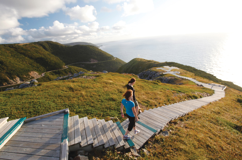
Skyline Trail
If the Acadian Trail wasn’t quite high enough for you, check out the Skyline Trail. This 8.2 km loop is on top of French Mountain, and you can actually look down and see the Cabot Trail. Get to the headland cliff for the most expansive ocean views, but the whole trail offers plenty of spectacular views of the surrounding area. Several parts of the trail are boardwalk and the rest of the terrain isn’t difficult, so the whole family can enjoy walking among the clouds. Details
Rating: Easy to Medium depending on your tolerance for heights
By: Adrienne Colborne