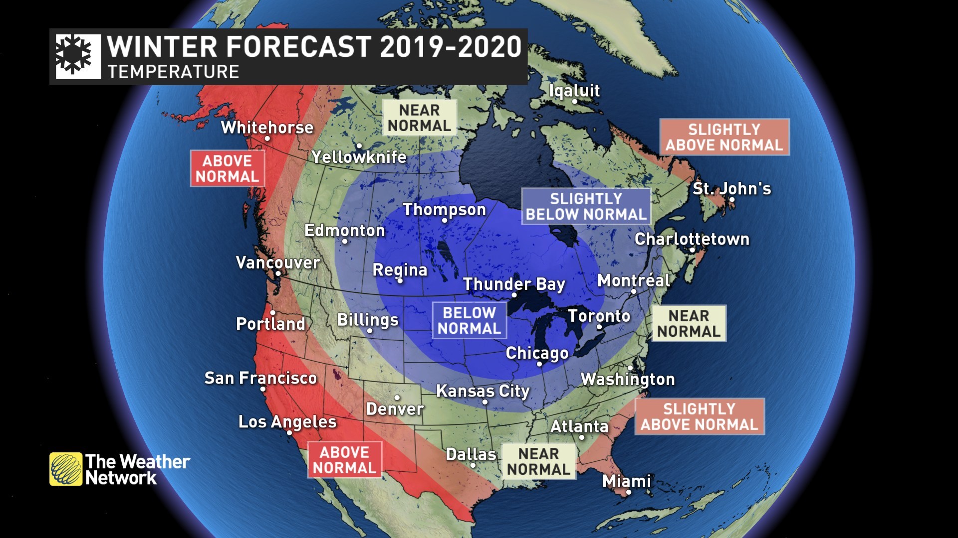
Temperature Map (CNW Group/Pelmorex Corp.)
The Weather network has released its annual winter forecast for the 2019-2020 season and much of Canada is in for a long cold, snowy winter.
According to Weather Network, much of the country can expect near normal to above normal snowfall with the exceptions being Atlantic and Pacific coastlines, where it can be milder than normal.
The Weather Network Winter Weather Forecast for 2019-2020
British Columbia – Mild to Near Normal
The Weather Network expects that rainfall totals will be slightly below normal for the south coast, but near normal snowfall is expected for the ski areas with near normal to above normal snowfall and near normal temperatures for the central and southern Rockies. Near seasonal temperatures and snowfall are expected for the interior, but temperatures should be above normal near the coastline and across the north.
Temperature Outlook: Above normal west and north; Near normal southern interior and east
Precipitation Outlook: Above normal north coast and southwest; Below normal south coast; Near normal elsewhere
Prairies
The Prairies can expect a long and frigid winter, with the coldest weather across Saskatchewan and Manitoba. Alberta will see periods of mild weather which could come close to offsetting the bouts of severe cold. The Weather Network expects that the coincidence periods of active weather and cooler weather will allow ski areas in the rockies to pick-up substantial snowfall at times.
Alberta – Mild at Times, With Bouts of Severe Cold
Temperature Outlook: Near normal west; Below normal east
Precipitation Outlook: Above normal southwest and far south; Near normal elsewhere
Saskatchewan – Long Frigid Winter
Temperature Outlook: Near normal west; Below normal east
Precipitation Outlook: Above normal southwest and far south; Near normal elsewhere
Manitoba – Long Frigid Winter
Temperature Outlook: Near normal west; Below normal east
Precipitation Outlook: Above normal southwest and far south; Near normal elsewhere
Ontario and Quebec
Ontario and Quebec can expect above normal snow totals to much of the region and a delayed start to spring. Northern Ontario is in for cold winter, while this winter brings along a risk of freezing rain at times to Southern Ontario. The above normal snow level can bring with it a threat of flooding along the shorelines of the Great Lakes.
Ontario – Long Snowy Winter
Temperature Outlook: Near normal west; Below normal east
Precipitation Outlook: Near normal northwest; Above normal elsewhere
Quebec – Long Snowy Winter
Temperature Outlook: Below normal; Near normal north and east
Precipitation Outlook: Above normal south; Near normal central and north
Atlantic Canada – Near to above Normal Snowfalls
An inconsistent start to winter is expected, but this region will still see an abundance of winter weather with near to above normal snowfall totals. Southern and eastern coastal areas of Nova Scotia and Newfoundland will see periods of milder weather at times with a higher potential for rain and ice. A delayed start to spring is expected for the entire region.
Temperature Outlook: Near normal; Above normal southern and eastern Nova Scotia and Newfoundland
Precipitation Outlook: Above normal Maritimes; Near normal Newfoundland
Northern Canada – Yukon, Northwest Territories, Nunavut
A typical winter is expected across the region with near normal temperatures and snowfall. However, periods of milder weather at times across western areas should tip this region to the mild side of normal
Temperature Outlook: Above normal Yukon and western NWT; Near normal elsewhere
Precipitation Outlook: Above normal southwest Yukon; Near normal elsewhere