Most of southern Ontario can expect heavy snow, strong wind gusts and the risk of freezing rain starting late Thursday morning according to the special weather statements issued by Environment Canada.
Southern Ontario
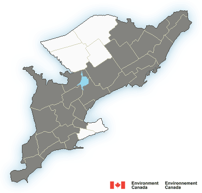
The weather statement is applicable to most of southern Ontario from Ottawa to Windsor.
While most of the region can expect anywhere from 5 to 15 cm, heavy snow with total snowfall amounts of 15 to 25 cm is expected at higher terrain north of Lake Ontario like Bon Echo Park.
Places near the immediate shoreline of Lake Ontario can expect lesser snowfall amounts where snow may transition to rain.
Environment Canada says snow is expected to begin Thursday afternoon and become heavy at times Thursday evening.
Snow will gradually taper to flurries Friday night in most regions.
Eastern Ontario can expect snowfall of up to 25 cm where snow is expected to begin over Thursday evening.
For the city of Toronto, Environment Canada’s weather statement reads, “Snow is expected to begin over the area near noon Thursday, but may be preceded by a brief period of ice pellets or freezing rain. The snow will become heavy at times Thursday afternoon, particularly impacting the Thursday evening commute.”
Environment Canada is predicting ice accretion from freezing rain, southeasterly wind gusts up to 80 km/h and snowfall amounts of up to 5 cm for the Hamilton region.
Southeasterly winds gusting up to 80 km/h are predicted for most of the GTA, and southwestern Ontario which may cause local power outages.
Special Weather Statement is in effect for:
- Bancroft – Bon Echo Park
- Barrie – Orillia – Midland
- Belleville – Quinte – Northumberland
- Brockville – Leeds and Grenville
- City of Hamilton
- City of Ottawa
- City of Toronto
- Cornwall – Morrisburg
- Dufferin – Innisfil
- Elgin
- Grey – Bruce
- Halton – Peel
- Huron – Perth
- Kingston – Prince Edward
- London – Middlesex
- Oxford – Brant
- Peterborough – Kawartha Lakes
- Prescott and Russell
- Renfrew – Pembroke – Barry’s Bay
- Sarnia – Lambton
- Simcoe – Delhi – Norfolk
- Smiths Falls – Lanark – Sharbot Lake
- Stirling – Tweed – South Frontenac
- Waterloo – Wellington
- Windsor – Essex – Chatham-Kent
- York – Durham
Environment Canada is predicting hazardous travel conditions due to heavy snow and reduced visibility and is advising residents to consider postponing non-essential travel until conditions improve, particularly late Thursday night through Friday.