Credit: Victoria Harrison/To Do Canada
The north of Canada calls to us, with its unlimited wilderness, incredible landscapes, interesting history and amazing wildlife. A road trip north to the Yukon speaks of adventure and leads you through some of the remote areas of British Columbia, along the historic route of the Alaska Highway, all the way to the capital of the Yukon – Whitehorse. Don’t rush. Enjoy the drive. There is plenty to see and do along the way.
If you are driving to Alaska from Yukon, see: Road Trip: South Klondike Highway from Whitehorse, Yukon to Skagway, Alaska
Planning Your Trip From Edmonton to Whitehorse
What will you need to discover the Alaska Highway on your own? Nothing more than a reliable vehicle, time and a good camera! There are three ways to enjoy accommodations along the self-drive tour to the Yukon – hotels, traditional camping or travelling with your motorhome or trailer.
No matter how you choose to travel, be prepared for areas with no cell service and few services. Carry snacks and water with you in your vehicle, bug spray (better to be safe than sorry), along with a spare tire and some cash, as some of the remote places along the way do not always have reliable internet service for their credit card machines.
When is the best time to travel this route?
The summer months of June, July and August generally see the most tourists and RVer’s heading up the highway. Even though, there will be others on the road, these months are the ideal ones to travel the route as the weather is generally good and animal sightings are common. These months generally see average temperatures hovering in the mid-twenties (Celsius), with long sunlight hours that can leave travellers with a sense that the days never end.
The shoulder months of May and September can be quieter on the highway, but you also take the chance that you will encounter snow or colder weather and some of the sites and campgrounds may not be open.
While you can drive from Edmonton to Whitehorse in two days without stopping to visit sites, we think this 2000-kilometer journey is worthy of at least four days of your time, depending on your interests. From historic sites to short hikes, this route is chock full of great stops.
Note: The drive time stated is the actual time of driving, not including stops.
For another perspective of the trip, see this article: Drive the Alaska Highway – Road Trip From Edmonton to Whitehorse
Day One: Travelling from Edmonton to Dawson Creek
Credit: Victoria Harrison/To Do Canada
Drive time: Approximately 6 hours
From Edmonton you travel a short distance west along Highway 16 to Highway 43 north, on which you will meander your way along to the small city of Whitecourt, less than two hours down the road. If you like, stop at the Visitor’s Center here to stretch your legs and experience the Forest Interpretive Center. Give yourself a bit of time here to enjoy the heritage buildings, interpretive center and the trails. There are clean bathrooms and plenty of room to park an RV.
Continue to the City of Grande Prairie where you can take some time to visit the interesting Philip J. Currie Dinosaur Museum. This is Canada’s newest museum and showcases the history of dinosaurs in the area, including the 1974 discovery of one previously unknown. Close by there is one of the densest dinosaur graves in the world, which has provided this museum with much of its artifacts. There is an outdoor walk here, along with a restaurant, in case you want to have lunch at the site.
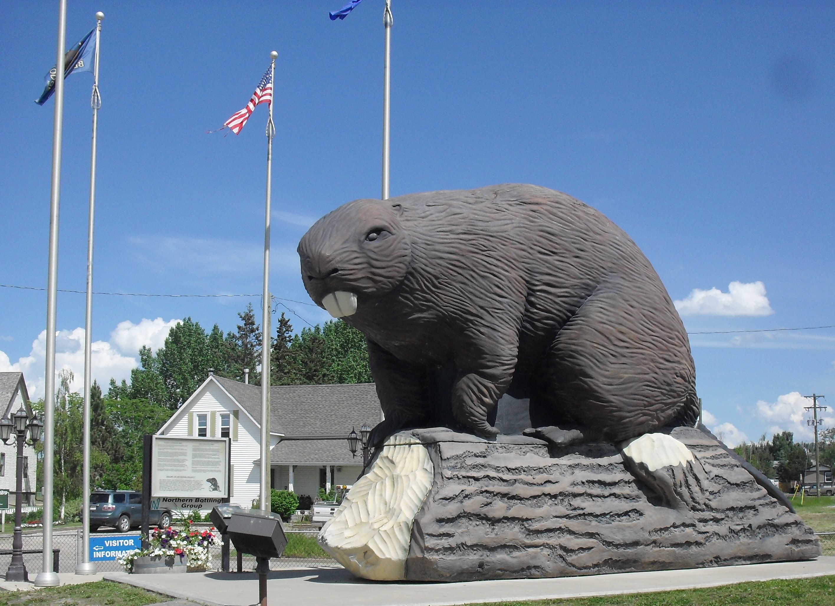
About 40 kilometers down the road from Grande Prairie is a cool little town of Beaverlodge, where you will want to make a stop to take a picture of the World’s Largest Beaver! This unique structure was built in 2004 to celebrate the town’s 75th anniversary and is 15 tall, 18 feet long, and sits atop a 20-foot-long log. There is some information about wild beavers and the statue itself at the base that is worth a read.
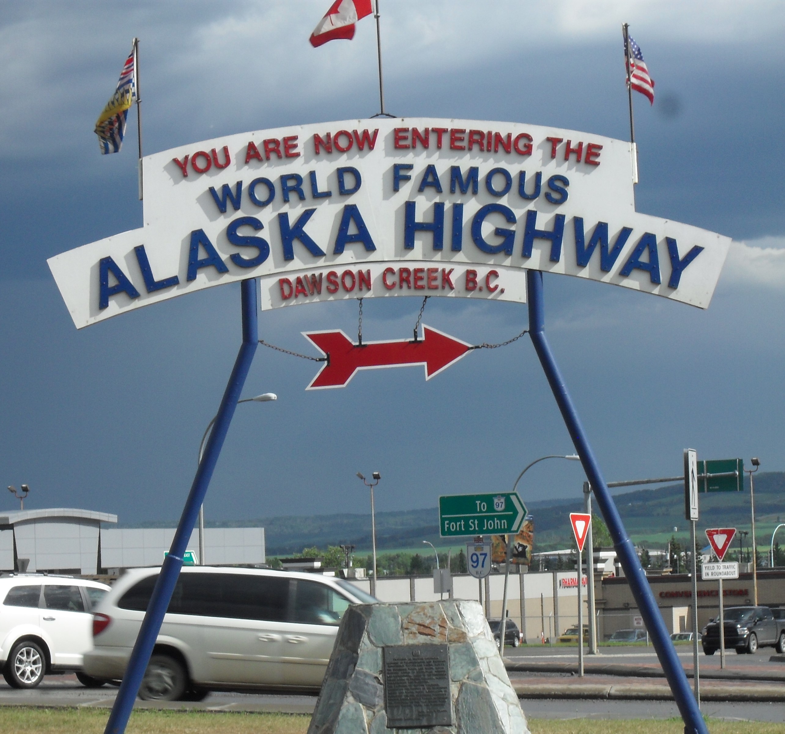
Your destination today is the town of Dawson Creek. This is a great place to spend the night and there are plenty of things to see within the town itself. Start with taking a picture at the historic Alaska Highway post outside the Visitor’s Center. Grab a walking tour brochure from the Visitor’s Center to take you through the quirky downtown, with its interesting murals and historical buildings. The Centre itself also hosts an Art Gallery which is worth a visit. Walk across the street to spend a bit of time in the Alaska Highway House, which showcases the story of how the Alaska Highway was built. If you have more time, you can also check out the Walter Wright Pioneer Village or the N.A.R. Station Museum. There are plenty of hotels and campgrounds here to spend the night.
Day Two: Travelling from Dawson Creek to Fort Nelson
Credit: Victoria Harrison/To Do Canada
Drive time: Approximately 5 hours
Dawson Creek is the official start of the Alcan, also called the Alaskan Highway, which stretches all the way to Delta Junction, Alaska. Built as a military route during World War II, you are going to find some interesting historic stops during these next days of travel.
Note: Dawson Creek is Mile 0, so all our stops from here on will be described by their mile marker numbers starting from there.
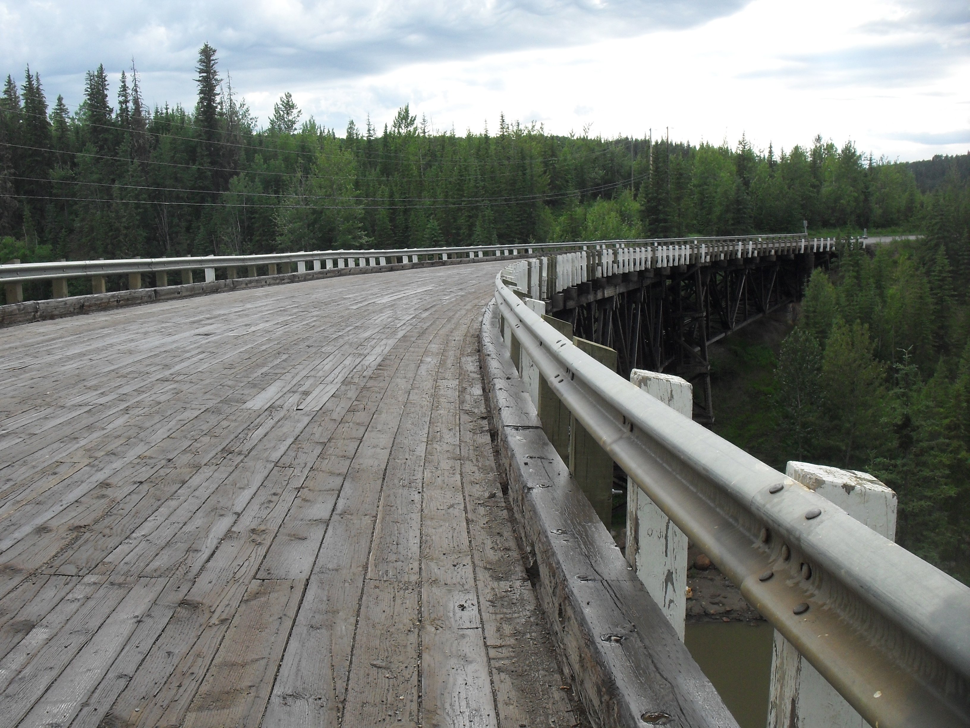
Mile Marker 21 – This is where you are going to see the Historic Kiskatinaw River Bridge, an original Old Alaska Highway wooden bridge. The very first of its kind to be built in Canada, this timber bridge was built in 1942 and served as a pioneer military road. As the only one still functioning today, the 534-foot bridge is a perfect stop to stretch your legs and take some pics of the rushing waters below or the cool curved frame of the bridge.
Credit: Victoria Harrison/To Do Canada
Mile Marker 34.4 -This is the Peace River Bridge, which is the longest water span on the Alaska Highway.
Mile Marker 35 – The town of Taylor is a good quick stop for a snap of the Gold Panner statue.
Mile Marker 51 – There is a day-use area at Charlie Lake day-use area if you want to stretch your legs or need a bathroom stop (pit toilets). The Alaska Highway monument here is a memorial to 12 American soldiers working on construction of the highway who drowned here in 1942, when their pontoon boat sank while crossing the lake.
Mile Marker 71.7 (Historical Mile 72) – The Shepherd’s Inn has a good restaurant with homemade baked goods and a gas station.
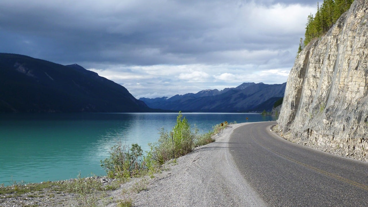
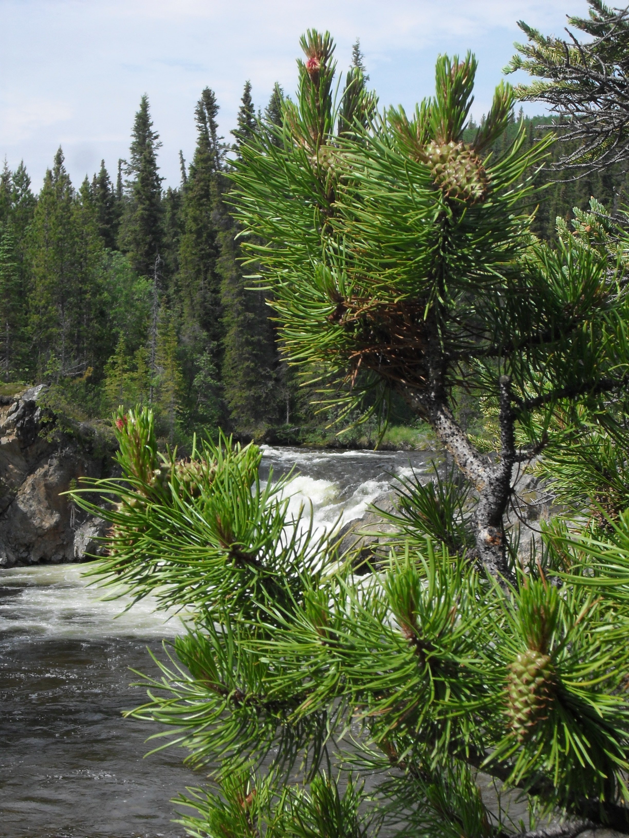
Mile Marker 159.2 (Historical Mile 162) – The Sikanni Chief Falls Protected Areas is home to the spectacular Sikanni Falls. At 30 metres (98 feet) high, the power of these falls is incredible! Use this opportunity to stretch your legs with a short walk to take in the scenic views. Breath in the fresh air and the amazing smell of the lush forest. This is a great spot for hiking, wildlife viewing, and photography. Keep an eye out for goats, elk, moose, and bears.
Credit: Victoria Harrison/To Do Canada
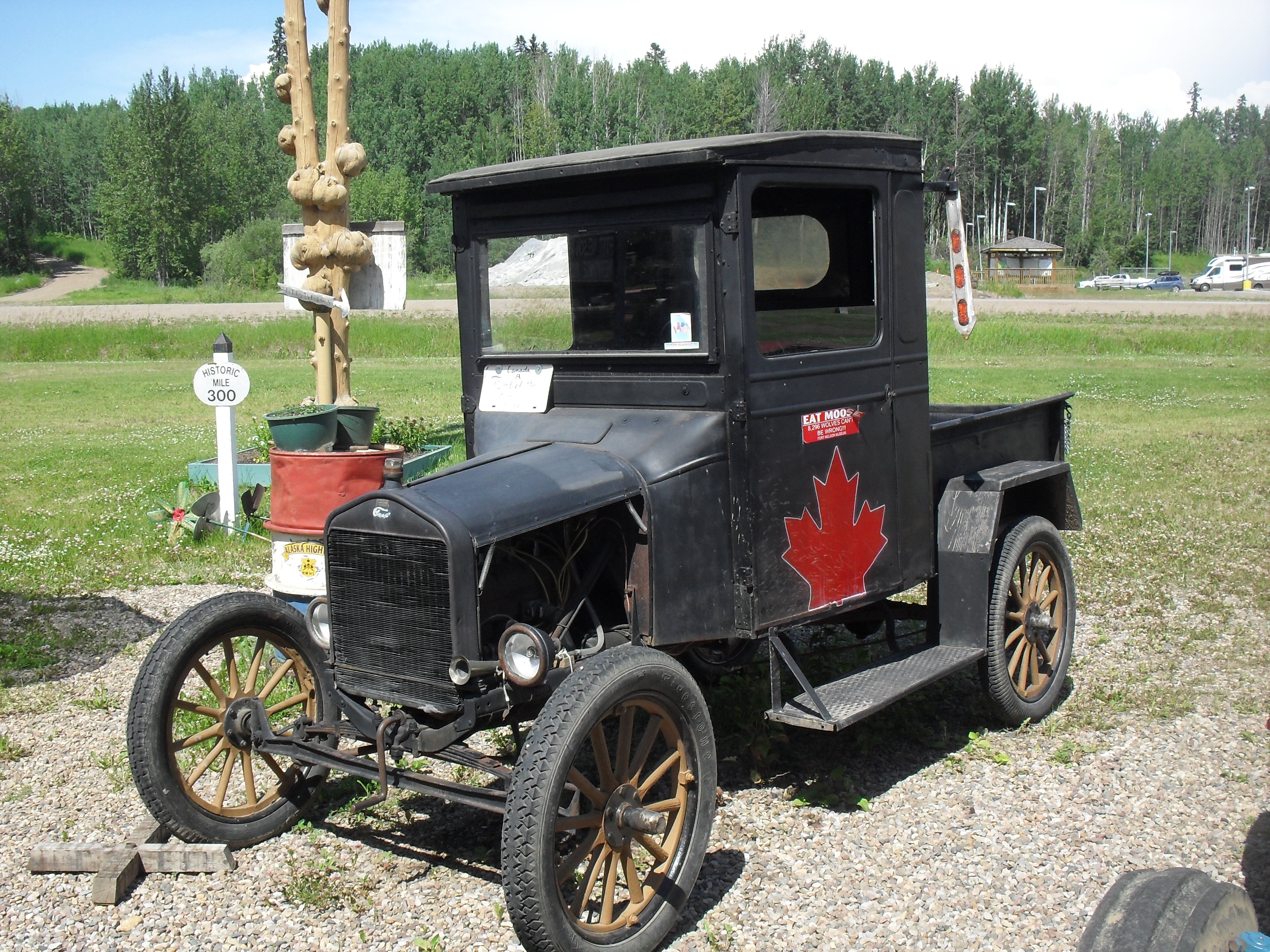
Mile Marker 283 (Historical Mile 300) – The town of Fort Nelson can be your stopping point for the night if you are staying in a hotel or utilize one of the campgrounds in the area to spend the night in your tent or RV. If you have time, we recommend visiting the unique Fort Nelson Heritage Museum, which has a variety of historical items including vehicles. They are open until 7 pm every day of the week and have a small admission charge.
The Visitors Center is located across the highway from the Museum and has clean bathrooms and a nice little gift shop.
Day Three: Travelling from Fort Nelson to Watson Lake
Drive time: Approximately 6.5 hours
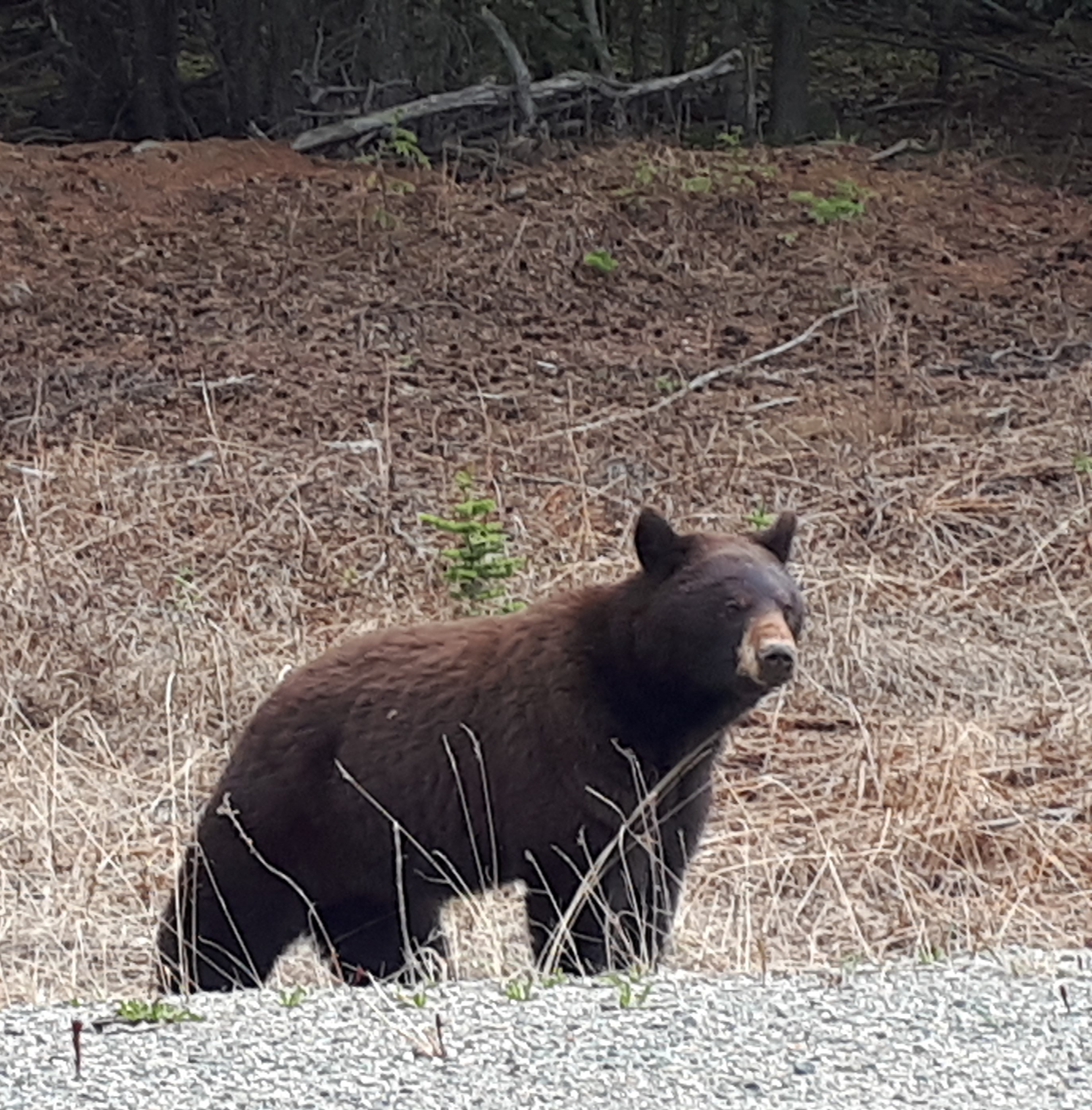
The stretch of highway between Fort Nelson and Watson Lake usually abounds with animal life but keep in mind that of course the animals are wild, so there are no guarantee sightings! However, this is great area to keep your eyes open for black bears, grizzly bears, red foxes, moose, mountain sheep, porcupines, hawks and eagles. Please do not get out of your vehicle to photograph wildlife, this can cause animals to become accustomed to humans and can put them and yourself in danger.
Credit: Victoria Harrison/To Do Canada
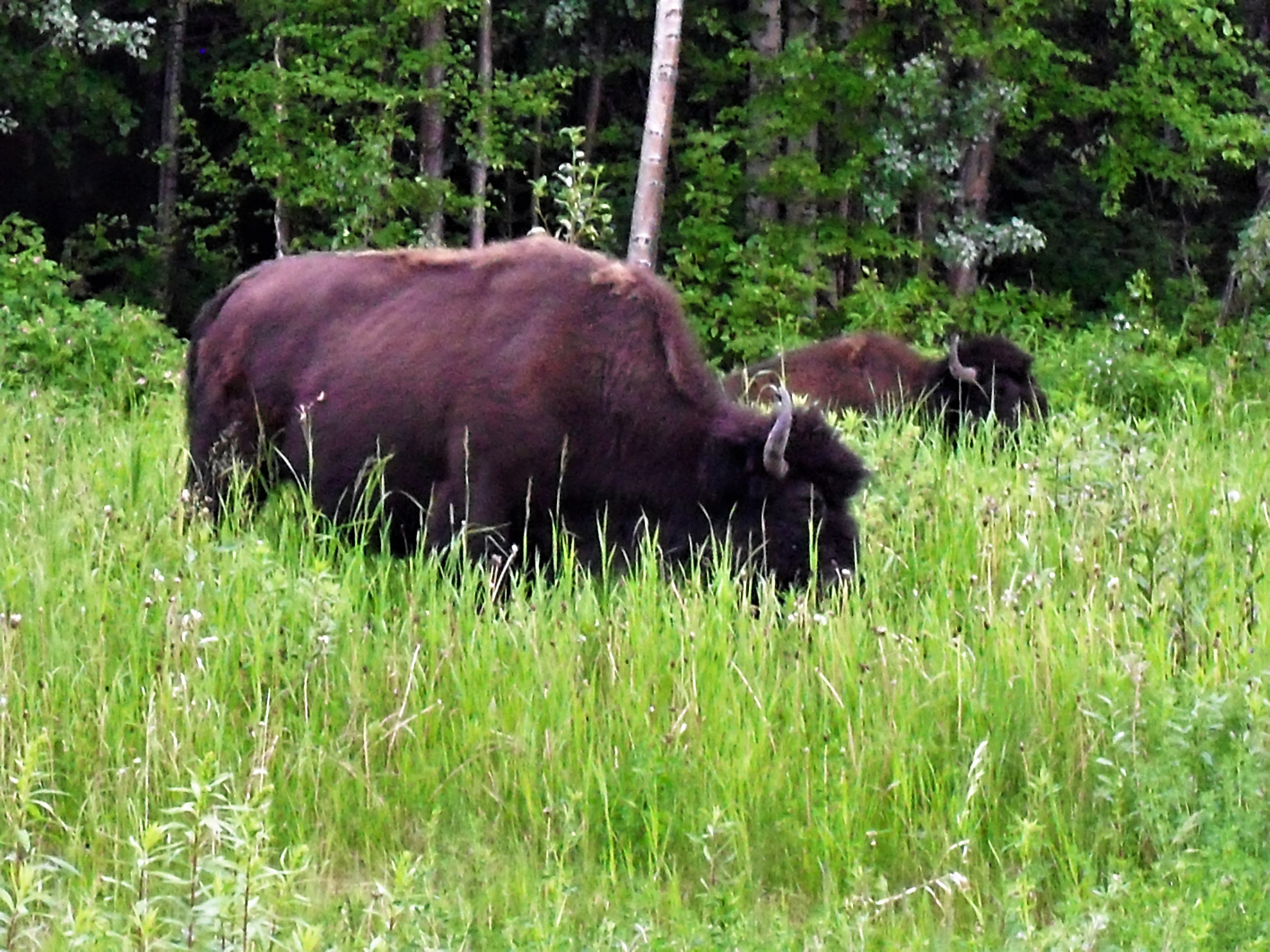
Of course, we can’t forget to mention the bison herds that reside between Liard Hot Springs and Watson Lake. The presence of bison in this area isn’t widely known, even though they have been here for most of the last 2 million years. Look for them on the sides of the road munching on the irresistible green grasses.
Gas stations are few and far between along this highway, so keep an eye on your gas gauge and fill up when you can or consider carrying a full gas can with you for emergency purposes as sometimes the stations close early. There are plenty of official campsites and general pullouts if you are travelling with an RV and want to spend the night somewhere along the route. Hotels are fewer, so planning ahead by making a reservation may not be a bad idea.
Mile Marker 357.5 (Historical Mile 375) – Tetsa River Services and Campground has a small gas station, a campground and rustic cabins. If you are hungry pop in for a homemade cinnamon bun, it is well worth it!
Mile Marker 373.6 – This is the highest point on the Alaska Highway at an elevation of 4,250 feet (1,295 metres). Summit Pass is home to Stone sheep, which you may find on or near the highway.
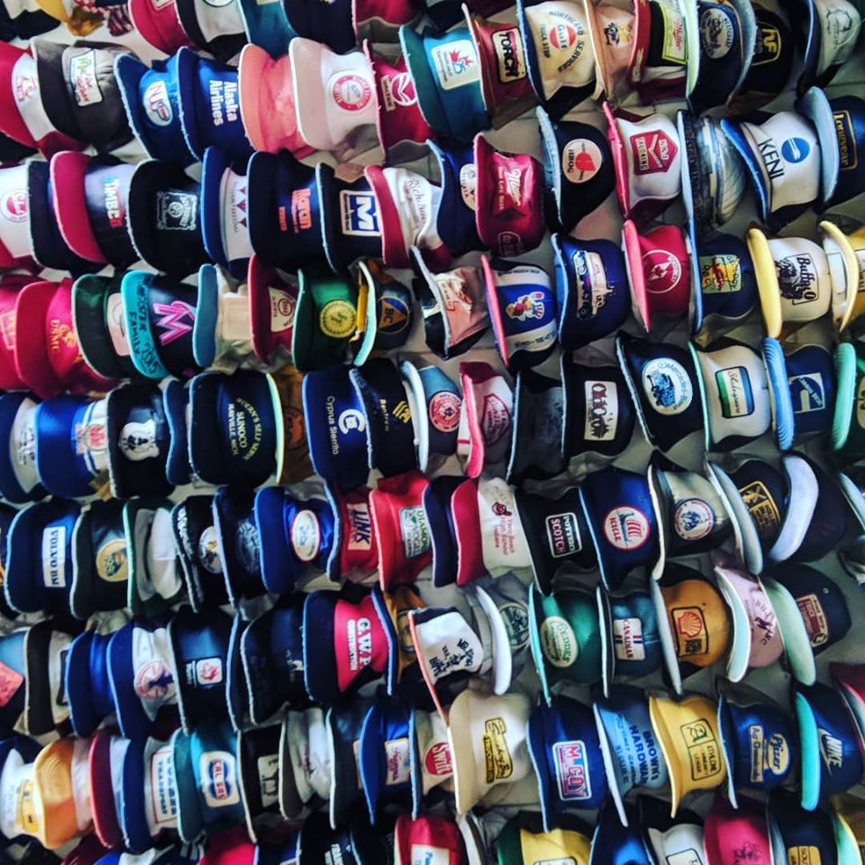
Mile Marker 404.6 (Historical Mile 422) – Toad River Lodge has lodging, camping, food and gas and is also home to a world-famous hat collection.
Mile Marker 436.5 – Mucho Lake has some excellent homemade baked items at the Double G Service station, so if you need to stop for gas, you might as well grab some snacks while you are there. The lake itself is just off the highway and is well known for its beautiful, deep green and blue waters and stunning scenery. If you have the time, take a boat ride, go fishing, or enjoy one of the hiking trails here. You can simply take a few minutes to refresh yourself in the mountain air. There’s a chance you’ll see Stone sheep, moose, caribou or mountain goats along this stretch of the highway, so there are always plenty of picture opportunities. When leaving the park, don’t forget to check out the unique geological formations of Folded Mountain – an impressive sight!
Credit: Victoria Harrison/To Do Canada
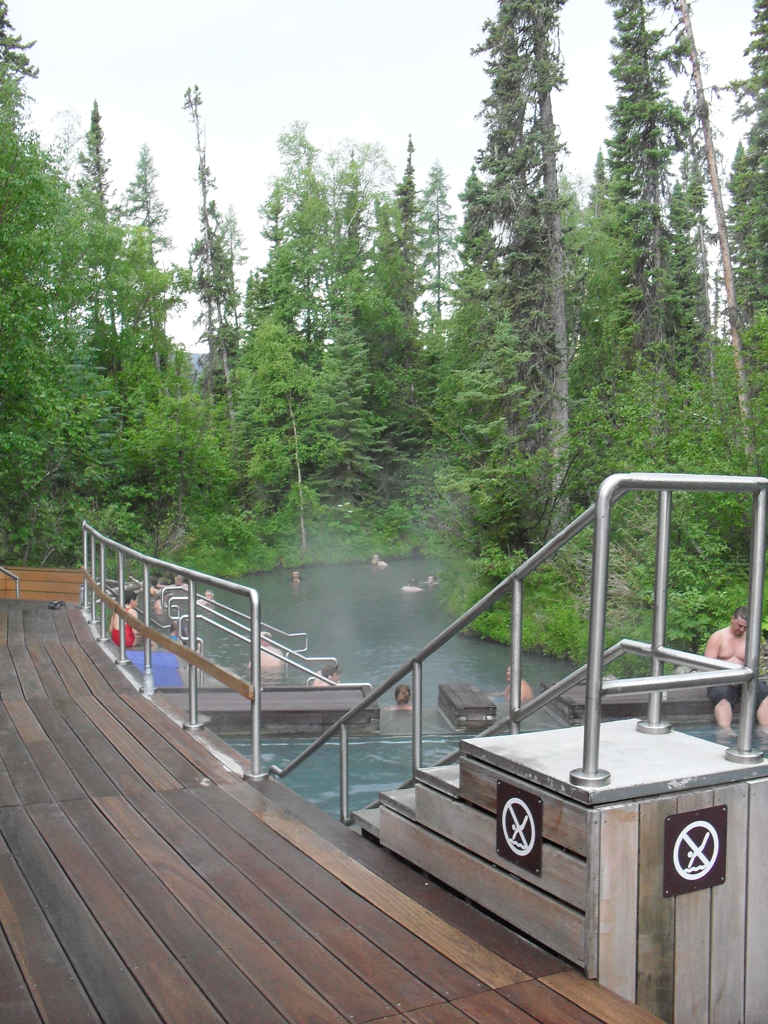
Mile Marker 477.7 – Here you find Liard River Hotsprings Provincial Park, along with a campground and across the road a lodge and restaurant. It is a short walk along a boardwalk to the hot springs, so even if you don’t want to enjoy a soak, take some time to walk just for the atmosphere. Here you can find 14 species of orchids and a variety of wildlife such as bison, moose and bears. This is one spot which cash is necessary to pay the park fee. The hot springs themselves are the second largest in Canada and they are surrounded by a lush boreal spruce forest, so you can’t ask for a better setting to relax after your time on the road. The hot springs pools range in temperature from 42° C (107.6 ° F) to 52° C (125.6° F). There are change rooms and bathrooms available to use. If you are thinking of camping here, make sure to make a reservation well in advance as the spots tend to fill up fast.
Mile Marker 567.9 (Historic Milepost 588) – This is Contact Creek, an important point along the highway, where crews who worked from the south and the north met in September 1942, completing the southern sector of the Alaska Highway.
Credit: Victoria Harrison/To Do Canada
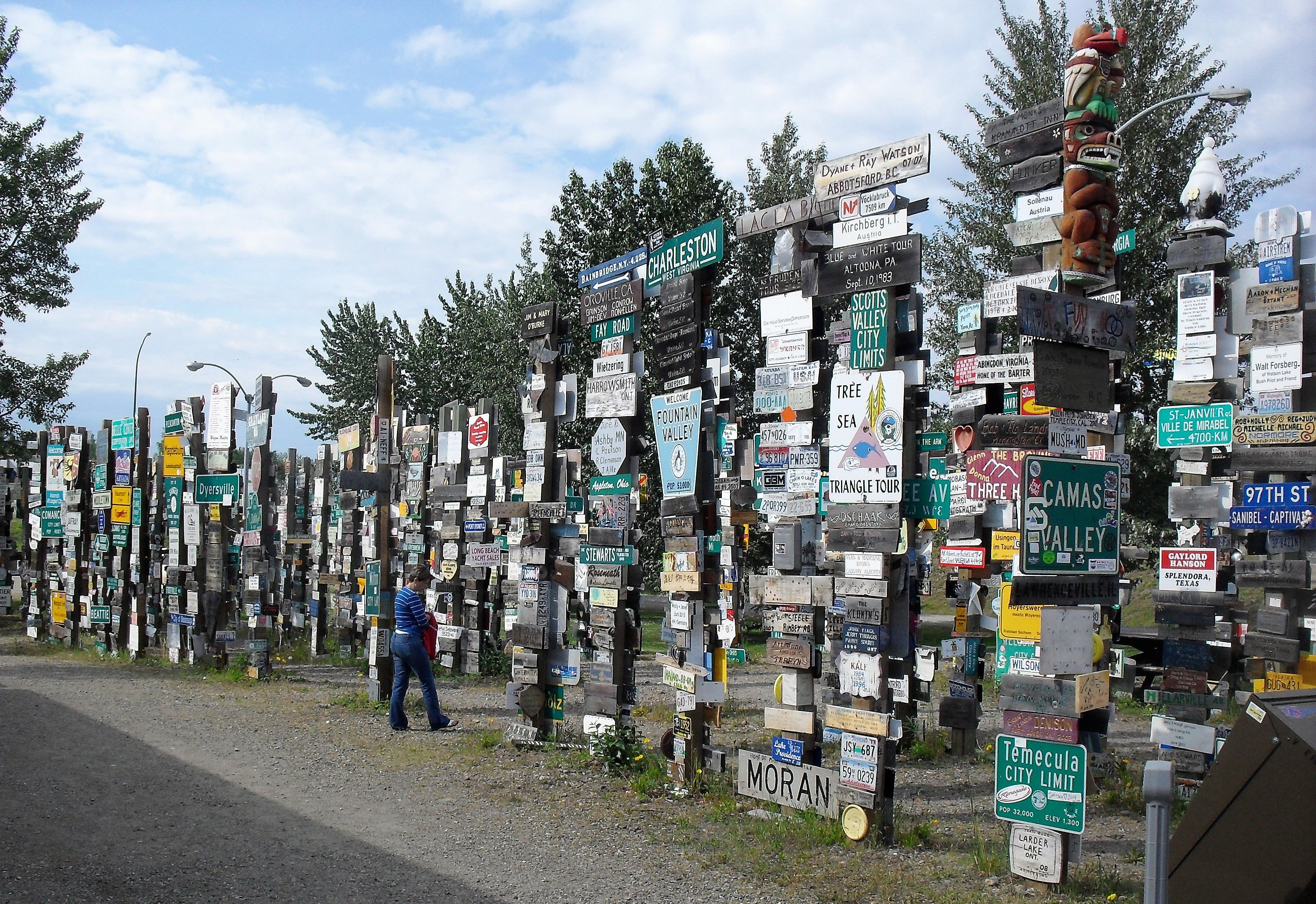
Mile Marker 635 – Watson Lake is home to the unique site of the Sign Post Forest. This site was started by a homesick American soldier who posted his hometown sign of Danville, Illinois. Others travelling through soon added their own signs and over the years it has grown to an amazing 72,000 signs from all over the world. This is located at the Visitor’s Center, who will handily provide you with a sign of your own if you haven’t brought one with you.
If you are looking for something truly unique to do here, visit the Northern Lights Center for an incredible show on the Aurora Borealis. The show features footage shot exclusively in the Yukon over a three-year period. There are shows into the evening hours, so this is a nice activity to do at the end of the day. Check out their website for information on show times and admission costs.
Day Four: Travelling from Watson Lake to Whitehorse
Drive time: Approximately 5 hours
On the last stretch of highway to Whitehorse you are going to find some stunning scenic stops and a few interesting cultural museums. If you are planning to camp in the Whitehorse area it is a good idea to make a reservation in advance as the campgrounds can fill up quickly.
Credit: Victoria Harrison/To Do Canada
Mile Marker 687.2 (Historic Mile 710) – Rancheria Falls Recreation Site offers pit toilets and a large parking area for those travellers who wish to take the 10 to 15-minute walk to the lookout for the falls. The walk consists of an elevated, informative boardwalk and a short section of rock and rough trail. The view is worth it though, and the lush greenery of the area will delight you.
Mile Marker 699.4 – There is a pullout here at the Continental Divide mark. The Continental Divide starts at Cape Prince of Wales, Alaska, and crosses into Yukon before zigzagging south through the United States, Central America, and ending in Patagonia. The ridgeline separates the two largest river drainage systems in North America.
Mile Marker 804 – The small town of Teslin is home to a couple of great little museums, including the quirky Wildlife Gallery located at the Yukon Motel.
The Teslin Tlingit Heritage Centre welcomes visitors to participate in the day-to-day life of the Tlingit people and houses the Great Hall, home of the Clan Governance for the Teslin Tlingit people. There are great interpretive displays that reflect the long traditions of the Tlingit people.
The George Johnston Museum as well has 3,000 square feet of galleries showcasing the lives of George Johnston and the Tlingit People of the area.
Note: If you are travelling in May or September, these museums may not be open.
Credit: Victoria Harrison/To Do Canada
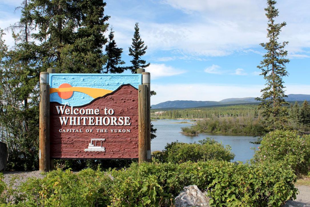
Mile Marker 918 – The Yukon’s capital city of Whitehorse is the destination for this road trip. Of course, there are plenty of things to do and see here, so plan to stay on for at least two days (or more if you are into outdoor activities) to experience all the interesting sites here.