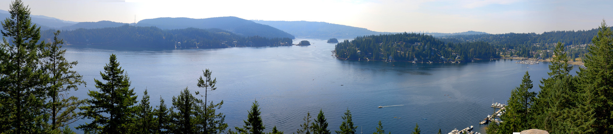
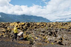
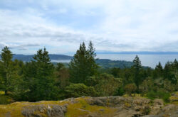
Quarry Rock; Credit:Howard Greenwood
Hiking is an exciting way to connect with your city. Vancouver is known for its beautiful surroundings and captivating trails that will get your blood pumping! Grab your friends or your four-legged furry friend and hit the trails.
NORTH VANCOUVER:
Quarry Rock
It would be hard to come to find a local who hasn’t done and loved this trail. This classic trail takes you through nature’s playground, including stairs, over tree roots and small creeks. The result of the 3.8 km hike is a jaw-dropping panorama of stunning Deep Cove.
Length: 3.8 km / 1.5 hours
Where: Baden Powell Trailhead – Panorama Drive, Deep Cove, North Vancouver
Difficulty: Easy-moderate
Lynn Loop
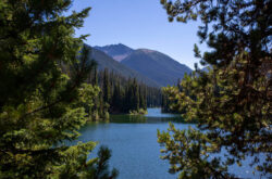
Lynn Loop is tucked into the Lynn Headwaters Regional Park in North Vancouver. This lovely trail offers views of Vancouver Island and even some of the Gulf Islands. There are multiple trails here, so you can pick whatever route you prefer, some long, some short.
Length: 5.1 km, 1.5 hour
Where: Lynn Headwater Regional Park, Lynn Valley Road, North Vancouver
Difficulty: Easy
Dog Mountain
The peak of Dog Mountain welcomes terrific views of Metro Vancouver and is often a favourite at night (with the right safety precautions) to see the twinkly lights of the city. This trail isn’t difficult but requires some careful footing.
Length: 2 hours
Difficulty: Easy
Where: This trail starts at the northern point of the Mount Seymour Ski Resort’s main parking lot.
https://www.instagram.com/p/BT8Bof3DnxL/
Hanes Valley Trail
Get ready for a challenge. This is a challenging route that takes you through the Lynn Headwaters regional park and ends at the peak of Grouse Mountain, and you can take the beautiful gondola down (your legs will thank you!) One aspect of the challenge is the steep boulder field that hikers must traverse by hands and feet!
Difficulty: Hard
Length: 8.5 hours or 16 km
Where: exit 21 to Mountain Highway in North Vancouver.
https://www.instagram.com/p/4dhYasjFPm/
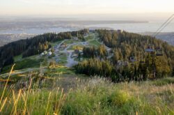
Grouse Grind
By far one of the most famous trails, this popular trail garters adventurous hikers from all over the world who want to take on the gruelling grind. Over 2,800 steps lead you to one of the most unforgettable views of the city!
Length: 2.9 km
Difficulty: Hard
Where: Grouse Mountain base, North Vancouver
Admiralty Point
Offering wonderful, unforgettable views of Deep Cove, Mount Seymour and Burnaby Moutain, this short and sweet hike is a lovely option with beautiful glimpses of changing scenery and passing boats. There is minimal elevation change, so its a good option for families.
Length: 5km
Difficulty: Easy
Where: Belcarra Regional Park
Seymour Mountain
Seymour Mountain trail is a beloved Vancouver classic and, because of it, is often packed with other revellers. This trail offers more viewpoints which offer pretty views of Indian Arm, Golden Ears Peak and even Mount Baker on a clear day.
Length: 9km
Difficulty: Moderate – Hard
Where: Mount Seymour, North Vancouver
The Lions
The Lions is for the brave-hearted! If you’re looking for striking views, this is for you. This hike takes you to the twin peak mountains, known as East and West Lion and offers insane views of Vancouver!
Length: 12.4 km
Difficulty: Hard
Where: Sunset Drive, Lions Bay, North Vancouver
WEST VANCOUVER:
Lighthouse Park
Nestled in stunning West Vancouver, Lighthouse Park offers various short easy trails that lead to beautiful ocean views and a picnic spot overlooking Star Boat Cove.
Length: Varies, 2 – 6 hours
Where: Beacon Lane, West Vancouver
Difficulty: Easy
https://www.instagram.com/p/B_hDrLhJzWR/
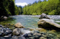
Capilano River Regional Park
This trail borders both North and West Vancouver, so is a great option wherever you live. This lovely trail traverses various terrain such as rocky shores, steep canyon cliffs, dense forests and beaches. Towards the end, you’ll eventually reach the pretty view of the Cleveland Dam.
Length: 15km, 4 hours
Where: Ambleside Beach, West Vancouver
Difficulty: Easy
Cypress Falls Trail
There’s nothing better than a glorious natural waterfall. This hike will take you along the flowing Cypress Creek, reaching not one but two gorgeous waterfalls.
Length: 3km or 1.5 hour
Difficulty: Easy
Where: Woodgreen Pl, West Vancouver
Baden Powell
Get ready for a super adventure! Baden Powell trail traverses the North Shore mountains and forks off into several spots for viewpoints. It’s a rugged, long and challenging hike, so it is recommended for experienced hikers.
Length: 48 km
Difficulty: Hard – Extreme
Where: Horseshoe Bay, Deep Cove, West Vancouver
BURNABY:
Burnaby Lake Regional Park
As the largest lake in Metro Vancouver, Burnaby Lake is a special spot, home to exciting ecology and about 10km of hiking to enjoy.
Difficulty: Easy
Length: 10 km
Where: Pipeline Trail – Burnaby Mountain, Burnaby
Deer Lake
While an easy option, Deer Lake is a beautiful option for any nature lovers. It passes a beach, a viewing tour and even a pier, so you will surely be impressed by the scenery.
Difficulty: Easy
Length: 5 km, or 1 hour.
Where: Sperling Avenue, Deer Lake, Burnaby
Velodrome Trail
A steep climb, the Velodrome Trail takes you up more than 500 wooden steps before joining the lovely trailhead. The viewpoints are worth the challenge, as you will see views of the Indian Arm and Burrard Inlet!
Difficulty: Moderate – Hard
Length: 1 hour or 3km
Where: Barnet Road, Burnaby
VANCOUVER:
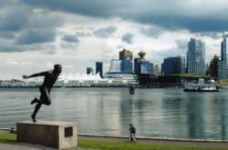
Stanley Park
You can’t be in Vancouver and not experience the magic of Stanley Park! This urban park can be traversed by a variety of trails perfect for hiking. You’ll enjoy beautiful views of the city, mountains and panoramic ocean.
Difficulty: Easy
Length: 2 hours, 6.5 km
Where: Stanley Park, Vancouver
Foreshore Trail
Located near the University of BC Campus, Foreshore Trail passes through Wreck Beach and offers lovely views of the Strait of Georgia, Bowen Island and some of Howe Sound.
Length: 3 hours or 5km
Difficulty: Moderate
Where: Pacific Spirit Regional Park – UBC, Vancouver
MAPLE RIDGE:
Mike Lake
This scenic route is a great option for families looking for a serene nature walk. Located in Golden Ears Provincial Park, you will enjoy views of the lake from the north side.
Length: 2km
Difficulty: Easy
Where: Golden Ears Provincial Park, Maple Ridge
Ridge Meadows
This demanding trail is a really popular option and results in stunning views of neighbouring Alouette Mountain, Blanshard Needle, Edge Peak and Golden Ears. This trail can be done in one day but is certainly a hard trail that gets increasingly steep. Keep going, the view is worth it!
Difficulty: Hard
Length: 12 hours or 24 km
Where: Golden Ears Provincial Park, Maple Ridge
SURREY:
Tynehead Regional Park
There are plenty of exciting trails to enjoy at Tynehead – even a fish hatchery! – so you can pick the course you want to meander. Most paths lead to the steep Trillium Viewpoint that overlooks the scenery. Take in and enjoy the view!
Length: 4.5 km
Difficulty: Easy – Moderate
Where: 16689 96 Ave, Surrey
ABBOTSFORD:
Abby Grind
The younger sibling to the infamous Grouse Grind, the Abby Ground is a little less steep and a lot less crowded version that offers lovely views of neighbouring farmland.
Length: 4km
Difficulty: Moderate
Where: Abbotsford, you can park at the Abbotsford Fish and Game Club
PORT MOODY:
Dilly Dally Loop
This fun hike offers an exciting viewpoint of Port Moody, Burrard Inlet, Indian Arm and even Lindsay Lake (where you can even stop for a dip to cool off!) Carry on, and you’ll reach the ultimate summit nicknamed ‘Mount Beautiful.’ This hike is not for the inexperienced so be warned!
Length: 25km
Difficulty: Challenging
Where: Buntzen Lake, Port Moody
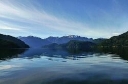
Swan Falls
This hike is rugged and, due to that, can be a bit of a challenge. This hike follows the Bunten Lake trail and then forks to Halvor Lunder, where you can take in the spectacular view of Swan Lake, complemented by the mountains and the western shore of the lake. Beautiful!
Length: 10km
Difficulty: Moderate
Where: Drive to the Buntzen Lake recreation area and follow the signs
Diez Vista
Diez Vista translates to ten views, which you’ll get to enjoy on this exciting hike. On a clear day, you can see as far as Burnaby Mountain, Deep Cover, Bedwell Bay, Belcarra and more. It’s a popular trail and has been favoured for many moons.
Length: 7km
Difficulty: Moderate
Where: Bunzten Lake Rec Area, Port Moody
PORT COQUITLAM:
Colony Farm Regional Park
Located in Port Coquitlam, this nature reserve awards nice views of the Coquitlam River and nearby fields. There are copious trails and paths that you can pick from at the map at the entrance. You can explore the Millennium Bridge, the Wilson Farm Dyke Trail and even the community gardens.
Length: 8km
Difficulty: Easy
Where: Colony Farm Regional Park off Lougheed Highway in Port Coquitlam


You are advising the public to travel to Quarry Rock. If you investigate you will find that Quarry Rock is on private property.