Take a road trip through Alberta’s most underrated scenic drive!
Just one of many incredible scenic drives in the province of Alberta, this route gives travellers an opportunity to experience some of the amazingly diverse landscapes that the area has to offer.
A road trip taking you from the dusty prairies of southern Alberta to the beautiful Rocky Mountains; there is much to see and do along the way, so plan to spend anywhere from a half day to several days enjoying every aspect of this journey.
The Crowsnest Highway, stretching 1,161 km from Hope, British Columbia to Medicine Hat, Alberta, facilitates the shortest route between the Lower Mainland and southeast Alberta, traversing the Canadian Rockies through the Crowsnest Pass. Inaugurated in 1932, it mostly follows Edgar Dewdney’s mid-19th-century gold rush trail.
Crowsnest Highway (Hwy 3) – Medicine Hat to Coleman
In Alberta, it’s known as Highway 3, covering 323 km and intersecting with several other highways, providing access to numerous localities including Fort Macleod and Lethbridge, before ending at the Trans-Canada Highway in Medicine Hat. The highway is chiefly two-laned, embodying a vital linkage encompassing historical and geographical significance.
Medicine Hat
Our scenic road trip starts off in the prairie city of Medicine Hat, which in itself has some incredible sites and things to do. The uniquely situated city sprawls out on both sides of the South Saskatchewan River, bringing little bits of green areas in a relatively dry zone of the prairies. An excellent place to spend a day or two before heading out on the road, the city is one of the sunniest in Canada, with an average of 330 days of sunshine a year.
The city inherited its name from the native word “saamis” which means medicine man’s hat, so it makes sense to start with a visit to the Saamis Tepee. Deemed as the tallest tepee in the world, this tribute to the native heritage is entirely made of steel. This is an opportunity to learn about the heritage and history of the First Nations of the area with the informative, storytelling panels and displays, as well as the Saamis Archaeological Site, located below the Tepee. There is a great self-guided walking tour which will show you all about this area, which was once a buffalo camp and meat processing site. Experts believe over 83 million artifacts are buried at the site.
If you have the time to explore the city itself, Medicine Hat has several self-guided walking tours through the historic city center and its many interesting and beautifully created murals, as well as self-guided coffee and eats tours that are designed to let you enjoy the culinary aspects here.
You could choose to spend some time in the Medalta Museum to discover the historic Clay District, which is now a National Historic Site. Currently, the complex is being used as a great exhibit space with interactive displays that guide you through the historic process of pottery making, introduces you to artists-in-residence and display old and new pottery. Of course, if you are an art lover, then you will not want to miss the Esplanade Arts & Heritage Centre, which is home to an art gallery and museum and hosts an incredible number of arts and culturally based exhibits and shows.
However great the city itself is, the road is calling, and there are plenty of places to stop en route to keep you entertained as you travel. From Medicine Hat, you will want to head west on Highway 3 towards the city of Lethbridge. It won’t be long before you take a short detour, though, as a can’t-miss spot just off the highway approaches.
Red Rock Coulee
Your destination is the stunning Provincial Natural Area of Red Rock Coulee. This unique place is home to 800 acres of unusual, pre-historic red rock formations, some of which are over 8 feet across (2.5 meters), putting them among the largest sandstone concretions in the world. If you like to hike, there is an opportunity to get out and stretch your legs for a while here, and if you are lucky, you may catch a glimpse of a beautifully unique pronghorn, mule deer or rabbit. Be aware that rattlesnakes and rare northern scorpions are present in this zone.
Bow Island & Taber
Heading back to the main highway, a short jog to the west brings you to the town of Bow Island. A moment is needed here to take a selfie with the world’s largest putter, located on the northeast side of the highway.
Another half hour brings you to the town of Taber, which is famous for its corn production, so it makes sense that there is also a cool attraction here related to corn. The fun 36-foot-tall corn stalk was built in 1994, and represents the quality, taste and success of Taber Corn throughout Western Canada.
Another twenty-minute drive along Highway 3 brings you to the town of Coaldale.
There are two great attractions here if you want to stop and experience some nature and some history. First, the Alberta Birds of Prey Foundation is open seasonally for visitors to experience some up close and personal time with amazing birds of prey.
The other interesting stop for history lovers would be the Gem of the West Museum, which features over 15 unique exhibits focusing on the history and heritage of Coaldale and the surrounding area.
Lethbridge
From Coaldale, you will continue west to the city of Lethbridge, where you may want to spend a night or two experiencing the city itself before continuing on through Crowsnest Pass. This southern Alberta city has some fantastic features and things to see and do and is worth stopping for a day or two to explore.
Indian Battle Park is home to more than five kilometres of walking trails that will allow you to soak up some natural beauty, but it is also home to the incredible Fort Whoop-Up Interpretive Centre, which allows visitors to learn about the history of the area. Elizabeth Hall Wetlands also provides an opportunity for outdoor fun with a self-guided tour, and the Helen Schuler Nature Center will give you the ins and outs of the natural aspects of this area.
The unique and beautiful Nikka Yuko Japanese Garden is well worth a visit, although it is only open seasonally. The Galt Museum & Archives and the Southern Alberta Art Gallery provide indoor activities if the weather isn’t cooperating. Some time at Brewery Gardens is an absolute must to catch the phenomenal view of the historic High-Level Bridge and the Number 8 Coal mine. This garden celebrates the High-Level Bridge, the longest and highest trestle bridge in the world at 96 meters high and 1623 meters long. Along with the sites, there are many good places to stay and eat in the area, if you choose to spend some time here during your travels.
Fort Macleod
Leaving Lethbridge, you will head along Highway 3 west to the town of Fort Macleod. This short drive along the Crowsnest Highway brings you to an amazing historical site, which is the town’s historic base – The Fort Museum. This is a must-do if you have any interest in the history of the RCMP or the First Nations of the area. The museum includes eight buildings with over 9,000 artifacts and houses two of the oldest buildings in the area that are restored on their original sites: the Fred Kanouse trading cabin and Frederick Haultain’s law office.
There are other things to do in and around the town of Fort MacLeod as well, including a stroll down their historic main street, discovering the many featured buildings and sets that have been used through the years for the movie industry, visiting the 1884 NWMP Barracks, or walking the two-kilometer loop trail that takes you through the River Valley Wilderness Park.
Head-Smashed-In Buffalo Jump World Heritage Site
While a bit off the main Crowsnest Highway route, you may want to detour to visit the incredible Head-Smashed-In Buffalo Jump World Heritage Site, located just 20 minutes outside of town.
The site is dedicated to preserving the Plains Buffalo culture that has lasted for over 6,000 years and features an interpretive center showcasing the Blackfoot Indigenous culture.
This cultural landmark tells a story of resourcefulness and ingenuity as the Blackfoot people hunted buffalo by using cliffs near Fort Macleod.
Pincher Creek
The town of Pincher Creek is the next destination, and this cute little place is where the prairies meet the mountains.
If you are willing to spend a day or a couple of hours here, you can check out the Kootenai Brown Pioneer Village, where you can experience a fun pioneer village from the late 1800’s, to see what life was like when the southwest was transitioning into cattle ranches and industrial areas.
It’s right in town, so convenient to visit as you travel this route.
Another neat place to visit is the historic Lebel Mansion, located right in town at 696 Kettles Street.
Originally a home, then a hospital, this fantastic historical building now hosts an art gallery and gift shop featuring local artists and artisans. The crown jewel here may be the gardens, though, if you happen to be travelling at the right time of the year, as the phenomenal rose garden here has an incredible 55 varieties of roses!
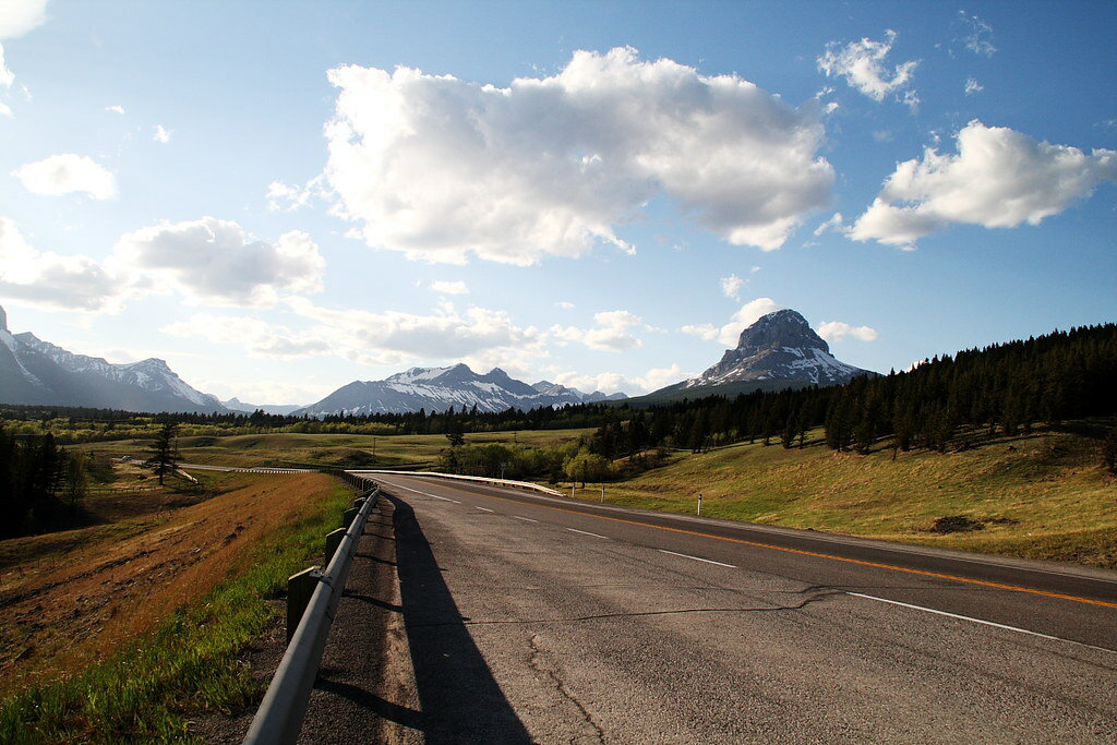
Around Crowsnest Pass
Heading west towards the mountains will take you to the breathtaking Lundbreck Falls. This stop is located right off the Crowsnest Highway and is easy access for those who would like a beautiful view without much effort. This 12-foot drop waterfall is gorgeous at any time of year and has been recently touted as the “Niagara Falls” of southern Alberta.
You can easily view the falls from the observation platform, or if you are a bit more adventurous, head down on the hike to the bottom to get an up close and personal look at the rushing waters. There is also a small campground in the Provincial Recreation Area if you want to spend the night. Otherwise, the route takes you into the small towns all through Crowsnest Pass, where there are a variety of accommodations and good places to eat.
A short five-minute drive will take you to another interesting spot – the unique Burmis Tree. This is now dead, but the famous tree is still about 700 years old. Stop for a moment and read the information panel; the history here is quite interesting. This is said to be the most photographed tree in the province, so it’s worth a couple of minutes to get your own photo perspective.
Another minute or two of driving takes you to the Leitch Colleries Provincial Historic Site. This site was an ambitious, entrepreneurial venture that had never worked out. Due to the long-lasting effects of a massive strike, the loss of major customers and the start of World War I, the mining company that built the beautiful structures and community here ended in financial ruin. There are interpretive guides to take you around the site and answer any questions you may have. Take note that this site is only open during the summer months.
Everything in this area is close, and the scenic beauty will entice you to stop naturally as well, so drive times between destinations here are short and sweet. If you are travelling during the summer months, you can stop for a visit to the Bellevue Underground Mine, where you can have an authentic experience of what it was like to be a coal miner while on an exciting hour-long tour underground guided by Heritage Interpreters.
If you are wanting to continue on to the next interesting site, head over to the infamous Frank Slide Interpretive Center, another five or ten minutes of travel down the Crowsnest Highway.
Take some time at the Frank Slide Interpretive Centre, viewing their new multimedia exhibits before taking a walk through the debris field to appreciate the scale of the boulders that tumbled across the valley during the horrific event on April 29th, 1903. It was a devastating time for the Crowsnest Pass area; this huge landslide killed 90 people.
This historic site will give you the opportunity to learn all about the slide, how and why it happened, and the people and mining community that were affected.
https://www.instagram.com/p/CwBSKpjSgKD/?img_index=1
If you have time and energy to hike Turtle Mountain, you will have phenomenal views from the top of the slide area. The hike itself is just over 6 kilometers return, with an elevation gain of 900 meters, but will reward you with incredible views of the slide and the surrounding area. The parking for Turtle Mountain is located at the end of a gravel road near 134 Street and 15 Avenue in Blairmore, just 5 minutes down the road from the Frank Slide Historic Site.
To get there, turn left onto 129 Street from Highway 3. Take a left at 19th Avenue, then right on 132nd Street; 132nd will turn into 15 Ave. At the T-intersection, turn right. 1 block later, take a right onto the dirt road across from the cul-de-sac. Follow it for about half a kilometre to the parking area at the top of a rise. Yellow markers painted at the base of the cliffs just past the parking area indicate the trailhead.
Blairmore
The town of Blairmore itself is also a great place to spend a night camping if you are skipping staying in hotels. Check out the Lost Lemon Campground, named after Frank Lemon, who killed his partner, Blackjack, shortly after they struck gold. The local legend says that Lemon spent the rest of his life slightly crazy after murdering his friend. Enjoy the area’s beauty from this campground, which even has an outdoor pool to cool off during the summer months.
Otherwise continue travelling west on the highway to Coleman and the Crowsnest Museum.
Coleman
The Crowsnest Museum, located in downtown Coleman, is a great place to learn the story of Crowsnest Pass. Their exhibit spaces are set up as rooms, so you can enjoy a Mining Room, a General Store and Blacksmith Shop, a Pioneer Room, a Military/Police Gallery, a Wildlife Room and one more room with changing exhibits.
If you don’t want to stop at the museum, the town of Coleman itself is almost living history. Spend some time exploring where the old town is now a National Historic Site, including its surface mine plant, the old downtown, and the railway, which preserves the atmosphere of a western Canadian mining town between 1905 and 1950. Take a self-guided tour of downtown – a National Historic Site lined with miners’ cottages and the original buildings that once housed a hotel, mercantile store, grocers, theatre and boarding house. Since you are in Coleman anyway, stop for a snack at the Cinnamon Bear Café and Bakery, located at 8342 20 Avenue.
If you are into hiking, check out the nearby Star Creek Falls hike. It’s only 1.6 kilometres, so you should be able to complete it in about half an hour. As well, there is only an elevation gain of about 110 meters. The trail will take you to a lovely view of the falls and an incredible canyon.
As you continue towards the B.C. border, there are some fantastic rest stops and viewpoints to soak in the mountain atmosphere and beauty. The incredible Emerald Lake is well worth a photo stop. Technically, an extension of the larger Crowsnest Lake, Emerald Lake, is cut off from the main body of water by the highway. Take the side road to get down to the lake itself. You can kayak here with your own boat, but the highway traffic doesn’t make for the quietest place to enjoy the water. You can stretch your legs by enjoying a 1.8 km loop around the lake.
On the right-hand side of the highway, the larger Crowsnest Lake is a draw for many highway travellers.
There is a convenient rest stop area right down by the lake, from which you can choose a couple of activities dependent on the weather and time of year – putting your feet in the water, fishing, walking on the ice (be careful of thickness), putting a non-motorized boat on the water, or simply enjoying the atmosphere.
The last stop before you hit the British Columbian border is the pretty Island Lake Provincial Recreation Area. Again, this is an excellent place to stretch your legs or partake of water sports such as kayaking, fishing, ice fishing and hiking.
There is so much to do along this route that it is easy to spend a week or more just exploring the fantastic Crowsnest Highway in Alberta. Take it slow, soak in the scenic beauty and diversity of the southern part of the province, and enjoy every moment.
To continue the trip into B.C. —
- Canadian Rocky Mountain National Parks Road Trip
- Canada’s West Coast Circle Road Trip Itinerary: Calgary – Jasper – Vancouver – Tofino – Okanagan – Calgary


