Looking for some fabulous trails to hike around Brandon? Here are seven trails that will take you through aspen and bur oak forests with mixed-grass prairie and marshes, shores of ever-winding rivers, or to the top of the trees.
- 25 Outdoor Adventures in Southwest Manitoba
- Nature Parks and Attractions to Visit in and around Brandon
Note: Do check Trails Conditions & Advisories before planning your hike.
1. Trails at Brandon Hills WMA
Difficulty: Easy
Where: 10km south of Brandon on HWY #10, 3km east of Beresford Road and 1km south.
Plan Your Trip
2. Assiniboine Riverbank Trail System
This 17 km trail system winds through the heart of Brandon, along the Assiniboine River corridor. This 17 km trails system consists of several smaller interconnecting trails, such as the Red Willow, Arbour, 1st street and others and range from paved, lit pathways to natural river bottom forest.
The trails connect to various attractions, recreational facilities, and parks in Brandon. Enjoy stunning views of the river, wildlife and bird watching. The trail starts from the Riverbank Discovery Centre. However, the trail can be accessed from a number of other access points throughout the locality. You can get maps, and information about the trail from the Riverbank Discovery Centre. This is also a wonderful place to spend time with family. Details
Difficulty: Easy
Where: Riverbank Discovery Centre,545 Conservation Drive; 204-729-2141 or 1-888-799-1111
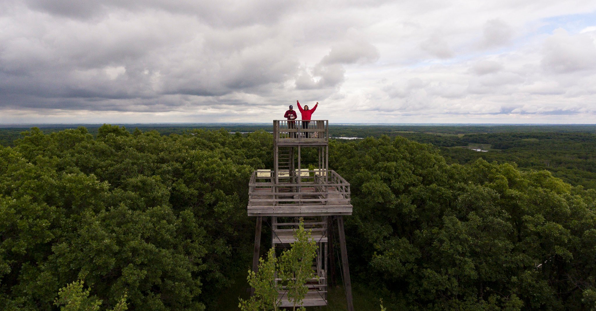
3. On the Trail of the Buffalo Chase
On the Trail of the Buffalo Chase is a small 1.5 km (1 hour) self-guided hiking trail located at Grand Valley Park. The park is home to the historic Stott National Historic Site, one of the most significant bison-kill sites in the province 700-1900 years ago.
The trail goes through a reconstructed bison pound across the campground and follows a slightly steep climb to reach a viewing tower. Enjoy scenic views of the river valley from the top! Details

Difficulty: Short one ourh hike. Some may find the climb to the viewpoint steep and strenuous.
Where: Grand Valley Park, Highway 1 and 459 Forrest; (204) 573-3798
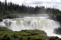
4. Souris River Bend Hike
This trail gives an incredible view of the Souris River ‘Elbow of Capture’ in the Souris River Bend WMA. This area consists of mixed-grass prairie, riparian woodland, and aspen forest and many trails ranging from 5 – 20 km. However, the trails are not marked consistently. Do take along a GPS and leave electronic footprints for easier navigation.
You can get a map from Prairie Pathfinders’ book, Hiking The Heartland (2007, pages 26, 27). The book details an 11-kilometre route with GPS waypoints. Carry plenty of fluids. Details
Difficulty: Easy to Moderate
Where: Souris River Bend Wildlife Management Area
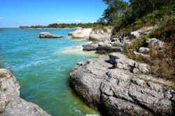
5. Turtle’s Back Hiking Trail
This hiking trail begins at the William Lake Provincial Park and follows along the shores of William Lake. Hike through hills of aspen and oak, cross marshes and creeks, encounter cattle at Turtle Mountain Community Pasture and finally to a lookout tower. There are a number of picnic areas as well as a beach for swimming along the trail.
The elevation is quite steep near the summit, which makes for a challenging yet rewarding hike. Enjoy spectacular views of southwestern Manitoba, including the International Peace Garden. Trial Map
Difficulty: 6.9 km, Moderate; Strenuous near the summit; some portions may be wet.
Where: William Lake Provincial Park; Located east of Highway # 10 and south of Highway #3
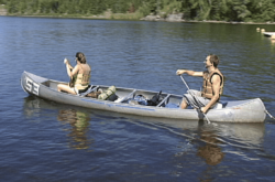
6. Adam Lake Trails
Adam Lake Trails is a network of trails used for hiking, biking, skiing and horseback riding. You can choose from 4 km, 9 km, 10 km and 15 km trails. Hike through forests, past lakes and water bodies full of abundant wildlife. You can choose from five trailheads starting from Adam Lake. Trail Map
Difficulty: Easy to Moderate
Where: Turtle Mountain Provincial Park; Leaving Brandon, follow PTH 10 south, 100 km/62.1 mi
7. Spirit Sands and Devil’s Punchbowl
This is a popular hiking trail that will take you through unique moving sand dunes, cacti, and Devil’s punch bowl with blue-green water. Along the way, you can see trail signs describing the land, the plant and wildlife, and the history of Spirit Sands. Trial Map

Difficulty: 10 km; Moderate; Walking in the sands can be challenging
Where: Spruce Woods Provincial Park
The trails at Assiniboine Food Forest and Crow’s General Store in Brandon’s east end could be added to this list.