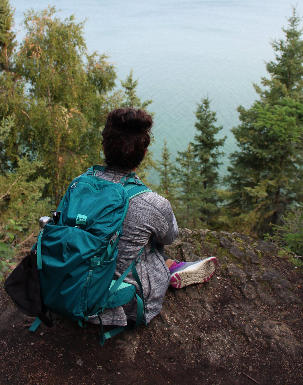
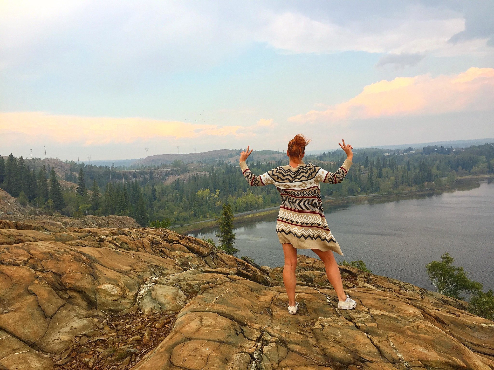
Manitoba is not just a flat prairie land, but a beautiful region with a varied landscape and stunning views.

Photo Credit: Travel Manitoba
Climb hills and cliffs, walk along lakes to enjoy soaring views of vistas. From the beauty of the escarpment at the Bald Hill to the beautiful Pembina Valley, the wonder of the Souris River bend to the power of water at the Pisew Falls, this article explores the beauty found in Manitoba’s vantage points.
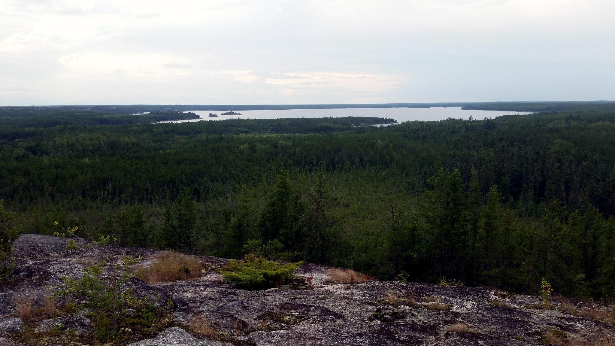
1. Tulabi Falls
In the Anishinaabe language, Nopiming means “Entrance to the wilderness”. At Tulabi Falls, you are awarded exactly that – an amazing view of the wilderness of Nopiming Provincial Park. Fish for walleyes, tulabi, northern pike, and perch or enjoy paddling at the Lake. You can camp overnight at the Tulabi Falls Campground. Trial Map
Location: Nopiming Provincial Park
2. Bald Hill
The Bald Hill is one of the most beautiful lookouts in Manitoba. With steep inclines and flat lands, the North Escarpment trail presents a good, challenging hike. And what a reward awaits hikers at the end – breathtaking views of hills, valleys and forests from the top of a bald hill. Trail Map
Distance: 8.7 km; Moderate; Trail Conditions
Location: Riding Mountain National Park. The trailhead is located a 45-minute drive along Highway 19 from the Wasagaming townsite.
3. Top of the World
Yes! That’s the name of the trail. Take in stunning vistas of Falcon Lake at the lookout. This looped trail can be enjoyed in all seasons and traverses rocky and forested terrain. At the viewpoint, relax on the bench and admire the views of Falcon Lake and surrounding forests. Trail Map
Distance: 4 km; Moderate
Location: Whiteshell Provincial Park; Hike along the High Lake Trail (trailhead at the Falcon Ridge Ski Slopes Parking Lot) for about 1.5 km. Follow signs for ‘High Lake Eco Cabins’ until you reach the Top of the World loop (1 km).
4. Clearwater Lake
Be rewarded with a stunning view of the crystal-clear blue waters of the Clearwater Lake. This spring-fed lake is renowned for its deep, cold, clear water as well as large lake trout. To get the best view of the lake, hike the Caves Self-guiding Trail. You won’t find actual caves here, but rather cave-like spaces (deep crevices) formed when rock fragments split off from the cliff. Trail Map
Distance: o.8 km (45 minutes); Easy
Location: Clearwater Lake Provincial Park. Leaving The Pas, follow PTH 10 north 19 km/11.8 mi. to PR 287, turn east and travel 19 km/11.8 mi. to the park
5. Turtle’s Back Hiking Trail
The Turtle’s Back Hiking Trail follows the shores of William Lake. Hike through hills of aspen and oak, cross marshes and creeks, and finally to a lookout tower from where you can enjoy spectacular views of southwestern Manitoba including the International Peace Garden.
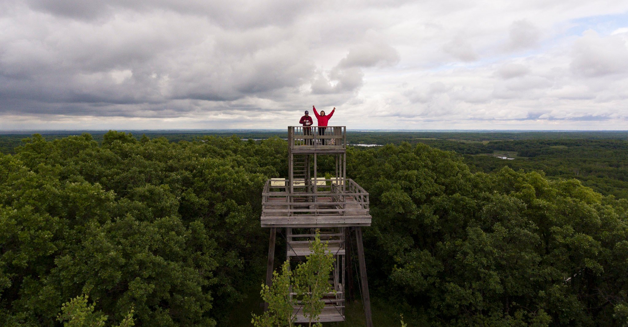
Distance: 6.9 km, Moderate; Strenuous near the summit; some portions may be wet.
Location: William Lake Provincial Park; Located east of Highway # 10 and south of Highway #3
6. Cape Merry
Take in the gorgeous North landscape at Cape Merry. The vast stretch of land, strewn with boulders and orange lichen, is strangely calming. Located in Churchill, the Cape Merry Battery was an important post during the fur trade era. Details
Location: Churchill; Located on the east shore of the Churchill River across from Prince of Wales Fort.
7. Walk On Ancient Mountains
Walking On Ancient Mountains trail is a short hike with several short but steep inclines and leads to spectacular 360° views. Those interested may study exposed rock surfaces that provide clues about the ancient mountains that once towered above here. Trail Map
Distance: 1.8 km (1 hour 20 minutes); Moderate
Location: Nopiming Provincial Park; Park Directions: From Winnipeg, follow PTH 59 north to PTH 44, east to PTH 11, north to PR 313, then east to PR 315, leading to Bird Lake at the south end of the park. PR 314, just inside the park, takes you north through the park. Distance: 227 km/141 mi.
8. Pisew Falls
Experience this amazing waterfall in Manitoba, where the Grass River falls down with a 13 m/42.7 ft drop. Though this is not Manitoba’s highest waterfall, the Pisew Falls is one of the most Instagrammable places in the province. This waterfall can be easily accessed via a short boardwalk that offers two vantage points. Details
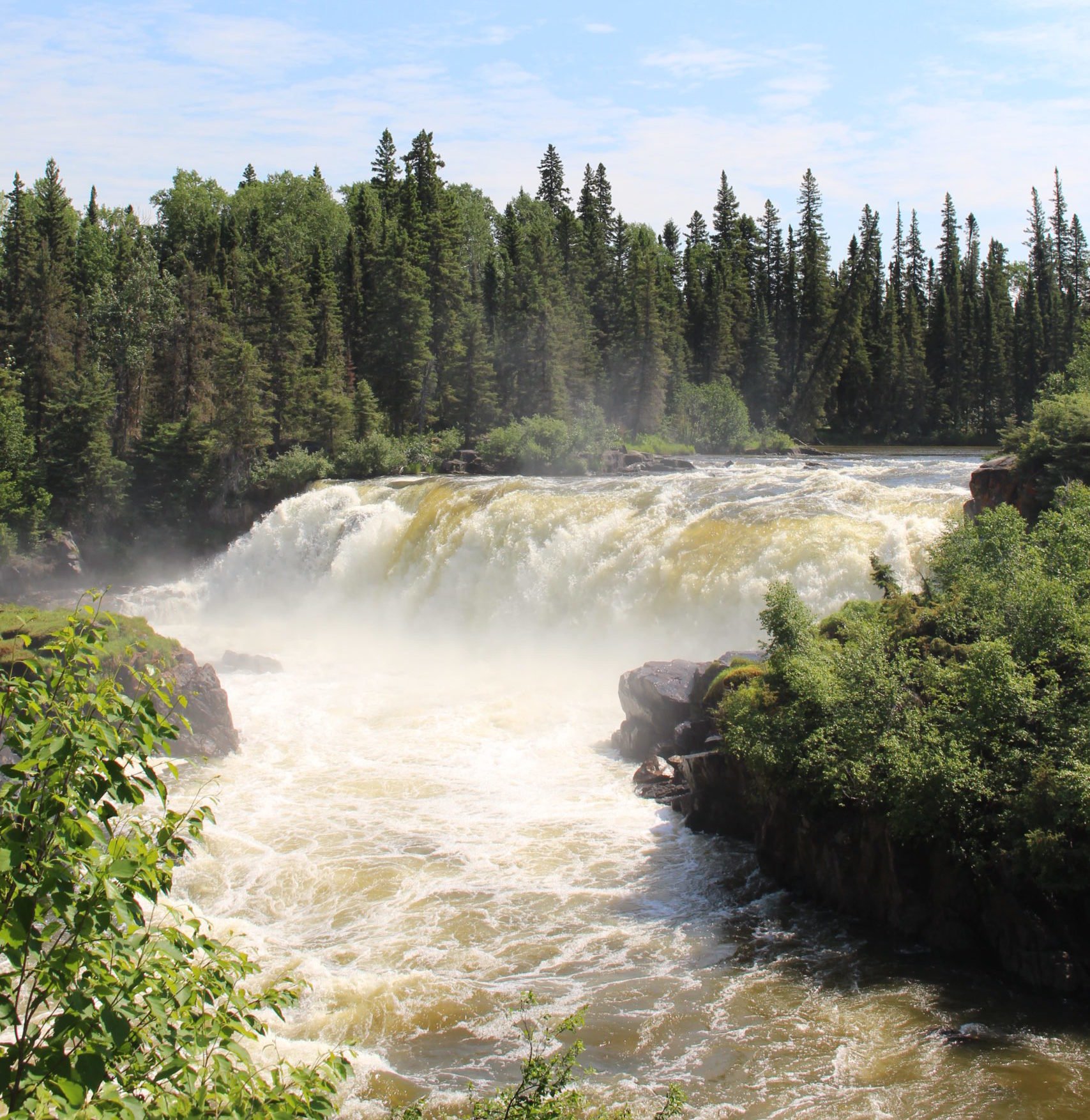
Photo Credit: Travel Manitoba
Location: Thompson; The short turn-off to Pisew Falls is 74 km / 46 mi. South of Thompson on PTH 6.
9. Hogsback Trail
This short trail from the Hogsback viewpoint moves along a narrow sand ridge to a beaver-dammed pool. Enjoy unobstructed views of the Assiniboine River valley along the trail. Spruce Woods Provincial Park has many other trails to enjoy with amazing scenic views, including the Spirit Sands and Devil’s Punch Bowl.
Distance: 1.2 km; Easy to moderate
Location: Spruce Woods Provincial Park
10. Hunt Lake
One of the most scenic trails in Whiteshell Provincial Park, the Hunt Lake trail is a difficult trail that follows the east shore of West Hawk Lake. All those steep climbs will be rewarded with spectacular views of the lake. Take along your swimwear for a refreshing swim. Trail Map
Distance: 12.8 km (return); Moderate to Difficult; Allow 3 hours to reach the trails end.
Location: Whiteshell Provincial Park
11. Pembina Valley
Take in beautiful views of the Pembina Valley all along the trail! With many lookout points, the Pembina Rim Trail has some of the best scenic lookouts in Manitoba. Trail Map
Distance: 6.5 km; Moderate
Location: Pembina Valley Provincial Park
12. West Hawk Lake
An easy trail will take you up a rocky outcrop that overlooks West Hawk Lake. But what a view it is at the end! Dragon Fire Trail Map
Distance: 1.1 km
Location: West Hawk Lake Campground
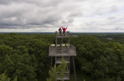
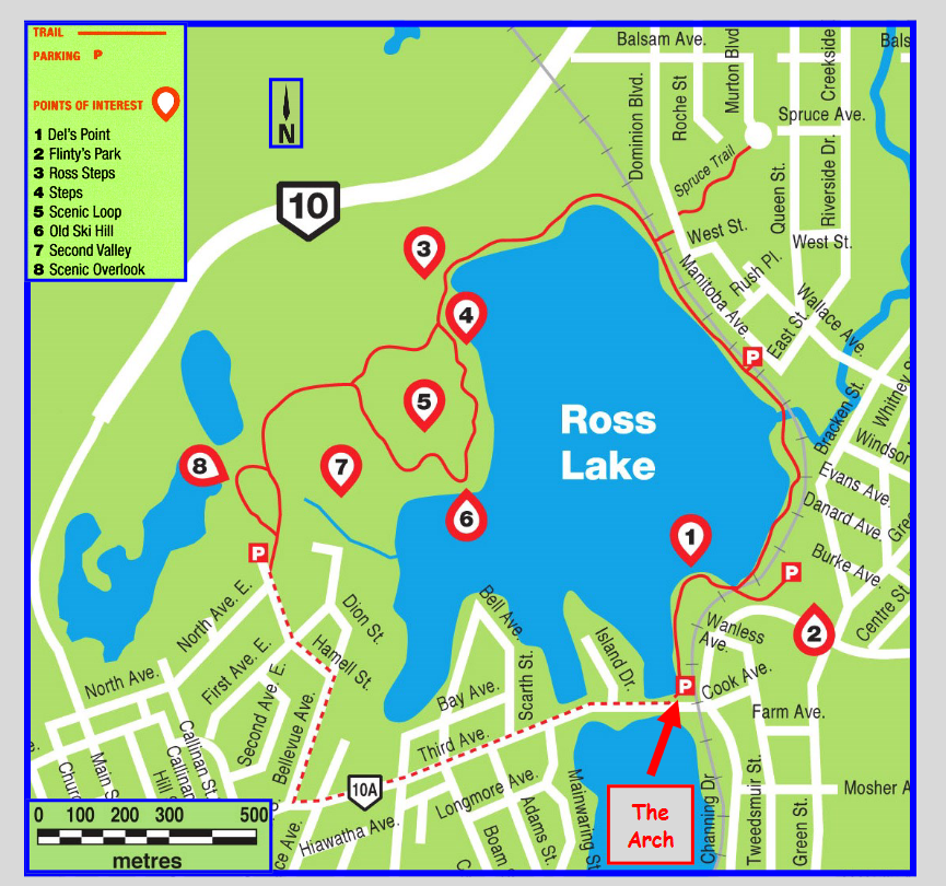
13. Flin Flon
This view is one of a kind! Flinty’s Boardwalk and Trail is a 4.2 km-long trail that leads to an amazing view of the city of Flin Flon. The climb to the top of the volcanic rocks, overlooking Ross Lake, makes for a challenging, yet rewarding hike. Trail Map
Distance: 4.2 km; Moderate
Location: City of Flin Flon
14. Steep Rock
Beautiful waters, rocky cliffs, small caves, beautiful sunset – all these await you at Steep Rock. Walk along the shoreline of the cliffs, kayak or explore the caves, or enjoy turquoise waters from the quarry. There is so much to do here. Those who enjoy hiking can try the hiking trail that encircles the quarry. Trail Map
Location: Steep Rock; Located 2.5 hours North of Winnipeg, off Highway 6
15. Gorge Creek Trail
Follow a gorge through thick boreal forests, small streams and steep slopes with endless views of the escarpment and lush forests! The trail offers many scenic views and traverses varied terrain, making for a challenging hike. Details
Distance: 12.8 km; Difficult
Location: Riding Mountain National Park; Located along PTH 19
15. Blueberry Rock
Located in Lac du Bonnet, this is an easy loop with granite rock ridges, a quarry, and a lookout tower that provides a view of the Winnipeg River. There are picnic areas and abundant wildlife to enjoy along the trail. This trail is part of the Blue Water South Trail, a Trans Canada Trail. Details
Distance: 1.8 km; Easy
Location: From Lac du Bonnet, go east on Hwy #313, and drive north on Blueberry Rock Drive for just over 1 km. You can see the trailhead sign and parking lot on the left.
16. Griffiths Hill
Griffiths Hill can be accessed from the Chickadee Trail as well as via the Bluestem and Aspen Trail Loop. Griffiths Hill is the halfway point along the Chickadee trail and is the highest elevation in the region at 265 m above sea level. The lookout tower at the Hill provides a view of the west side of the park, beyond the Park’s boundary. Trail Map
Distance: 4 km (return); 2 hours
Location: Birds Hill Provincial Park; Start at the Chickadee parking lot, off North Drive.
17. Lover’s Leap
The Ducks or the escarpment always provides breathtaking views shaped by glacial processes. From the steep bank, see views of the Pine River flowing below. Details
Distance: 3.5 km; Moderate
18. Baldy Mountain
Baldy Mountain is the highest point in the province at 831 meters above sea level. Climb the viewing tower (0.6 m) at the summit for a southward view of Grandview Valley and the slope of the Riding Mountain beyond it. Interpretive signs provide information on the early inhabitants, the fur trade, as well as the Ducks. Although the viewing tower is located very near the trailhead, you can go along the looped old Central Trail for a good hike. The trail leads to a viewpoint above a wetland. Trail Map
Distance: 3 km; 2 hours; Moderate
Location: Duck Mountain Provincial Park; Trailhead is situated on top of Baldy Mountain
19. Rice Creek Tower
Accessed by a 32.2 km multi-day hiking trail is a lookout offers stunning views of the Manitoba Lowlands. Some visitors opt to drive and hike the last few kilometres to the lookout point. Details
Location: Mountain, Manitoba
20. Bakers Narrows
The viewing tower at Bakers Narrows provides a spectacular 360° view of crystal clear waters, boreal forest and rock outcrops. The interpretive signs describe how the history of the area was influenced by early inhabitants. The lookout tower is located near the day use area across the Park Office. Details
Distance: 1.5 km return; 30 minutes; Easy
Location: Bakers Narrows Provincial Park; Located south of Flin Flon
21. Souris River Bend
See the power of nature at the Souris River Bend where the Souris was captured by a tributary of the Assiniboine. Details
Location: Souris River Bend Wildlife Management Area