The Weather Network has issued the 2021 Fall season forecast which says most Canadians can expect near or above normal temperatures and precipitation for the fall season as a whole.
The Weather Network expects that the arrival of consistently cold weather will be temporarily delayed in western Canada, while Ontario and Quebec, can expect a quicker start to winter than we have seen during many recent years.
“The early arrival of cooler weather has brought relief from the relentless summer heat and wildfire smoke across western Canada. However, warm weather is not done with us just yet.” said Chris Scott, Chief Meteorologist at The Weather Network. “Late September and October will feature extended periods of pleasant fall weather with near seasonal or above seasonal temperatures. However, we are also watching the risk for a significant pattern change that could bring a quick start to winter for parts of Canada.”

Weather Network
Here’s a more detailed look at the conditions expected across Canada this fall and into December:
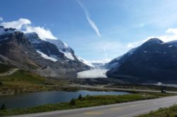
British Columbia
The weather forecasting organisation expects near-normal temperatures across most of B.C. with a typical number of fall storms and rainy days.
Southern areas in B.C. is forecasted to be slightly warmer than normal.
Above normal precipitation is anticipated with moisture laden systems bringing the risk for excessive rainfall at times.
Mild temperatures are expected for the end of fall and continuing into December.
Temperature Outlook: Near normal; Slightly above normal south
Precipitation Outlook: Above normal; Near normal west
The Prairies
Bringing an end to the e drought conditions which dominated the year so far in the Prairies, near-normal temperatures and precipitation are expected across most of the region.
The Weather Network expects alternating periods of warmer than normal temperatures and shots of cold weather that will bring a risk for an early season freeze.
The agency says the arrival of consistent cold will be delayed.
Alberta
Temperature Outlook: Near normal
Precipitation Outlook: Near normal
Saskatchewan
Temperature Outlook: Near normal
Precipitation Outlook: Near normal
Manitoba
Temperature Outlook: Near normal
Precipitation Outlook: Near normal; Above normal far north
Ontario & Quebec
Warmer than normal temperatures are expected to dominate the heart of the fall season with extended periods of pleasant weather through October.
However, a pattern change during late fall should bring more winter weather during December than what Ontarians and Quebecers have become accustomed to seeing in recent years.
Ontario
Temperature Outlook: Above normal; Near normal far north
Precipitation Outlook: Near normal; Above normal north
Quebec
Temperature Outlook: Above normal; Near normal central and northwest
Precipitation Outlook: Near normal; Above normal far east, north and parts of central
Atlantic Canada
Warmer than normal temperatures are expected to dominate the fall season, along with the typical number of fall storms.
Active hurricane season is expected to continue with the potential for a couple of systems to bring excessive rainfall totals to parts of the region.
Near normal temperatures are expected for December.
Temperature Outlook: Near normal
Precipitation Outlook: Above normal; Near normal northwest New Brunswick
Northern Canada
Near normal temperatures and precipitation are expected across the Yukon, while above-normal temperatures and precipitation are expected for eastern Nunavut, including Iqaluit. The coldest weather relative to normal is expected to shift from near Hudson Bay to western parts of the NWT during mid-fall.
Temperature Outlook: Near normal Yukon and south NWT; Below normal central NWT & central Nunavut; Above normal east Nunavut
Precipitation Outlook: Near normal; Above normal south, central Yukon & around Hudson Bay