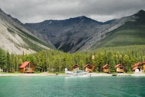
The Okanagan is well known for its pretty vineyards, plenty of fruit-laden orchards, beautiful lakes, as well as the multitude of fantastic eateries and accommodations. There is a lot to keep you busy while you are in the area, and if you are a hiker you will discover some great paths to wander along. From beginner hikes to more advanced multi-day treks, there is something for everyone who wants to take a walk in the area. Covering an area of about 200 kilometers long and 20 kilometers wide, the Okanagan Valley is just waiting to be explored on foot.
You may like:
- 50 Things to Do with Kids in the Okanagan Valley
- 25 Bucket List Activities in the Okanagan Valley
- 50 Outdoor Adventures in the Okanagan Valley
BEST HIKES IN KELOWNA AREA
Little White Mountain Trails
There are two trails available to enjoy on Little White Mountain. Located outside of Kelowna, Little White Mountain is a good destination for those who are looking for longer or more difficult hikes, and who still want the incredible views. The Highland Trail is shorter but steeper, with an elevation gain of 598 meters and not accessible before mid-June due to snow. The Crawford Trail is longer and good for moderate to advanced hikers.
Distance: Highland Trail 5.39 kms (one way)
Distance: Crawford Trail 10.3 kms (one way)
Lochview Trail
A great way to get some phenomenal views of Okanagan Lake, this trail takes you along forested paths and to a secluded beach. It is not as popular as some of the other hikes that are just outside of Kelowna and hooks to the Paul’s Tomb hike listed next, so you can continue to that one if you choose to. There is an elevation gain of approximately 95 meters, mostly on wooden stairs. If you want to make it a loop trail, start from Clifton Road, go all the way to Paul’s Tomb and then take one of the many trails that loop in the vast network of Knox Mountain Trails.
Distance: 1.5 kms (one way)
Hike to Paul’s Tomb
Distance: 2.42 kms (one way)
Details
Spion Kop Hiking Trails
The Spion Kop Recreation Area encompasses 880 acres of land and has seven different trails that can be enjoyed from five different trail heads. There is one easy, four moderate, and two difficult hikes available, and you can start with one and end with another (or two or three). Create your own loop trail based on your time and desire. The views from the top are spectacular, and the name even means “spy hill” or “look out hill” in Dutch, giving you an idea of just how far you can see from the viewpoints. Located between Kelowna and Vernon this recreation zone can be accessed easily from Highway 97.
Distance: From 0.9 kms to 5.2 kms (one way)
Details
Carrot Mountain Bluffs
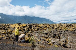
The Carrot Mountain Bluffs in the Kelowna area create fantastic opportunities for several hikes. The view from the height of the bluffs is a good incentive, not to mention the opportunity to view wildlife and walk through the natural sub-alpine terrain. Accessed from Kelowna, you want to have some hiking experience for this walk, as it is considered difficult due to the steep uphill climb and the technical downhill descent. Keep in mind this is not a good winter trail as it is not marked well, you need to be able to see where other hikers have passed. As well, you may have to navigate over or through streams, especially in the spring, the bonus being that there is also a waterfall to view along the way!
Distance: 4.34 kms (round trip)
Details
Hike Myra Canyon Trestles
The Myra Canyon Trestles were part of part of the Kettle Valley Railway and today are used for outdoor activities, conveniently located just thirty minutes from downtown Kelowna. There are two tunnels and eighteen trestle bridges to hike over and get some phenomenal pictures of the region. Great views and amazing history await you along this unique trail. You can go as far as you want before turning around, so it is a nice place to walk for either a short stroll or a long hike.
Distance: 0.1 to 12 kms (one way)
Details
BEST HIKES IN PEACHLAND AREA
Hiking a Fur Traders Route on Mt. Eneas
You can spend a day hiking along a historical route originally used by the Hudson’s Bay Company fur traders. Don’t be fooled though, this is a hike that is for experienced walkers, with a 911-meter elevation gain and the trail itself is not well travelled, which means that a GPS is a necessary accessory. You are rewarded by the incredible ridgeline walk that you will enjoy along the way. If this journey isn’t enough for you, you can connect to other trails in the Garnet Valley Trails network here.
Distance: 13.2 kms (one way)
Details
Hardy Falls Hike
Just a couple minutes from downtown Peachland, you will find this lovely short trail that will take you to the Falls and back along the same route. Appropriate for walkers of all ages and abilities, the flat path will take you along the creek, where in the fall you can see salmon swimming, another great attraction!
Distance: 0.43 kms (one way)
Details
Hike Pincushion Mountain
Just outside Peachland you will find this short but demanding walk to the summit of Pincushion Mountain. There are markers along the way to keep you on the right path and lots of places to stop and take pictures and catch your breath. Good hiking shoes or boots are suggested as the gravel can be slippery, especially on the way down. If you are hiking in winter or spring conditions, be wary of ice.
Distance: 1.8 kms (one way)
Details
https://www.instagram.com/p/BNfWa8RAeqp/
BEST HIKES IN LUMBY AREA
Camels Hump Hike
The road to get to this trail is extremely rough, so a 4×4 or high clearance vehicle is a must to get to the trailhead. Camel’s Hump was an ancient volcano and is the prominent peak in the area. Of course, this means it has phenomenal views from the top and great hiking opportunities. There are two humps that you can get to from the main trail. This is listed as a moderate hike and should take about two hours total for the round trip. There are many lookouts along this trail that provide excellent photo opportunities of the valley, surrounding mountains and even nearby towns.
Distance: 3 kms (one way)
Details
Tsuius Mountain Trail to Mirror Lake
Part of the Sawtooth Mountain range, Tsuius is reached by several different trails but for the purpose of this article we will talk about the one that starts behind the Monashee Powder Snowcats Lodge. Defined as difficult, this hike can be completed as a long day hike or as a two-day hike, with an overnight camp at Mirror Lake. The beautiful sub-alpine terrain affords fantastic views of the surrounding mountains and an exhilarating hike. This is also grizzly terrain, so keep your eyes out.
Distance: Possibly 4 to 5 kms (one way) Plan for at least 6 hours one way.
Details
https://www.instagram.com/p/BHGfX_0hgf5/
BEST HIKES IN VERNON AREA
Okanagan High Rim Trail
The trail runs from Vernon to Kelowna, with a total trail length of There are six entry points to the High Rim Trail at the forestry service roads throughout the area. Along the trail there are two set campsites with pads and outhouses. Rated as difficult because of the steep ascent and descent at the start and finish, you want to allow three to four days to complete the whole trail. Shorter day hikes can also be done from the various entry points. GPS is suggested for this hike.
Distance: 57.9 kms (one way)
Details
Hiking in Fintry Provincial Park
The hike to Fintry Falls is nicknamed the “Stairway to Waterfall Heaven” and once you tackle this short hike to see them for yourself, you will wholeheartedly agree. There are around 400 stairs to climb up and down, so if you have bad knees you may not want to attempt this walk. There are several other smaller waterfalls that you can see if you keep walking past the main one or extend your hike to some of the historical sites in the area. Parks Canada offers a self guide map of the area to explain the sites.
Distance: 2 – 3 kms (round trip)
Details
The Enderby Cliffs
With phenomenal views of the Shuswap and the North Okanagan, the clifftop offers hikers a unique view of the area. The well marked trail is good for moderate to expert hikers because of the elevation gain of 868 meters. The trail goes all the way to the summit, but most walkers stop at the 5.6-kilometer mark as there are not any views after this. Expect 4 to 5 hours round trip if you have an average walking speed.
Distance: 7.29 kms (one way)
Details
Denison Lake Hike
This trail is appropriate for hikers who are looking for a moderate level walk. Located within Denison-Bonneau Provincial Park about a half hour east of Vernon, this path gives hikers an excellent opportunity to go through remaining old-growth forest to the beautiful lake and some interesting volcanic formations. There is good fishing here if you feel like toting your equipment along with you.
Distance: 8 kms (round trip)
Details
Monashee Lake Hike
This is not a hike that beginners, or even intermediate hikers should attempt. This is a steep trail with an elevation gain of over 700 meters up to a small lake and an alpine meadow. You need to allow for about 5 hours to do this hike without hurrying. The beautiful glacier fed lake is well worth the walk. It is advisable to have a GPS with you for this hike as the path is not always clear.
Distance: 8 kms (round trip)
Details
Spectrum Lake Hike
Located in Monashee Provincial Park, just about an hour from Vernon, this is another popular hike that takes you to a gorgeous lake. There are even rainbow trout here that you may be able to catch a glimpse of. This is a beginner to moderate hike that can provide a wilderness camping opportunity as well. There are tent platforms, pit toilets and piped drinking water available so it makes it an excellent two-day hike. There are plenty of trails leading off from the lake, so you can complete other hikes if you decide to stay overnight, maps are available from the Parks website. Please be aware that grizzlies are frequent in the area.
Distance: 6 kms (one way)
Details
Vista Pass Hike
To get to the stunning views at the peak of the trail, you follow a creek up to the alpine heights. You probably need about five hours to complete this trail, or more if you want to stop a lot to take pictures. You gain just over 700 meters as you head up, so it is not recommended for beginner hikers. From the alpine meadows at the top of the trail you can wander up to the ridges to get better views. Located by Lumby, you can easily access this trail from Vernon.
Distance: 9.5 kms (round trip), or more if you continue onto the ridges
Details
BEST HIKES IN PENTICTON AREA
Peach Cliff Trail
Peach Cliff Mountain is a well-known landmark in the Okanagan Falls region. Just 25 minutes outside of Penticton you will find this interesting hike. For the most part this is not a well marked trail but if you happen to miss the small trail leading off you will encounter another one farther up. There used to be a mine in the area, so there are some cool things to see along the path, including ore samples. Of course, like a lot of the hikes in the area, this one comes with an amazing view at the end.
Distance: 4.5 kms (one way)
Details
Twin Lakes Hike
This hike is best done between July and September as it winds its way to higher elevations. Snow can be seen up at the top into late July, so be prepared with appropriate gear. Meant for experienced intermediate to advanced hikers, as there is an elevation gain of about 500 meters. There are several other additional trails from the lakes that you can use to get to the peaks for amazing views of the area.
Distance: 8 kms (round trip)
Details
https://www.instagram.com/p/B2YYGAfBhUc/
BEST HIKES IN SUMMERLAND AREA
The Trans-Canada Trail near Summerland
The Trans-Canada Trail, also known as the Great Trail, is a network of greenways, waterways, and roadways that stretch from the Atlantic to the Pacific to the Arctic oceans and provides outdoor enthusiasts ample opportunities to enjoy themselves. Near Summerland you can easily access the 61- kilometer hiking or biking route between Summerland and Osprey Lake. This is a very well marked trail with amenities along the way and some pretty viewpoints and interesting sites.
Details
Giant’s Head Trail
Giant’s Head Park is the perfect place to spend a couple of hours exploring the heights of an ancient volcano and provides incredible views from the top. The hike from the parking lot is short but worth it, only about 15 minutes to the summit, so nothing extremely straining and accessible to everyone. Otherwise, if you would like a slightly longer walk, start from the trailhead on Milne Road at the base of the hill.
Distance: 1.6 kms (round trip)
Details
Naramata Creek Park
This is an easy walk that is appropriate for all ages and abilities. A very pretty trail that takes you past several waterfalls and, if you are feeling adventurous, you can continue to additional waterfalls or connect with the Kettle Valley Railroad track. The path at the beginning is quite well maintained but as you continue on you will find that it deteriorates and you will have to cross the creek once or twice on rocks or through the water, so it is not the ideal path to walk during the spring when the waters are high.
Distance: 2.4 kms (round trip)
Details
BEST HIKES IN OSOYOOS AREA
Mount Kobau Trail Network
Located in the South Okanagan Grasslands Protected Area, this trail network offers a few trails to take you up to be rewarded with excellent views. The trails here are excellent for beginner, intermediate and advanced hikers and each trail rewards you will amazing views. Wildflowers abound in early summer and from the top you can see the surrounding vineyards, orchards, wetlands and grasslands.
Distance: up to 3.6 kms (round trip)
Details
Golden Mile Trail
The Golden Mile Trail is a lovely trek through the Tinhorn Creek vineyard and past the Tinhorn Creek gold mine ruins. The access to this trail is through the vineyard itself with permission from the landowners, so you don’t have to worry about trespassing. There is a bit of a steep section that will reward you with outstanding views of Oliver and towards Osoyoos. Eventually you will come along to the stamp mill ruins and the creek itself with its refreshingly cool water. You can return the same way and enjoy a meal or a glass of wine at the vineyard!
Distance: 11 kms (round trip)
Details