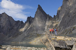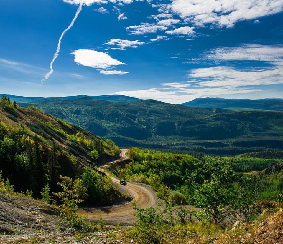
Credit: Stewart Cassiar Tourism
The highways that wind their ways through the beautiful and varied landscapes from the city of Vancouver, through British Colombia, and up to the incredible territory of the Yukon, with its small capital city of Whitehorse, are a road-trippers dream. There are so many things to do and see along the way that your vacation can be the journey itself, rather than just the end destination. Keep your eyes peeled for wildlife along the way – from deer and moose to bears and eagles. The multitude of historic sites, First Nations areas, and natural wonders allow travellers plenty of opportunities to stop and enjoy.
Alternative Road Trip – Road Trip: Vancouver to Whitehorse via Sea to Sky & Cassiar Highways
Planning and Preparing for Your Trip
Hotels and campgrounds along the route open opportunities for both RVer’s, tenters or hotel goers to enjoy this trip without worrying where they will find accommodations, but it is always a good idea to make reservations ahead of time if you can, as some campgrounds and hotels fill up quickly during the summer season. If you are travelling in the spring or fall, it is recommended that you check to see if campgrounds are open along the Cassiar Highway and check out the B.C. website for up to date road conditions.
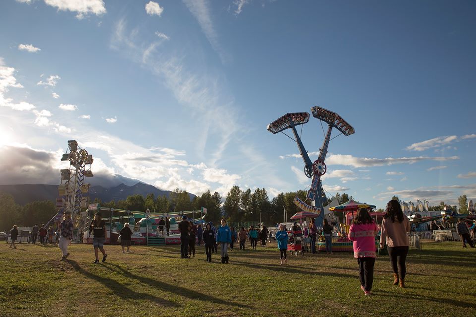
This trip can be done in two long days if you don’t stop to see anything, but we recommend at least four or five days to properly enjoy the regions you are travelling through. Our suggested itinerary, below, is for a six-day self-drive tour.
You may like:
- Trip to Vancouver: Optional 1, 2, 3 or 4 Day Trip Itinerary
- Trip to Victoria, Nanaimo and Tofino – 5 Days in Vancouver Island
Note: The drive time stated is that actual time of driving, not including stops.
Day One: Vancouver to Cache Creek
Drive time: Approximately 4 hours
This will be a relatively short drive day with time spent in some fabulous places along the way. The town of Hope and the surrounding mountains is well worth one whole day, if you have the time and the inclination. This is an area that is heaven for outdoor enthusiasts. If not, you can hit the best of the sights here instead and continue on your way.
Credit: Hope, Cascades & Canyons
Hope is located on Highway 1 out of Vancouver and is a small town of approximately 6,200 residents. It is commonly referred to as the “Chainsaw Carving Capital” because of the 80-plus wooden carved structures throughout the community. Head to the Visitor’s Center to pick up a self-guide walking map.
You can also check out the Art Gallery here, which features a variety of art such as paintings, pottery, sculptures, photography, drawings, jewellery, basketry and fabric arts. There is another self guided walking tour that will take you on an Art Walk around the town.
Travelling along the scenic Fraser Canyon, up Highway 1, you will find Hell’s Gate. A sinister name for an amazing place, this site is actually home to one of the only descending air-trams in North America, a suspension bridge, fisheries exhibit, a wall dedicated to Simon Fraser, gold panning, observation decks, fudge factory and a café. Plan to spend the whole afternoon here to really enjoy the experience of 750 million litres of water travelling through a 33-metre-wide passage.
Your destination today is the town of Cache Creek, another hour and a half up the winding highway. There are a variety of hotels and campgrounds to stay in here, along with plenty of good dining options.
Day Two: Cache Creek to Barkerville
Drive time: approximately 4.5 hours
When you reach the town of Quesnel, you will have the chance to walk across a piece of history – the wooden truss bridge built in 1929, which connected the two communities of West and North Quesnel for many years.
Instagram
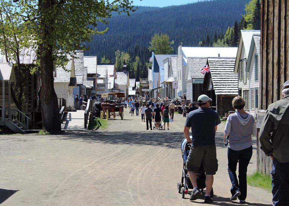
Credit: Barkerville Historic Town & Park
If you leave Cache Creek early in the day and don’t make too many stops, you will have time to spend time in historic Barkerville. Summer hours extend into the evenings, but if you are visiting in winter or shoulder seasons make sure to check the website for hours and open exhibits. From Highway 97, turn right onto Highway 26, for a drive of approximately an hour to reach the site.
There is plenty here to keep you busy, including more than 125 heritage buildings, authentic displays, satellite museums, restaurants, shops and accommodations. This was declared a National Historic Site of Canada in 1924 and a Provincial Heritage Property in 1958 and is now the largest living-history museum in western North America. The entrances are valid for two days, so if you want to, you can spend a couple of days here before continuing on your journey.
There are several places to stay at the site itself, but it is necessary to reserve in advance. Otherwise you can stay down the road in Quesnel, which also has several accommodations and camping options available.
Day Three: Barkerville to Prince George
Drive time: approximately 2.5 hours
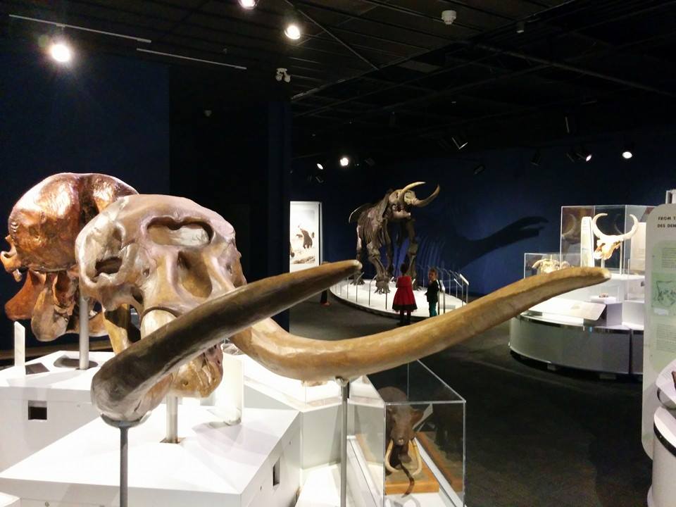
Credit: The Exploration Place
Today you will continue to head north until you reach the city of Prince George. This is an easy drive that will allow you plenty of time to experience the city itself when you arrive. Check out the Exploration Place Museum & Science Center, especially if you are travelling with kids. This interesting museum has a great mixture of cultural history of the Lheidli T’enneh First Nations, paleontology exhibits and a children’s gallery, amongst others. It is easy to spend a couple of hours enjoying everything here.
You can also visit the Central BC Railway & Forestry Museum, which, of course, features the city’s history of an era when the railway was the region’s lifeline and forestry was becoming the provinces future. This is another great place to take kids, but interesting for adults as well. The museum is located in a park setting and there are plenty of hands on experiences to keep you busy for an hour or two.
Instagram
If you prefer to experience a different side of history, just 40 kilometers north of Prince George on Highway 97, you can find the historic Huble Homestead, which is located at the base of the historic Giscome Portage. Originally a homestead and fur trading post, the site has been restored to its 1915 condition and is open to the public from May to October for guided tours, lunch and shopping in the General Store.
Prince George has plenty of shopping, eating and accommodations of all sorts, and even a casino if you would like to keep yourself busy in the evening.
Day Four: Prince George to Smithers
Drive time: approximately 4.25 hours
An hour down the highway you will come across the town of Vanderhoof. Take awhile to stop and enjoy the Visitor’s Center & Museum, located right on the highway, which will allow you to take a step back in time to the early 1900’s. Historic buildings, exhibits and a 1 kilometer interpretive walking trail through the forest and site will give you a good idea of what life was like back then and the history of the town itself. There is a café here with yummy goodies as well.
Continuing on from here, you will find the small town of Fort Fraser about 25 minutes drive from Vanderhoof. This is actually one of the oldest settlements in the province, as there was a fur trade post set up here in 1806 by Simon Fraser. Amazingly, this is also the site of the last spike of the Grand Trunk Pacific Railway, driven on April 7th, 1914. There is a plaque marking the spot on the left-hand side of the highway which makes a great photo stop. This is a superb area for fishing, especially during the summer salmon run, but if you decide to stop to enjoy throwing a line in the water, make sure you have a current fishing license. There is a small museum in town – the Fraser Lake Museum – which is located at the Visitor’s Center and can provide you with the interesting history of the area.
From Fort Fraser and Fraser Lake, continue west on Highway 16 another two hours to reach the town of Houston. Here you will find two interesting things, one a giant fishing pole which is the world’s largest fly rod, and the other the Visitor’s Information Center, which is home to a large taxidermized bear, well worth a picture. You can’t miss these; they are located on the right-hand side of the highway in a small park. The Center can also provide you with information on hiking, fishing or paddling in the area.
Credit: Smithers Tourism
Your destination today is the charming town of Smithers. Located strategically in the valley, this town offers skiing during the winter months on the nearby Hudson Bay Mountain and plenty of hiking, biking, fishing and paddling opportunities in the summer months. There are cute little stores along the main street and plenty of good restaurants around town. If you need some exercise, there is a loop trail that takes you along the river and into town. You can start and end this trail in several places, so grab a map from the Visitors Center and head out! Be careful though, it is common to see black bears along this trail, especially by the river. For another short hiking opportunity, you can check out Twin Falls Recreation Site, located just west of town. The Bulkley Valley Museum is a great little place to get some background of the history of the town and the area and has great volunteers who will be pleased to share some of their own stories with you as well. There are a variety of hotels and campgrounds in the area to stay in. This is the last major town in which you will find large grocery stores before starting the trek north, so if you need to stock up on road trip snacks, this is the place to do it.
Day Five: Smithers to Stewart
Drive time: approximately 4 hours
Continuing west on Highway 16, you will find the villages of Hazelton and New Hazelton. Take an hour to take a walk to check out the lookout and waterfall here. To get to the start of the trail, head to the end of Laurier Street in New Hazelton. The trail to the lookout is steep, but well worth it, as it affords amazing views of the valley and the surrounding mountains. The waterfall trail is easier, and it is guaranteed that you will enjoy the rushing waters of these unnamed falls. Allow yourself an hour to do both trails.
Your drive north will start approximately a half hour farther down Highway 16, when you turn onto Highway 37. This highway is also chock full of photo opportunities and interesting places to stop, but it is a more remote highway, which means that there are not as many services available and at times there is no cell service available.
You will find the small village of Kitawanga just a couple minutes up Highway 37. This is a great quick stop to see some ancient totem poles. This is considered one of the best places in the province to view authentic totem poles. As well, in the area you will find the Gitwangak Battle Hill. Here you can view remains of a fortified village occupied by the Gitwangak First Nation and from here have some amazing views up and down the Kitwanga River valley. About 15 kilometers farther, the village of Gitanyow is also home to both original and replica totems, some painted by Emily Carr.
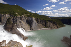
Many travellers think of BC as a common place to see salmon, and they would be right! The Meziadin Fish Ladder, located another hour and forty-five minutes up the highway, is an excellent opportunity to see sockeye and chinook salmon as they migrate back to the lake. This 670-foot-long fish ladder bridges both the upper and lower Victoria Falls, with 33 ascending pools! There is a public viewing area at the foot of the ladder, as well as an area where visitors can view operations. Visit in late summer for the best viewing, and watch out for the bears, eagles and wolves which frequent the area looking for dinner.
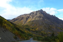
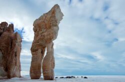
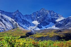
A short drive farther will get you to Meziadin Junction. Here you will turn down Highway 37A through Bear Pass which heads west to Stewart, your destination for today. The stunning scenery along this route showcases upwards of 20 glaciers that are all visible from the highway. Bear Glacier and Salmon Glacier are perhaps the most photographed of all.
Credit: Stewart-Cassiar Highway
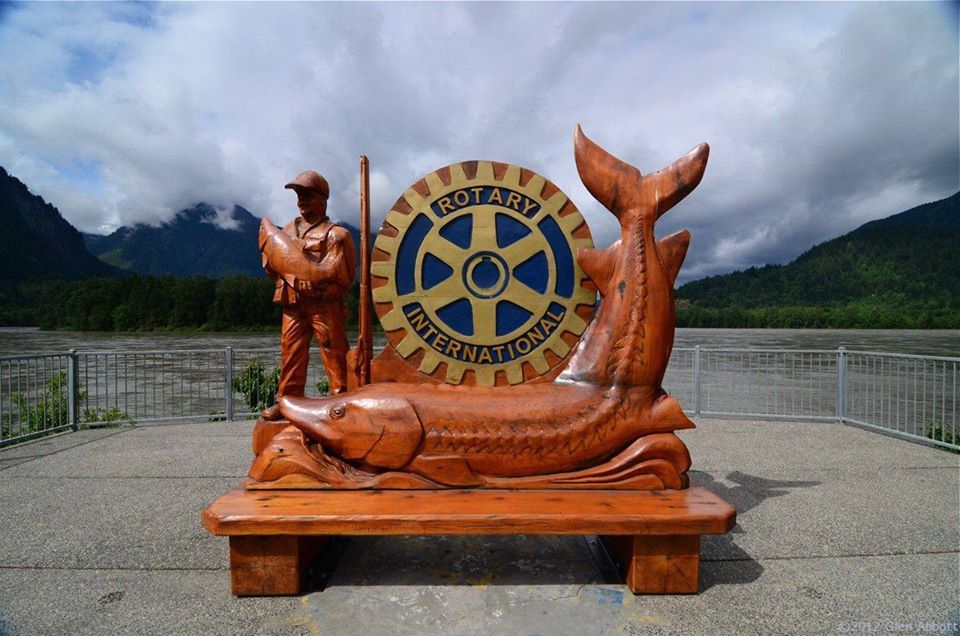
A remote wilderness town, Stewart is an excellent place to really experience animal and bird life. You definitely want to spend a bit of time checking out the Estuary Boardwalk, a 278-foot raised boardwalk that takes through the estuary ecosystem behind the Visitor’s Center. If you visit early in the morning, or late in the day, you will have ample opportunity to view a variety of birdlife. It is also very common to see bears strolling around town or on the sides of the roads here. Be bear aware! Of course, there are plenty of other outdoor activities available, so if you have the time to spend a whole day here it is worth it. There are both campgrounds and hotels available, but it is best if you book in advance. Details
Day Six: Stewart to Dease Lake
Drive time: approximately 5.5 hours
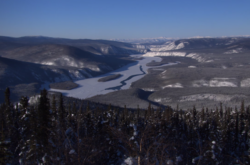
You will return to Highway 37 the same way you travelled in, but these views are worth a second peek and some more picture stops. Turn left onto Highway 37 to continue travelling north to the Yukon! There are many places to stop and stretch your legs or take pictures along the route. The town of Dease Lake is the destination for today. This is the largest settlement on the highway and has some good history.
A fort was built nearby in 1837 when prospecting miners and suppliers poured through town during the Cassiar gold rush of the 1870s. This made Dease Lake part of a major transportation route for trappers and prospectors wishing to make a living off the rugged and weathered land.
You can spend a bit of time exploring the remains of the Hudson Bay Company trading post that still stands at the south end of the lake.
The surrounding area is well known for the abundance of magnificent wildlife, including grizzly and black bears, moose, caribou, wolves, beavers and over 140 species of birds. Keep your eyes open, you never know what you may see.
Day Seven: Dease Lake to Whitehorse
Drive time: approximately 8 hours
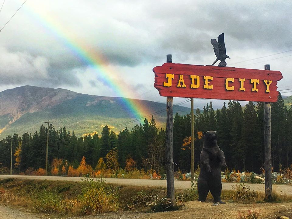
Credit: Jade City
This is your longest drive day as you continue up Highway 37 to the junction of Highway 1 – the Alaska Highway. Approximately an hour and a half up the highway you will come across the interesting Jade City. Approximately 90% of the world’s jade comes from British Colombia, and here you have the chance to not only purchase beautiful jade items, you can take a peek at the carving and sawing tables and the talented people working on site.
If you want to, when you reach the turn-off, turn right for the short 20-minute drive to Watson Lake and the attractions there, but if you don’t have the time, turn left to continue on to Whitehorse. On this stretch of road there are Mile Markers that can be used as reference for stops.
The Rancheria Falls Recreation Site at Mile Marker 687.2 (Historic Mile 710) has pit toilets and a large parking area. There is a lovely 10 to 15-minute walk to the lookout for the falls. The walk consists of an elevated, informative boardwalk and a short section of rock and rough trail. The view is worth it though, and the lush greenery of the area will delight you.
The small town of Teslin at Mile Marker 804 is home to a couple of great little museums, including the quirky Wildlife Gallery located at the Yukon Motel. Here you will also find the Teslin Tlingit Heritage Centre, which welcomes visitors to participate in the day-to-day life of the Tlingit people and houses the Great Hall, home of the Clan Governance for the Teslin Tlingit people. There are great interpretive displays that reflect the long traditions of the Tlingit people.
Another great stop here is the George Johnston Museum, which has 3,000 square feet of galleries showcasing the lives of George Johnston and the Tlingit People of the area.
Note: If you are travelling in May or September, these museums may not be open.
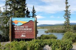
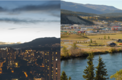
Your destination for today is the Yukon’s capital city of Whitehorse. Of course, there are plenty of things to do and see here, so plan to stay on for at least two days (or more if you are into outdoor activities) to experience all the interesting sites here.