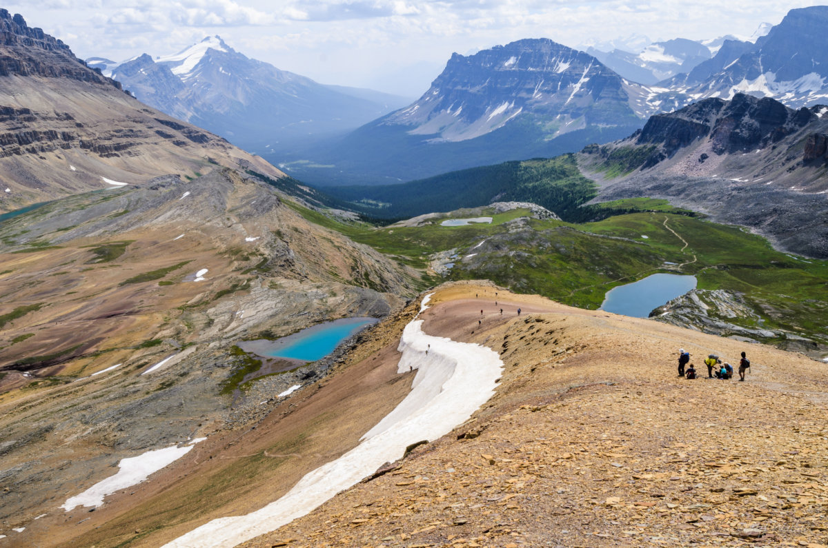
Cirque Peak; Credit: WherezJeff/Flickr
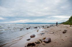
If you are going to hike, you might as well choose a route with a culmination of breathtaking views and the feeling of being on top of the world. There are so many places around the city of Calgary to visit and enjoy a good walk to a viewpoint that it’s impossible to list them all, but if you are enamoured by elegant vistas and beautiful pathways, then these are a great place to start.
All of the hikes listed will require a day including ~ 4 to 5 hours roundtrip drive.
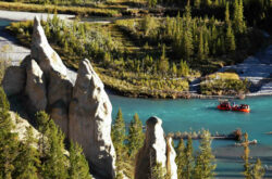
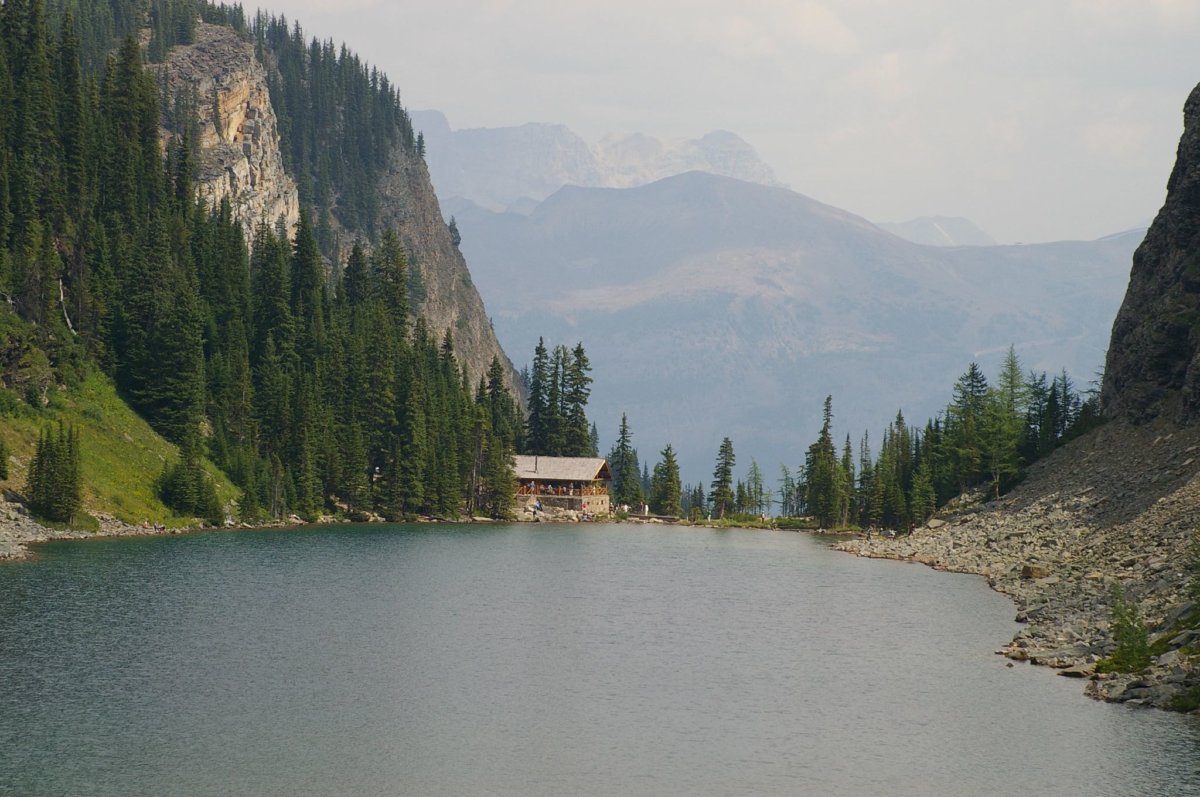
Lake Louise Hike to Lake Agnes Teahouse
Let’s start with one of the most obvious hikes, which offers one of the most spectacular viewpoints that you can get on a well-known hike.
There are several aspects to this particular hike, which you may want to experience, depending on how much time you have and how much walking you would like to do. The most popular route is to Lake Agnes and the Teahouse located there and is best done between June and September. This is an excellent viewpoint destination, with multiple places along the route to stop to catch your breath and take in the views of the surrounding mountains and the stunning, famous Lake Louise, which appears below you as you climb. Not to mention that Lake Agnes itself is beautiful, and you can relax and enjoy the scenic atmosphere as you recharge at the Teahouse.
This is an up and down climb, expect to take at least two to three hours to complete the round trip 7.2 kilometers if you are not a seasoned walker.
Start from the path right next to the hotel and go up, with an elevation gain of about 433 meters. Of course, if you want a longer hike, head to the second teahouse and back down to end at the far side of the lake.
Directions: Approximately two hours drive from Calgary
Mount St Piron
The reward at the end of this hike is panoramic views of the spectacular peaks surrounding Lake Louise, especially in the late summer, early fall months when the colors of the golden larches appear. This hike is slightly different from the Lake Agnes Teahouse hike, and be prepared for some pretty intense switchbacks, 13 in total, to take you to the top.
As you are going up, watch for the Little Beehive/Lake Agnes junction and take the Little Beehive trail, keeping an eye out for the Parks Canada sign indicating the split off to the St Piron trail. The last little bit is a scramble, and make sure you come down the same way, we don’t recommend taking the loop trail which is harder and easy to get lost on.
Expect to take 5 to 7 hours to complete the 12.5-kilometer round trip journey. Enjoy the views from this summit (2649 m / 8690 ft)! Details
Directions: Approximately two hours drive from Calgary
Sulphur Mountain Hike
Okay, we are not going to lie, this isn’t the easiest of hikes, as it is a series of switchbacks all the way up the mountain. However, for those who don’t want to pay the gondola fee or who simply want the accolades for climbing up, this is an extremely rewarding journey as you reach the top and the incredible views of the valleys, peaks and rivers.
Start from the Upper Hot Springs parking lot. The trail is 5.5 kilometers with a 655-meter elevation gain. Once at the top you can enjoy a network of trails and lookout points, including another trail taking you up to the Cosmic Ray Station. As the trail up can be slippery at times, make sure to check the trail report before heading out. Details
Directions: Approximately 1.5hrs drive from Calgary
View this post on Instagram
Little Lougheed Hike
Located in Kananaskis, this is a great hike even though it is described as difficult. As well, although Kananaskis is a popular area for hiking, this trail seems to be often overlooked, which means that you may have the lookout to yourself once you arrive at the top. There are several summits and trails for Mount Lougheed and this one can be accessed near the Spray Lakes West Campground in Spray Valley Provincial Park off of Highway 742 (the Smith Dorrien Trail).
This is an out and back hike of approximately 5 kilometres and an elevation gain of 721 meters. There are four noted scenic viewpoints and fantastic views from the summit. Hiking poles are recommended for this trail. Details
Directions: Approximately 1 hr 44 min drive from Calgary
View this post on Instagram
Ha Ling Peak
This is an incredibly popular route, so be prepared to encounter a lot of other people along the way. One of the reasons that it is so popular, even though it is classified as a difficult trail, is the proximity to the town of Canmore. In fact, the views from the top will give you a bird’s eye view of the town and the surrounding area.
Starting from Goat Creek Day Use Area, it is 3.9 kilometres to the summit with an impressive 810-meter elevation gain, but you definitely can’t beat the views. Details
Directions: Approximately 1 hr 20 min drive from Calgary
View this post on Instagram
Aylmer Lookout
A stunning lookout hike that will give you incredible views of Lake Minnewanka and the surrounding mountain peaks in the Banff area. This is one of the easiest accessed routes you will find and it’s an absolute must-do if you want to hike near Calgary. The in and out hike takes anywhere from 7 to 9 hours depending on your walking speed and how much time you spend at the top. Check out the original fire tower on the other side of the lookout area before heading back down.
Expect a round trip distance of approximately 24 kilometers and an elevation gain of 575 meters.
Be aware that this is an area that has early season ticks. Details
Directions: Approximately 1 hr 30 min drive from Calgary
View this post on Instagram
Rockbound Lake
Another out and back trail has a lot of switchbacks that take you to the most amazing panoramic viewpoint of the Lake. In the area you can also find a waterfall and other lovely scenery.
The 17-kilometer trail with a 760-meter elevation gain will take you about 6 hours in total, with the best time to hike being the late spring and summer months.
Get ready for a steady climb through a mixed forest, behind the distinctive cliffs of Castle Mountain, Eisenhower Peak, and on to the beautiful meadows and flower-fringed Tower Lake, to a climb along a low cliff band to ultimately emerge in a glacial cirque filled by Rockbound Lake. Details
Directions: Approximately 1 hr 45 min drive from Calgary
View this post on Instagram
Grassi Lakes
This is probably one of the easiest and most popular scenic viewpoint hikes in the Calgary area, and is great for hikers of all abilities.
Located in Canmore, this trail is only 4.3 kilometers but still will provide you with excellent views of Ha Ling Peak, along with the stunning deep turquoise lakes below. The different colors are due to the different depths. There is a gradual ascent as well as some stairs with this loop trail. Start by taking the righthand trail to go up (the easier one) and come down the other one.
You will need about an hour and a half for this trail that has an elevation gain of only 232 meters. Details
Directions: Approximately 1 hr 20 min drive from Calgary
View this post on Instagram
Smutwood Peak
In Kananaskis County, you are going to find an incredible trail that will take you to easily one of the most beautiful summit views near the city of Calgary. Let’s be honest though, this trail is listed as difficult for a reason.
Expect to scramble as well as hike along this 17.9 kilometers with an elevation gain of 845 meters. This is a good peak for experienced hikers and best to do in the summer or fall when it is guaranteed that the snow has melted. The heart-stopping scenic views of the alpine lakes, valleys and ridgeline will make the effort worthwhile, especially the southeast view toward Mount Birdwood. Details
Directions: Approximately 2 hrs drive from Calgary
View this post on Instagram
Tent Ridge
Kananaskis Country is home to so many incredible hikes and this one is no exception. A great loop trail, this trail offers up not just one viewpoint but several along the top ridge. The first section takes you through some dense forest before coming out onto the ridge for the rest of the hike. Make sure you are dressed appropriately as you will be exposed for the majority of the trail.
The almost 11 kilometer walk with its 750-meter gain in elevation is considered moderate and will take you 4 to 6 hours to complete.
The views of the area’s peaks make this one of the best trails in the area. Details
Directions: Approximately drive from Calgary
View this post on Instagram
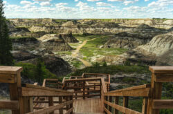
Horseshoe Canyon
The Alberta Badlands is so close to Calgary and such a unique landscape, that this makes a perfect place to spend some time walking. This huge canyon’s walls reveal the timeline of the area, back to the era of dinosaurs. Use your imagination as you explore and savour the landscape. The best way to experience this canyon is to start at the bottom and head up to the top to get the best scenic viewpoint. This is a great little trail of only 4 kilometers and an elevation gain of 241 meters. Expect heat during the summer months and go prepared with a sufficient amount of water. Details
Directions: Approximately 1 hr 20 min drive from Calgary
View this post on Instagram
East End of Rundle (EEOR)
Lovingly called EEOR by the Canmore locals, this is a moderate hike that is not technical but will still require some scrambling to reach the top. The trail is just under 6 kilometers with a 907-meter elevation gain, and takes you beyond the tree line to be rewarded with beautiful views of the Bow Valley, along with the nearby Ha Ling Peak and the other surrounding peaks.
Make sure to note which way you have gone up so you can find your way down again. Keep an eye out for marmots, bighorn sheep and mountain goats that frequent the area. Details
Directions: Approximately 1 hr 20 min drive from Calgary
View this post on Instagram
Mount Yamnuska
The gorgeous Bow Valley Provincial Park is home to some of the best hikes around, and Mount Yamnuska offers up a fantastic 11-kilometer trail that takes you through some incredible scenery up to several peak viewpoints along the ridge line. This hike is not recommended for kids as there are parts that have chains to use to navigate the narrow ledges. You will encounter more than 900 meters of elevation gain with quite some serious ups and downs before getting to the point where you can gaze west to the beautiful peaks or to the east to the flatlands. Mount Yamnuska marks the official eastern border of the Canadian Rocky Mountains. Details
Directions: Approximately 1 hr drive from Calgary
View this post on Instagram
Turtle Mountain
This is a bit farther than some of the others listed here, but Crowsnest Pass is an incredible area to visit with some great scenic lookout hikes, including this one. The unique feature of this hike is the fact that you get to see the second largest landslide area in Canada from the top.
It is just over 3 kilometers to the summit, but with an elevation gain of 780 meters, this walk will get your heart pumping. You can also summit the south peak if you have enough time and energy. Details
Directions: Approximately 2 hr 25 min drive from Calgary
View this post on Instagram
Mount Lady MacDonald
Another hike in the Canmore area, you can’t beat the views on any part of this trail. The 9.9 kilometers takes you on a fairly challenging trail that only experienced hikers should try. The path takes you through lovely evergreen forest and up to the rocky summit. You should take trekking poles with you as they can be handy for some of the more difficult ascents. Watch out for bighorn sheep and marmots along the route.
You will come to a helipad, where most hikers are satisfied to turn around, but you need to continue to get up to the true summit, just be prepared for the most difficult part of the hike, scrambling up the scree. The views from the top are absolutely spectacular, and on a clear day you can even see Mount Assiniboine to the south.
Allow 6 to 8 hours to test yourself on the 1117-meter elevation gain trail. Details
Directions: Approximately 1 hr 10 min drive from Calgary
View this post on Instagram
Rawson Lake and Sarrail Ridge
The only descriptive word for this hike is stunning. From the Upper Kananaskis Lake start along the lake path in a clockwise direction, cross the Sarrail Falls bridge, then take the Rawson Lake path which leads to the left. This path has a gradual incline until you arrive at the lake, which is a great place to take a break, a quick cold swim, or have a picnic.
Be aware that grizzlies are common in this area. From the lake the trail to the top is short but decently steep.
When you leave the tree line, head to the right for incredible views of both the Upper and Lower Kananaskis Lakes. You will want to have at least 5 hours to complete the 11.5-kilometer round trip to the ridge. Details
Directions: Approximately 1 hr 50 min drive from Calgary
View this post on Instagram
Tunnel Mountain Summit
Let’s face it, getting to a summit for a view is never completely easy if you are hiking. This trail, however, is easily accessible from the town of Banff, and pretty decent for most hiking abilities, as it is only 2.4 kilometers each way with an elevation gain of only 260 meters. The cool thing about reaching this summit is that you have a fantastic view of the town, Bow Valley and Mount Rundle. Details
Directions: Approximately 1 hr 30 min drive from Calgary
View this post on Instagram
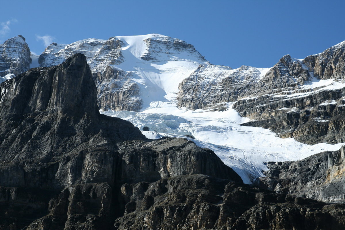
Stanley Glacier
The name says it all! This hike culminates at a point where you have a clear view of Stanley Glacier and several waterfalls. It’s a bit farther drive from the city as it is in British Columbia but well worth it.
The short hike of only 8.4 kilometers return is considered moderate with an elevation gain of 365 meters. Expect to spend 3 hours enjoying this in and out path that will take you through lovely lodgepole pines and through flowery meadows before reaching the viewpoint.
You may also join for guided hikes by Parks Canada. Details
Directions: Approximately 2 hr drive from Calgary
Castle Mountain Lookout
This lovely little hike up to an old fire tower site provides an excellent opportunity to enjoy the beautiful scenery and wildflowers that are abundant in the summer months.
Like most of the other lookout trails, this is an out and back path that has a 588-meter elevation gain and is 3.7 kilometers each way. With beautiful views of the Bow Valley, this is an appropriate hike for most people, with a listing of moderate.
Located near Lake Louise, you know you will be guaranteed gorgeous views in every direction. Details
Directions: Approximately 1 hr 50 min drive from Calgary
View this post on Instagram
Read’s Tower
This hike is best done later in July or into August and September, as it is common to still have snow up in the pass until mid-July. It is a hike that is better done by more experienced hikers as it is quite strenuous physically and the path is not always clear. The reward, however, is some of the best views of the Spray Lakes Reservoir, and if you choose, you can continue another 2 to 3 hours to the summit of Sparrowhawk Mountain for even more panoramic scenery.
This is a moderate hike of 6 kilometers, with and elevation gain of 646 meters. Details
Directions: Approximately1 hr 45 min drive from Calgary
View this post on Instagram
Piper Pass
A much longer journey of a little more than 19 kilometers one way, this hike is more remote than most and there are a lot less people out on it on a daily basis. The goal is to reach the Pass, with its phenomenal views of the Tombstone Mountains.
The elevation gain is only 617 meters but this walk is listed as moderate, only because of the length of it.
Be prepared to be out of civilization with proper clothing, food, water and other necessities. You can overnight camp at Tombstone backcountry campground or at Elbow Lake. Details
Directions: Approximately 2 hrs drive from Calgary
View this post on Instagram
Prairie View Viewpoint and Jewell Pass
While not having the incredible mountain and valley views that some of the other hikes listed have, this one is very close to the city of Calgary and is much easier to complete if you don’t have a lot of time. Located in Kananaskis Country, this trail to the viewpoint and on to the Pass is pretty, and once you get to the top you will feel quite satisfied with the scenic view of Barrier Lake and Mount Baldy.
You only need a couple of hours to enjoy the 2.9-kilometer (each way) route that takes you up an elevation gain of only 250 meters. Of course, if you want a much longer hike, do the loop trail to the peak of Yates Mountain before descending to the Pass – a total of 15.9 kilometers. Details
Directions: Approximately 1 hr drive from Calgary
View this post on Instagram
Nahahi Ridge
This is a popular trek, even if it is challenging. It consists of a mostly vertical climb that also requires some time bouldering in spots. The seemingly endless switchbacks bring you to an incredible view of the Elbow River Valley, and there’s a cool spot of scree which is perfect to rest and enjoy whatever lunch you have packed with you. Despite the vertical challenge, this hike is good for almost everyone.
The 12-kilometer path has an elevation gain of 813 meters, and is an out and back hike. Details
Directions: Approximately 2 hrs drive from Calgary
View this post on Instagram
West Wind Pass
Located in Spray Valley Provincial Park, this might be one of the most impressive scenic hikes that we know of for views from the top.
This is a pretty short hike of about 5 kilometers, with only an elevation gain of 400 meters, but the views are still incredible. Of course, if you are up for it, you can take a cold plunge in Spray Lakes to cool off! Details
Directions: Approximately 1 hr 40 min drive from Calgary
View this post on Instagram
Cirque Peak
This is one of the least technical summit hikes that you can do in the Banff area, although it is still listed as difficult, with an elevation gain of 1060 meters and a round trip distance of 14.5 kilometers. You first head up to Helen Lake, then on to the summit of Cirque Peak, which gives you incredible 360-degree views of the Wapta Icefields, Bow Glacier, Bow Lake and Peyto Lake, along with Isabella Lake and the Siffleur Wilderness area. Dolomite Pass is directly below to the southeast and you will find you are almost eye level with Mount Hector and Dolomite Peak to the south. Be aware that bears are common in this area. Details
Directions: Approximately 2 hr 20 min drive from Calgary
View this post on Instagram