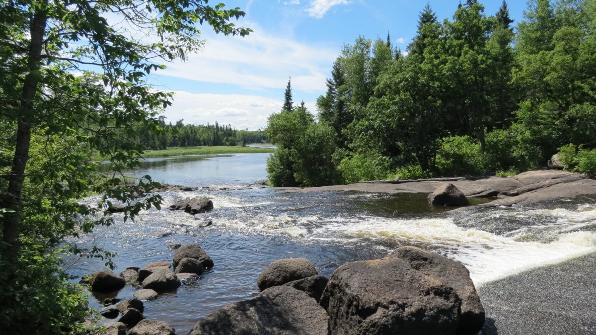
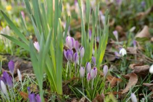
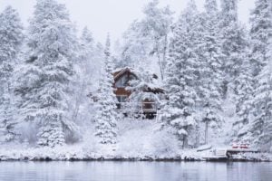
Viburnum Falls at Pine Point Trail; Credit: Robert Linsdell
There are a number of trails you can enjoy at the Whiteshel Provincial Park. Some of them cross steep rock outcrops, while some may be wet or muddy. Go prepared with proper walking shoes, a hat, sunscreen, insect repellent, and drinking water. Don’t forget your camera and binoculars!
Be sure to check trail conditions before starting.
You might like: Top Hiking Trails in Manitoba
McGillivray Falls Self-guiding Trail
The McGillivray Falls trail follows a small drainage basin that is typical of the Precambrian Shield. Hikers can choose between a shorter 2.8 km loop or a longer 4.6 km trail. The trail can be challenging in certain portions, with steep inclines and slippery rock surfaces. Do try to remain on the trail as much as possible as keeping track of the rocky outcrops is not easy.
As the granite rocks (of the Precambrian Shield) are resistant to water erosion, the water drainage paths are highly irregular. Along the way, you can notice more details about the geological history of the Whiteshell and understand how this drainage system influenced the vegetation in the region with its dry regions of Jack pine trees and regions of wet bog plants and black spruce.
From the Viewpoint, you can see views of McGillivray Lake and the bog through which the stream flows. The McGillivray Lake has a brownish tinge due to the presence of nutrients, algae, and naturally occurring humic acid.
The trails are accessible from PTH 44 near Caddy Lake. Trail Map (PDF)
Distance: 2.8 km (2 hours)/ 4.6 km (3 hours)
View this post on Instagram
View this post on Instagram
Hanson’s Creek Trail
Hanson’s Creek Trail is a short 7.1 km trail that is part of the longer Centennial Trail connecting Rennie and Caddy Lake. At the trail’s end, you can find a quaint red bridge (relocated from King’s Park in Winnipeg) over the creek. Directions
Distance: 7.1 km (2 hours)
View this post on Instagram
Whiteshell River Self-guiding Trail
The premise of the Whiteshell River Self-guiding trail is the role Whiteshell and each of us play in keeping our planet healthy. The interpretive signs located along the trail describe various aspects of this diverse theme – biodiversity, natural ecosystem, the balance between nature and industry, wildlife and humans, and other aspects.
The trailhead is located just off PR 312. Trail Map (PDF)
Distance: 2.8 km (2 hours)
Amisk Trail
This is a two-hour trail that begins at the north end of Brereton Lake just off Highway 307. The trail passes through a boreal forest and over rock ridges to the Rennie River. If you are walking in the morning, you might get to see beavers at work. The trail can also be accessed from Inverness Falls via a side trail. Trail Map (PDF)
There are several places on the trail where you can stop and have a picnic or fish (fishing permits!). Munch on blueberries and raspberries found along the trail. Bring along your binoculars and try to spot the birds. Can you hear ‘chickadee-dee-dee’? Although the actual trail is only 2 hours long, you can easily spend half a day on this trail.
Distance: 4.3 km (2 hours)
View this post on Instagram
Bear Lake Trail
The Bear Lake Trail is a moderately difficult trail accessible from PTH 44, 13 km east of Rennie. The trail traverses rock ridges through jack pine stands. Wearing rubber boots is recommended as the trail is often wet. Allow two hours for the hike. Trail Map
Distance: 6 km (2 hours)
Hunt Lake Trail
This is a 12.6 km difficult trail with steep difficult climbs and spectacular views at the Whiteshell Provincial Park. The terrain is typical of the Canadian Shield, and the trail moves along the east shore of West Hawk Lake to Little Indian Bay. The trail moves through forested areas of cedar and white pine, along beaver dams and places with steep climbs and descents. There is a shelter with a wood stove at Little Indian Bay, however, no overnight camping is allowed here.
There are many scenic views (pack a picnic bag) great swimming spots (pack your swimsuits!) and photo ops (don’t forget your cameras) along the way.
For a longer trek, start the hike from the Border Reception Centre. Trail Map (PDF)
Distance: 12.6 km (3 – 6 hours)
View this post on Instagram
Lost Lake Trail
This is a hiking trail located near Caddy Lake. The trail moves along the shores of the West Hawk Lake, with a shorter version of the trail going past Lost Lake. Start your hike along Highway 312 (before the Mantario South Trail) down the cabin access road at the Big Island Landing area.
The longer trail has several offshoot trails leading to the lakeshore and is a fairly easy hike. This is a great trail to snowshoe in winter and ends at a snowmobile route. Directions
Distance: 4.2 km / 8.5 km return
https://www.instagram.com/p/Cvpu0o0u1F1/
Sturgeon Falls Trail / Whiteshell River Bridge Trail
This popular hike starts at the Nutimik Campground at the Whiteshell. Hike across the Whiteshelll River Suspension Bridge which gives stunning views of the Whiteshell River and Nitimik Lake before reaching Sturgeon Falls.
This is also a biking trail, so look out for cyclists! The trail is relatively flat in most regions which makes it a great hike for beginners and families. Directions
Distance: 4.2 km
View this post on Instagram
Big Whiteshell Trail
See spectacular views and encounter wildlife at this 1.5 km loop trail. The trail is suitable for families with small kids and will take around 1 hour to complete and is located near the Big Whiteshell Campground. Trail Map
Distance: 1.5 km (1 hour)
Bannock Point Petroforms Trail
The Bannock Point Petroforms is one of the highlights of the Whtieshell Provincial Park. Bannock Point Petroforms are stones laid out on the bedrock in the shapes of snakes, turtles, humans, a Thunderbird, or other abstract patterns. Park Interpreters offer guided tours of the Bannock Point Petroforms throughout the summer. Details (PDF)
Use the trail map to trek to the site.
Distance: 1.8 km
Cabin Lake Trail
The trail is accessible from Block 3, Red Rock subdivision road, west of PR 307. This is a good trail to try especially if you are interested in seeing how beavers have bought about changes in the drainage system by building dams. The trail may be wet near the trailhead due to beaver dams. Read the interpretive signs placed along the trail to learn more about beaver ecology.
The trail ends at the Red Bridge at Cabin Lake. If you don’t want to end the hike here, you can cross over the bridge down the Centennial Trail to Inverness Falls. Trail Map
Distance: 5.8 km (return, 2 – 3 hours)
Jessica Lake Trails
Jessica Lake Lodge (off PR 307) is the staging area for five hiking trails that meander through Precambrian Shield country. The trails can be used for hiking, skiing, or snowshoeing. Trail Map
- Loop A – This 1.3 km trail will need 45 minutes
- Loop B – Allow 45 minutes for this 1.5 km return trail. The trail is groomed for walking in the winter
- Loop C – This 3.5 km return trail will take 1.5 hours to complete
- Loop D – This is a 5 km trail that will take 2 hours
- Rainbow Falls Hiking Trail – Starting from the Jessica Lake Lodge, the Rainbow Falls trail travels through a forested region to the White Lake Campground before reaching the scenic Rainbow Falls. There are picnic tables and toilet facilities at Rainbow Falls and White Lake Campgrounds. The Rainbow Falls can also be reached from the White Lake Resort access road. Trail Map
Rainbow Falls is located at the end of the White Lake subdivision road and has a wheelchair-accessible dock.
Distance: This 8 km intermediate hike will take around 3 hours.
Dragon Fire Self-guiding Trail
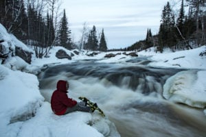
Dragon Fire Trail is a short trail that gives fantastic views of West Hawk Lake. Did you know that West Hawk Lake was formed by a meteorite and is the deepest lake in Manitoba at 110 meters? The trail can be a bit challenging with rocky, steep points. So be sure to wear proper footwear. Go down the rocky slope to enjoy the beach. Trail Map
Distance: 1.1 km
You might like: Scenic Lookouts in Manitoba
View this post on Instagram
Inverness High Rock Ridge Trail
The hike starts at Inverness Falls Resort and has many loops that meander through the forest. There is a picnic area at the halfway point. Some parts of the trail may be wet and are indicated by the dotted lines on the map. This trail is used as a ski trail in winter. Trail Map
Distance: 8.5 km
Falcon Creek Trail
Allow 1 to 1.5 hours for this easy trail. The trailhead is located north of the Trans-Canada Highway near the entrance to Falcon Lake. Along the trail, you can find rocks and boulders that are scattered randomly which occurred when glacier ice receded. These rocks point to the existence of glaciers that once covered the land. There are lots of quartz veins in the rocks along the trail.
Be sure to pick up a guide/activity booklet from the Interpretive Centre or print it out here (PDF).
Distance: 2.2 km (1.5 hours)
The White Pine Trail
The 2.8 km White Pine trail is a 2-hour novice trail found on PR 312 just past Green Bay Resort and winds down to the Whiteshell River. This area is a transition zone between 2 major forest regions – the Boreal Forest and the Great Lakes / Saint Lawrence Forest.
Throughout this trail, you may identify many trees such as Jack Pine, Trembling Aspen, Juniper, White Spruce, Black Spruce, White Cedar, Black Ash, Balsam Fir, and Eastern Pine. Trail Map
Distance: 2.8 km (2 hours)
Alf Hole Goose Sanctuary Trail
The 2.5 km trail starts at the Visitor Centre and circles around the south side of the Sanctuary pond. You will be able to see Great Canada Geese in their natural habitat. The signs explain g wildlife management techniques. A beautiful hike for spring and fall. Trail Map (PDF)
Distance: 2.5 km (45 minutes)
Forrester’s Footsteps Trail
Walkthrough a native mixed-wood forest as well as a Jack Pine and Red Pine plantation on this trail. The trail, located at Betula Lake, follows old logging roads before climbing up a granite rock ridge. Some regions of the trail is a designated mountain bike trails, so watch for cyclists! Trail Map (PDF)
Distance: 2.4 km return (2 hours); Mountain bike trail is 4.2 km return
Pine Point Rapids Trail
Hike this 8.2 km trail that passes through mixed-wood forest and rock outcrop. Here you can see much wildlife such as white-tailed deer, waterfowl, and turtles, and a variety of plant life. There are fire pits along the trail, so take your hot dogs and marshmallows!
As the Whiteshell River flows over rocks, it creates spectacular rapids (Pine Point Rapids) and falls (Acorn Falls and Viburnum Falls) that can be seen along the trail. The trail transforms into a skiing trail in winter.
Accessible from PR 307 and is located 7 km southeast of Nutimik Lake. Trail Map (PDF)
Distance: 8.2 km
Mantario Hike
A challenging hike that will take from three to six days. This 63 km trail is accessible from PR 312 and Big Whiteshell Lake. For a shorter day hike, trek from the southern trailhead off PR 312 to Marion Lake, 15 km in.
It is highly recommended that you purchase a copy of the Mantario Hiking Trail brochure from Canada Map Sales or the park office at West Hawk Lake. Details
Distance: 63 km (3 – 6 days)
North Whiteshell Trail
The trails start from the dam at Seven Sisters Falls to Caddy Lake and link many trails, campsites, and points of interest at the park. Some of the features are the Seven Sisters Falls, Winnipeg River, Caddy Lake, Natalie Lake, Eleanor Lake, Dorothy Lake, Nutimik Lake, Betula Lake, White Lake, Brereton Lake, Otter Falls, and Bannock Point Petroforms. Details
To best enjoy all features, hike the trail in sections. There are opportunities to view wildlife and a variety of birds. Trail Map
Distance: 104.77 km
Centennial Trail
The Centennial Trail is a part of the Trans Canada Trail (as well as the Border to Beaches network) that passes through the Whiteshell Provincial Park. The trail follows the granite ridges of the Precambrian Shield and areas of the boreal forest. Details
The Centennial Trail runs from the Bear Lake trailhead to Caddy Lake. Along the trail enjoy the views of McGillivray Falls and Lilly Pond.
Distance: 36.3 km
South Whiteshell Trail
The South Whiteshell Trail runs from Rennie to the Ontario border. After the Centennial trail (see above) to the Caddy Lake, continue hiking to West Hawk Lake and on to Falcon Lake. Continue along the Falcon North Shore trail before crossing to the beautiful Marsh trail and the Falcon South Shore trail. Details
Falcon and West Hawk Park offices and campgrounds, trail kiosks, and various businesses throughout South Whiteshell carry hard copies of the trail map. You can also use the Trail Forks website or the free Trail Forks app. Trail Map
Distance: 48.85 km
Falcon Ridge Trails
The Falcon Ridge Trails are easily accessible from the Falcon Trails Resort. Check conditions at Falcon Trails Resort (204) 349-8273 before setting out. Trail Map
- Sunshine Lookout Trail – This is a short 2 km round trip to the south-facing ski slopes. The trail then climbs up the rock outcrop overlooking Falcon Lake.
- High Lake Ski Trail – This is a beautiful trail to hike in the winter that goes up to High Lake and along its shoreline. Distance: 9.3 km
- Top of The World Trail – Trek to a spectacular lookout point above Falcon Lake. This is the highest elevation in the area. Hike along the High Lake Trail for about 1.5 km. Follow signs for ‘High Lake Eco Cabins’ until you reach the Top of the World loop (1 km).
- Pine Ridge Trail – The trailhead is located at the Falcon Ridge ski slopes and heads along the pine ridges of High Lake Bay. The Swinging Rope is around 3 km from the trailhead. From here, the trail continues another 6 km to the High Lake Portage.
- Others – Most ski trails are suitable for hiking, but some sections may be wet. The Blue Trail (2.5 km) and most of the Red Trail (5 km) are quite dry and good for hiking. Trail Map
View this post on Instagram


These trails should be protected when wet and should not be used.
Telling people to wear rubber boots is irresponsible and will destroy the beauty of these pristine places, its akin to rape is ok, just wear a condom. Mother Nature is the victim.
“Wearing rubber boots is recommended as the trail is often wet”
More true then ever when the social media sends people in masses.
You should be ashamed.
I found this link on the web when I Googled here in Winnipeg “Stay Off Trails When Wet” .
kalimaquotes.com/quotes/195393/walk-lightly-in-the
Nothing local at all.
Please be mindful people!